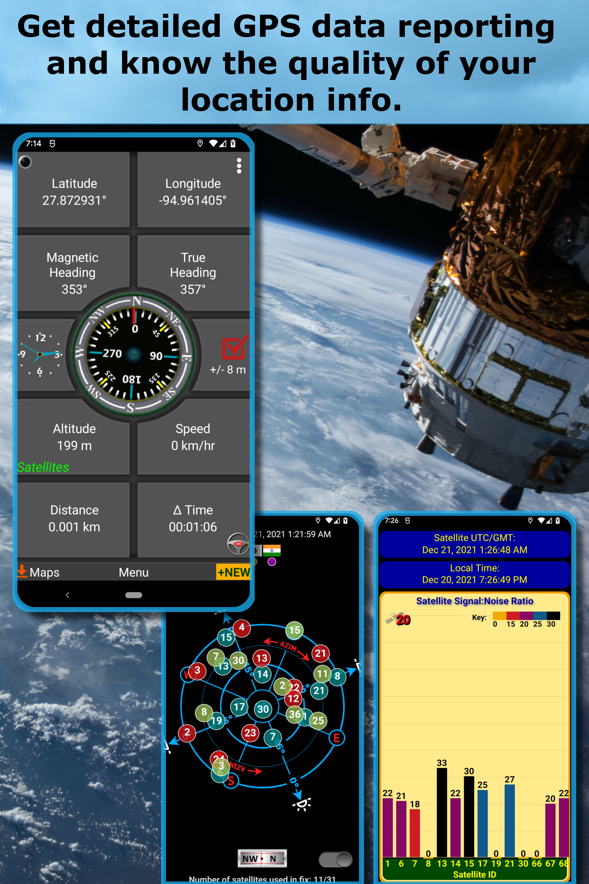
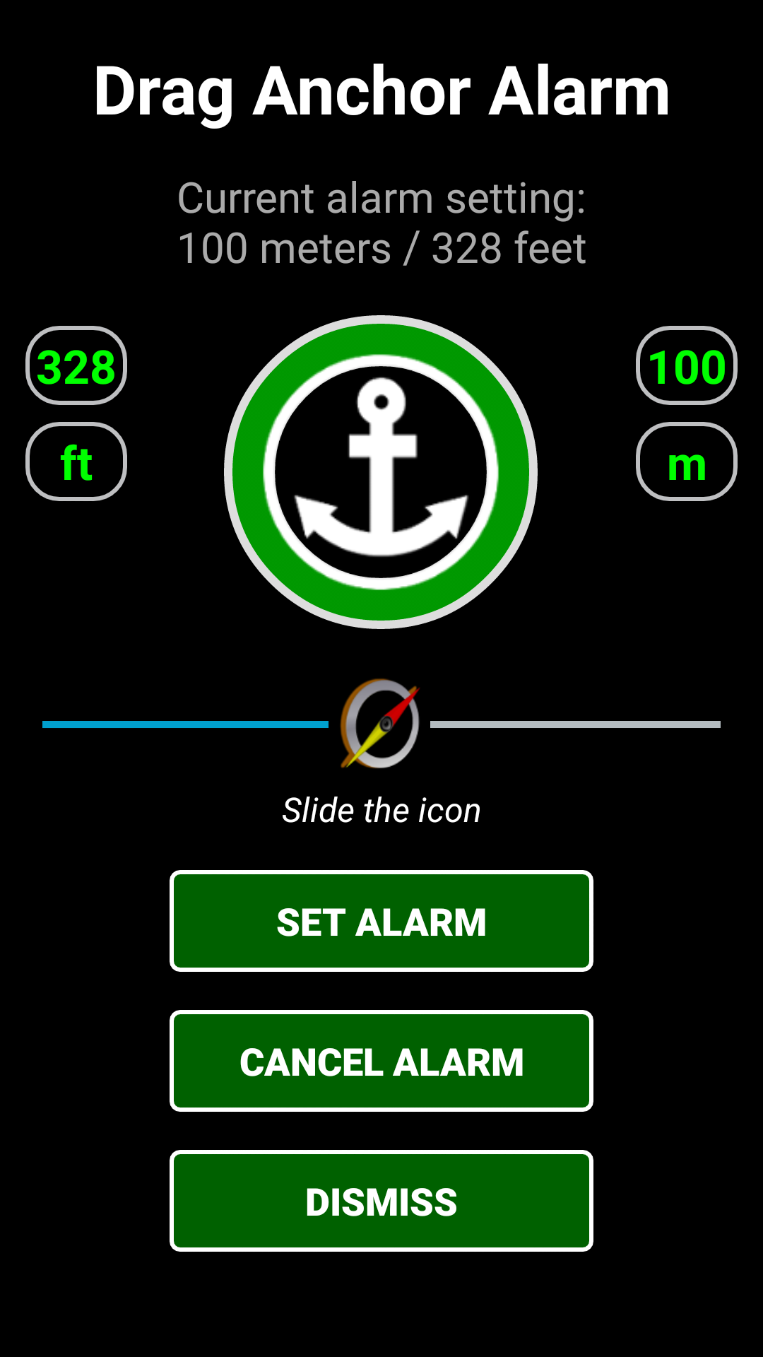
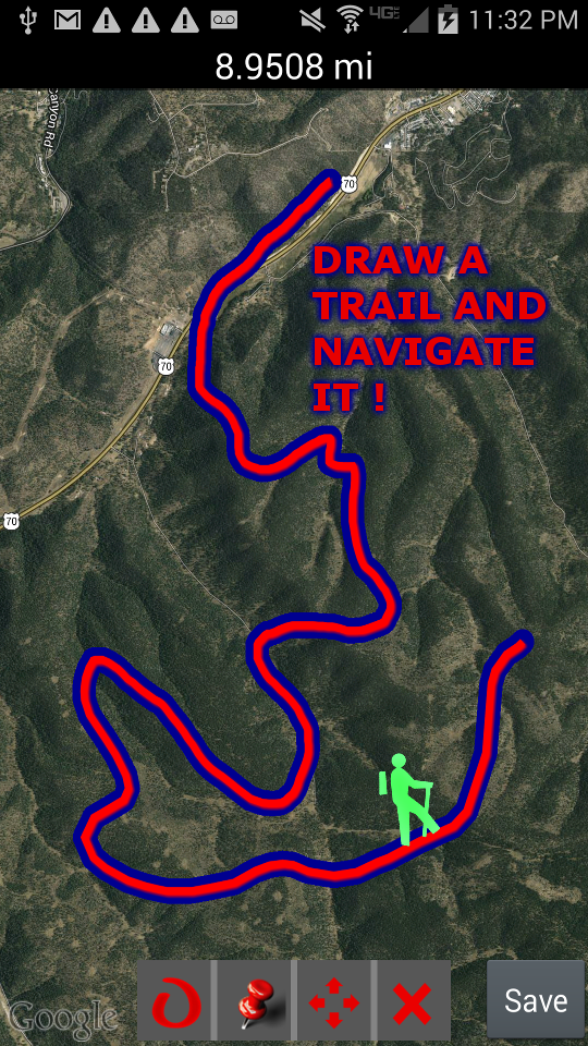
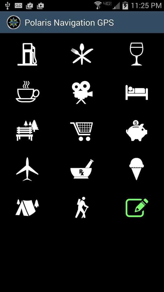
Polaris GPS Hike, Bike, Marine
9.2 3K+
v9.27 by Disciple Skies Software


Requires Android: Android 6.0+
Architecture: arm64-v8a
Screen DPI: nodpi
SHA1: ed04a29863f9ea3920ef7157044e199a1b1a2b6d
Size: 24.57 MB
What's New:
Requires Android: Android 4.4+
Architecture: arm64-v8a, armeabi-v7a, x86, x86_64
Screen DPI: nodpi
SHA1: 6ee82ea71498cd85dee94751a951c1f52737c49c
Size: 21.25 MB
What's New:
Requires Android: Android 4.4+
Architecture: arm64-v8a, armeabi-v7a, x86, x86_64
Screen DPI: nodpi
SHA1: 228285e385ec52346dc8dcfa01fccedfdddd9066
Size: 21.34 MB
What's New:
Package Name:
Category:
Update Date:
2026-05-12
Latest Version:
9.27
Need Update:
Available on:
Requirements:
Android 6.0+
Report:
HuntStand: GPS Maps & Tools
The Only Hunting App You Need
5.5 2K+
komoot - hike, bike & run
Discover new routes, plan hikes, rides & runs, and navigate your adventures.
8.2 40K+
Fishing Points - Fishing App
Uncover best fishing times and angler spots using maps, tide & weather forecast.
8.9 19K+
Wikiloc - Trails of the World
Discover millions of trails for hiking, biking, trekking, GPS navigation routes
9.0 10K+
Marine Traffic – Ship Tracker
Explore marine traffic using ship tracker, marine radar and vessel finder
4.8 57
USA GPS Maps & My Navigation
The easiest navigation app ever!
8.9 776
BaseMap: 3D Hunting Maps & GPS
3D Maps, Offline 3D, Location Sharing, Public & Private land, weather, wind, GPS
8.0 455
MapFactor Navigator
GPS Navigation - offline maps from OSM & TomTom. Android Auto, Live Traffic.
8.2 82K+
Navily - Your Cruising Guide
Easily book marinas and discover anchorages via the Navily community.
7.9 151
DS Speedometer & Odometer
High accuracy speedometer and route recorder with digital and classic odometers.
9.2 3K+
GPS Reset COM - GPS Repair
GPS tools and navigation system. Get a faster GPS fix and repair GPS problems..
8.8 1K+
Walking Odometer Pro
Record & map your walks. Walk to a leaner, healthier you! Lose weight. Stay fit!
9.2 180
Find My Car - GPS Navigation
Find your parked car with a state-of-the-art car locator- Internet optional
8.6 615
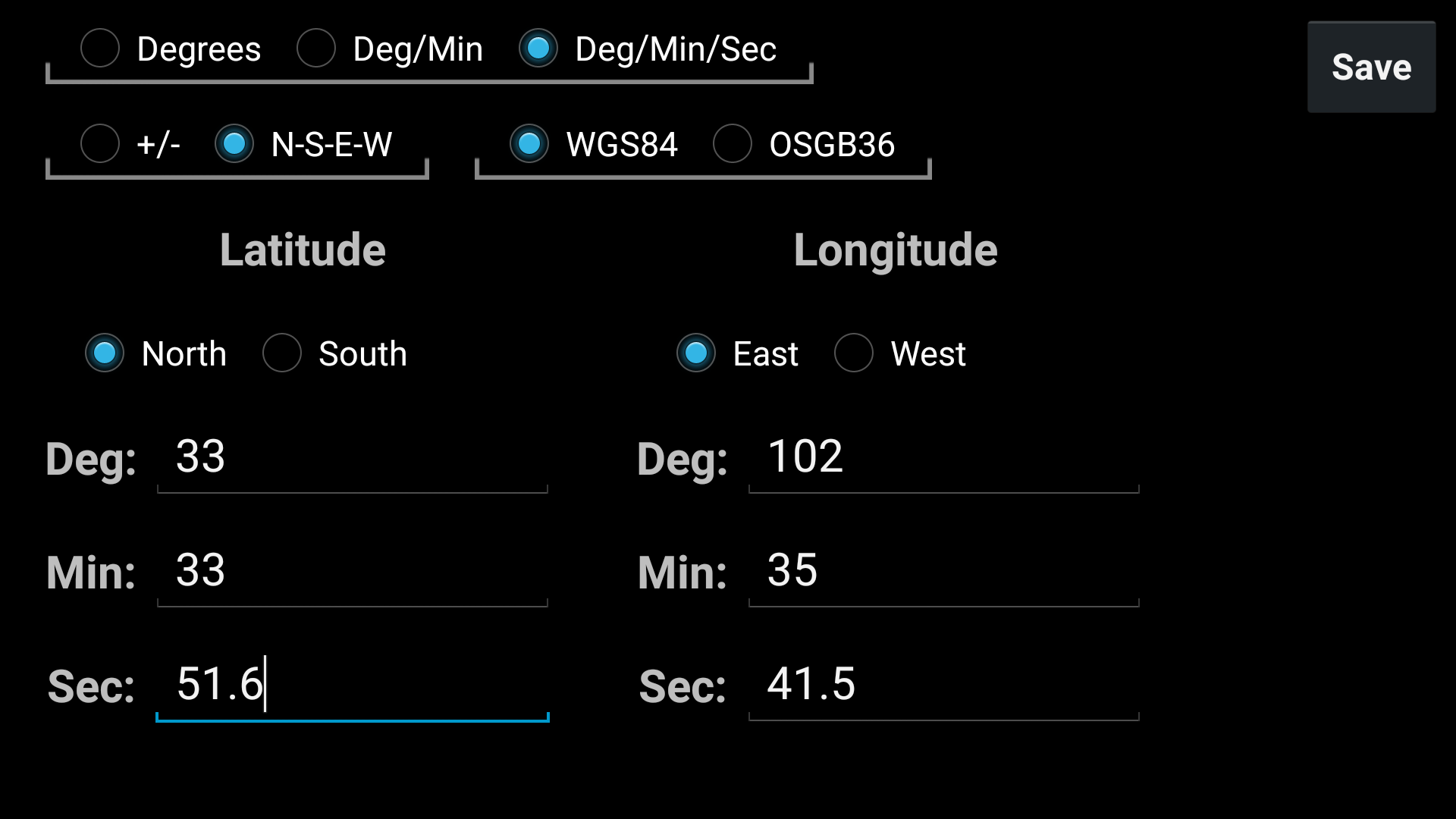
Map It! Address & Coordinates
Coordinate and address mapper and converter. Supports UTM, MGRS & Maidenhead.
8.4 147
DS Barometer & Altimeter
Barometer for devices with or without a barometer sensor. Includes altimeter.
8.6 486