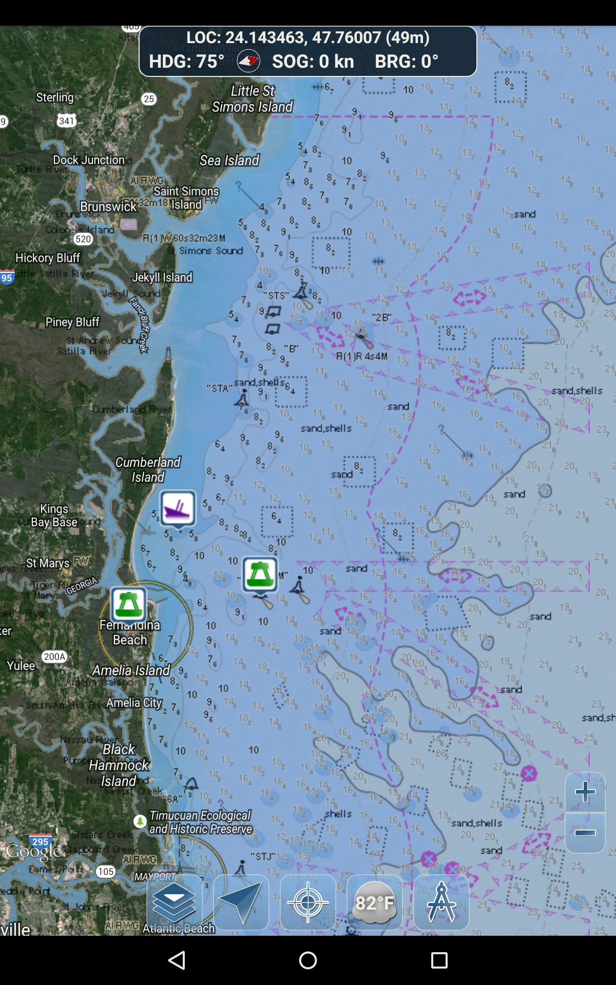
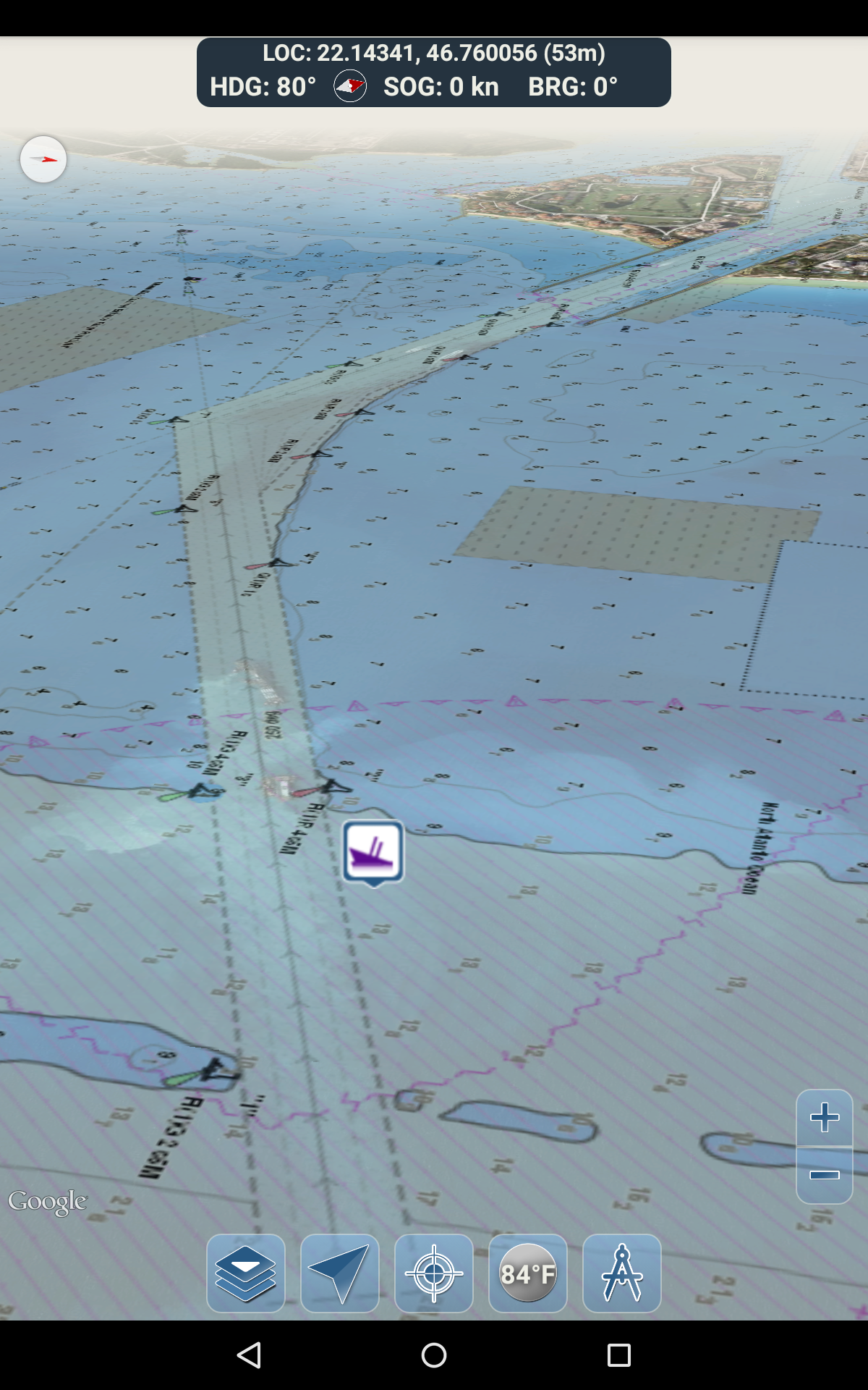
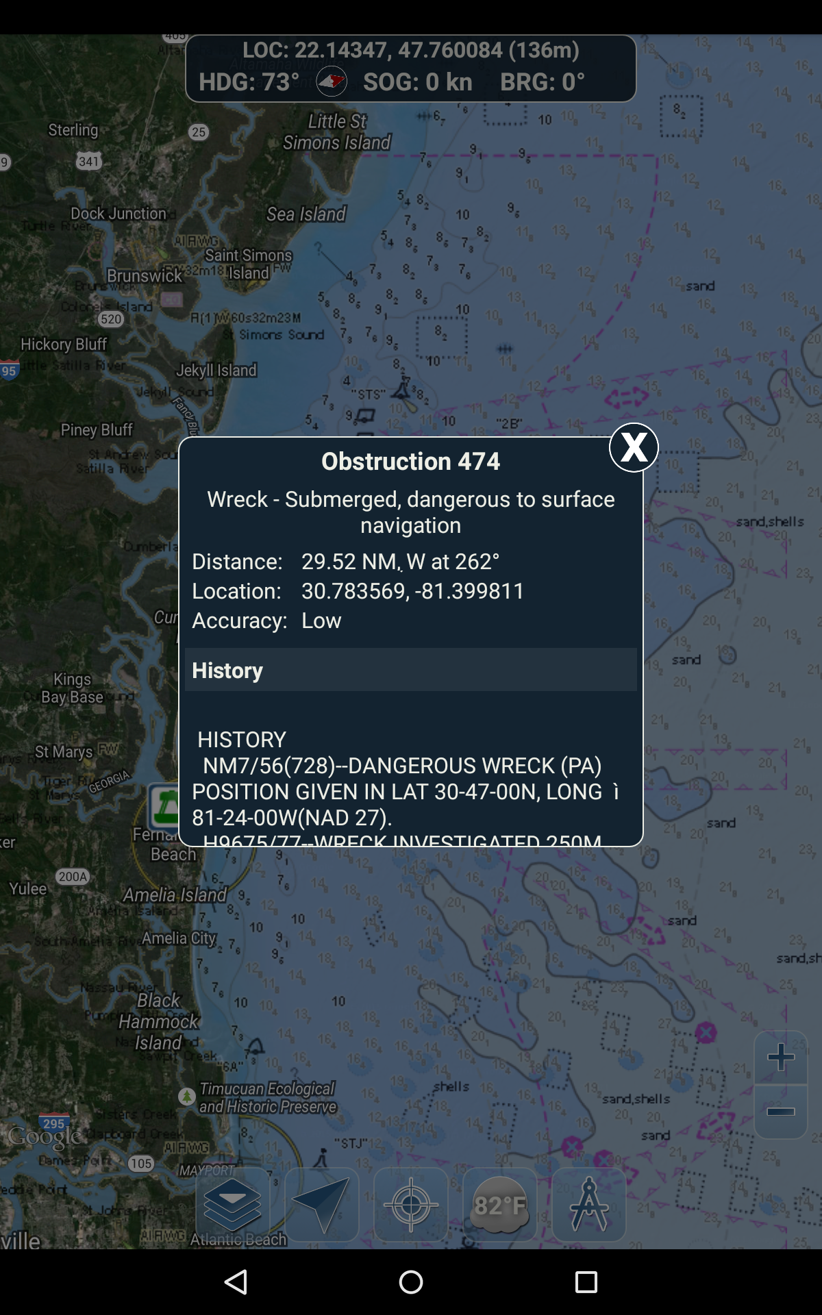
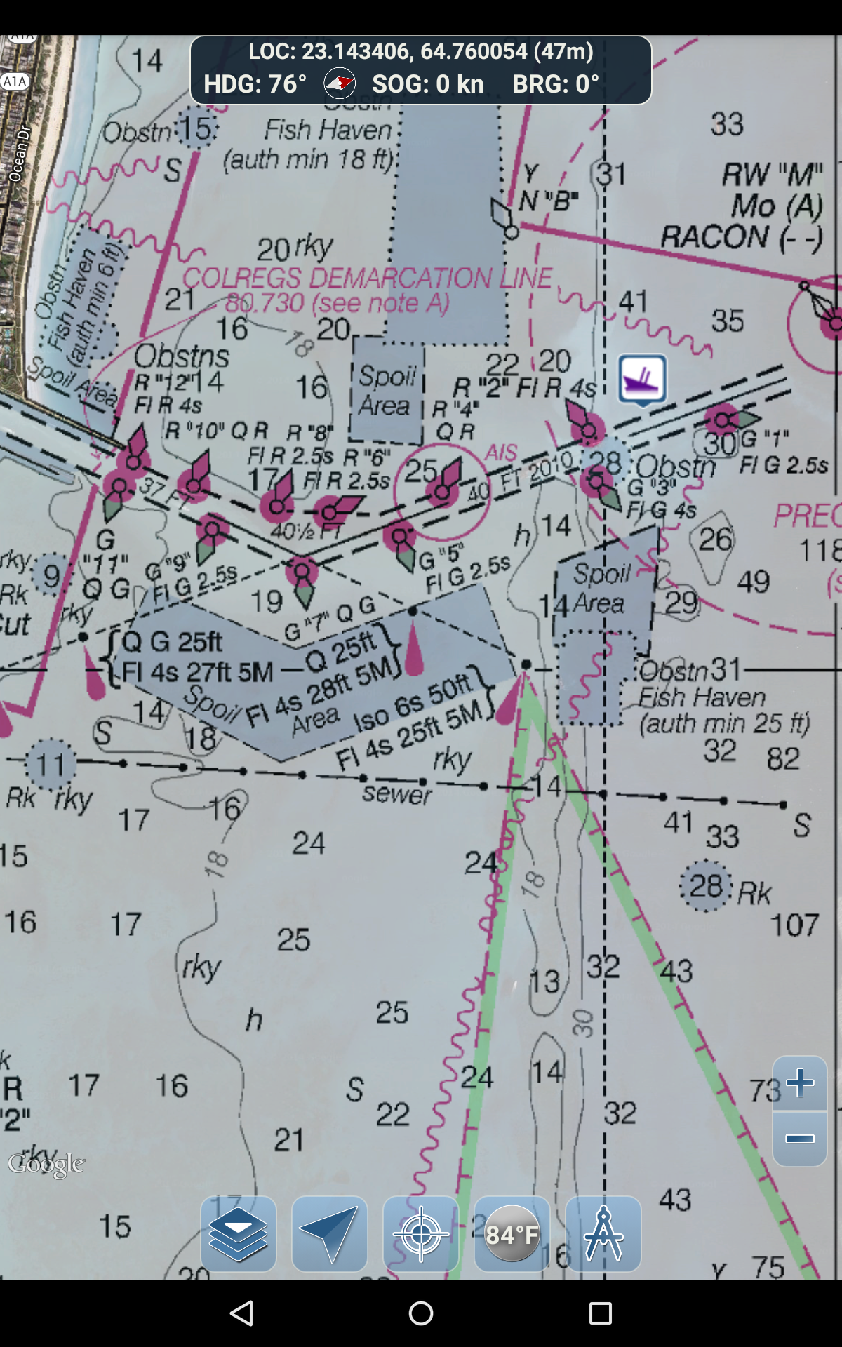
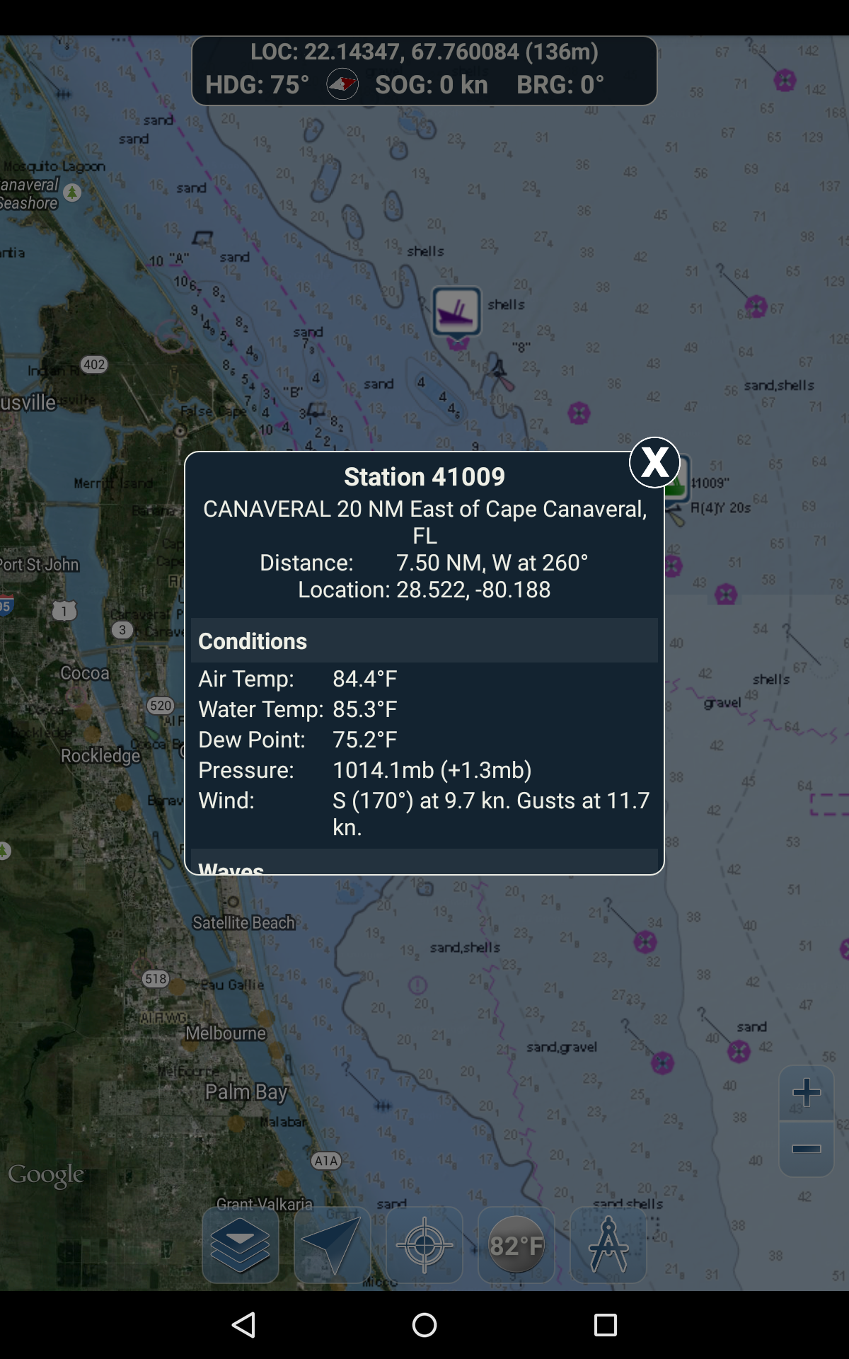
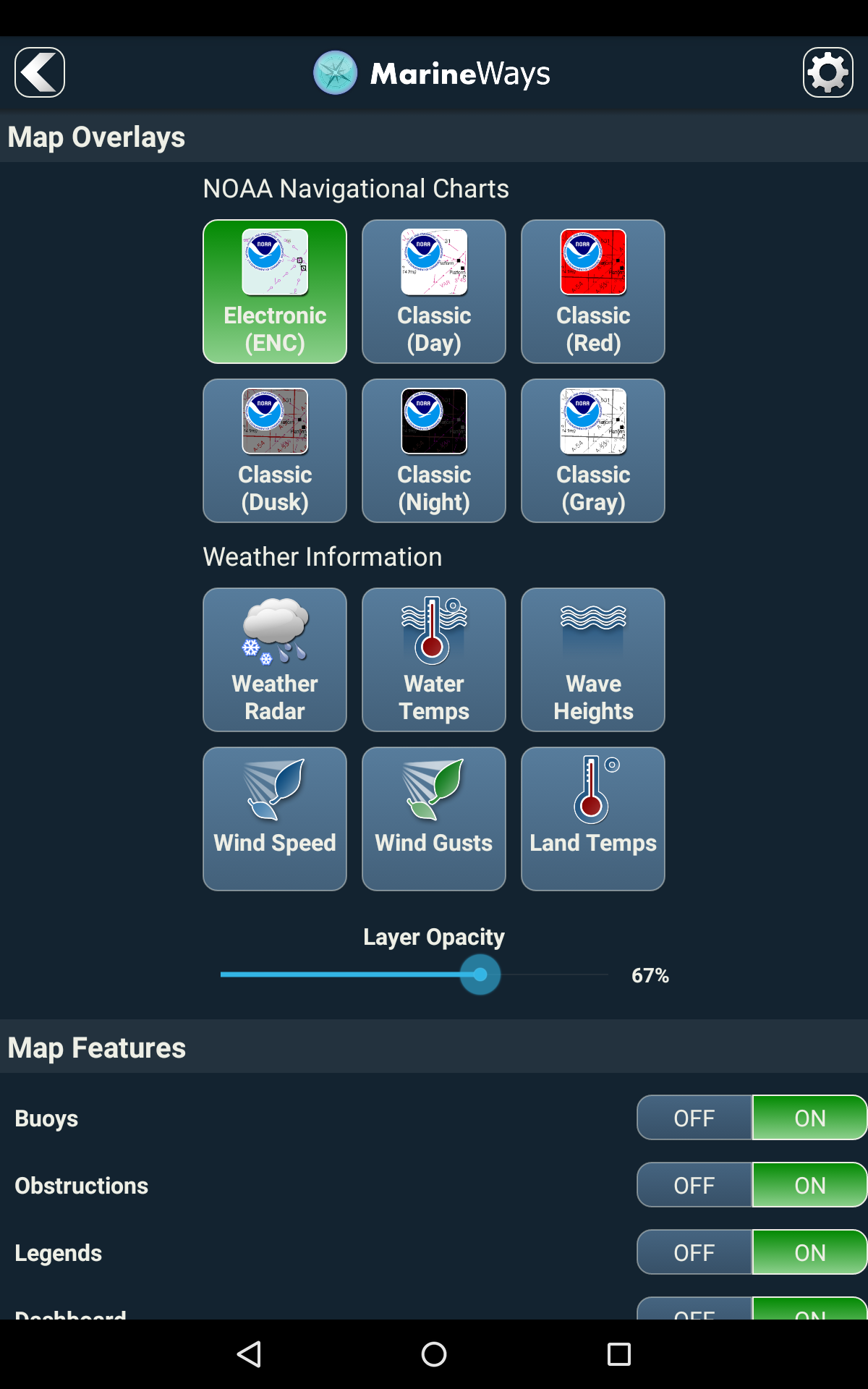
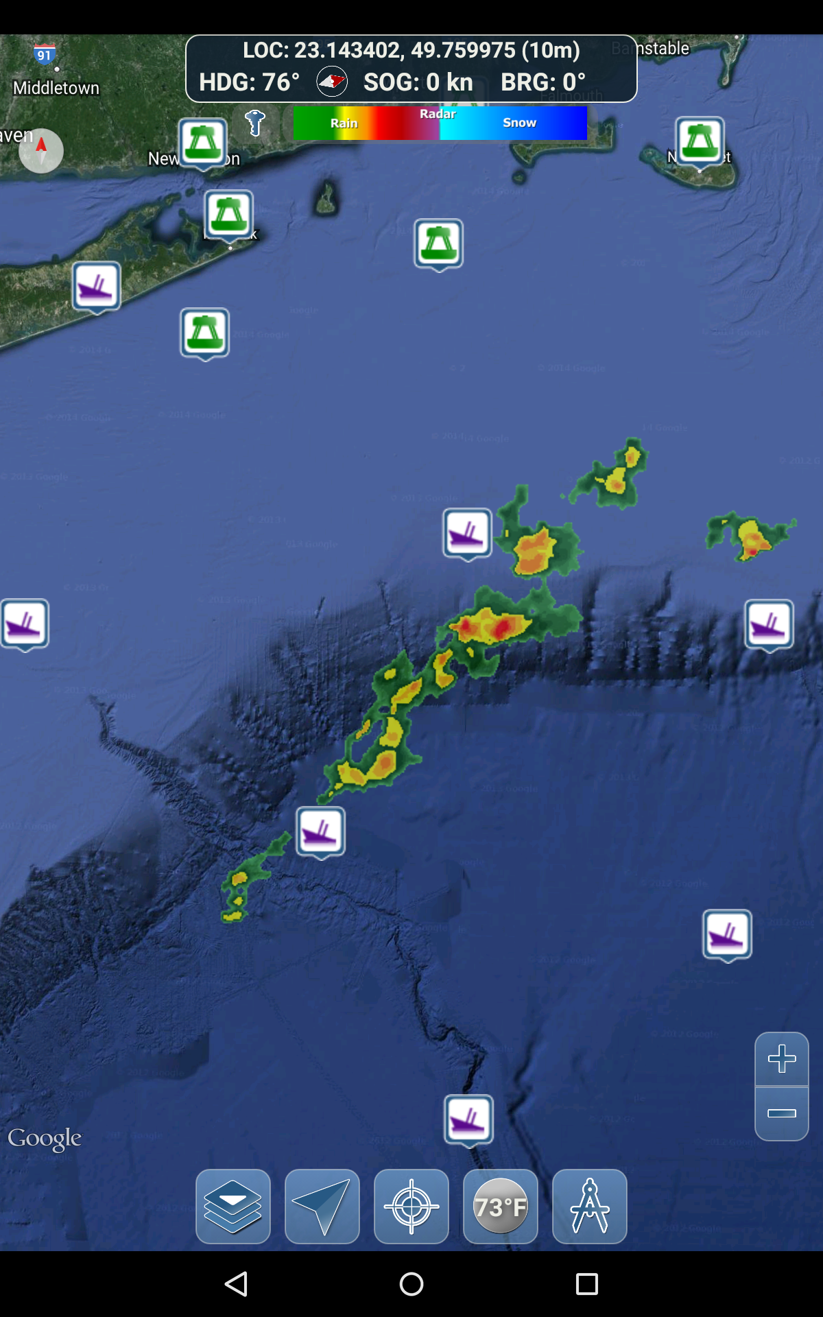
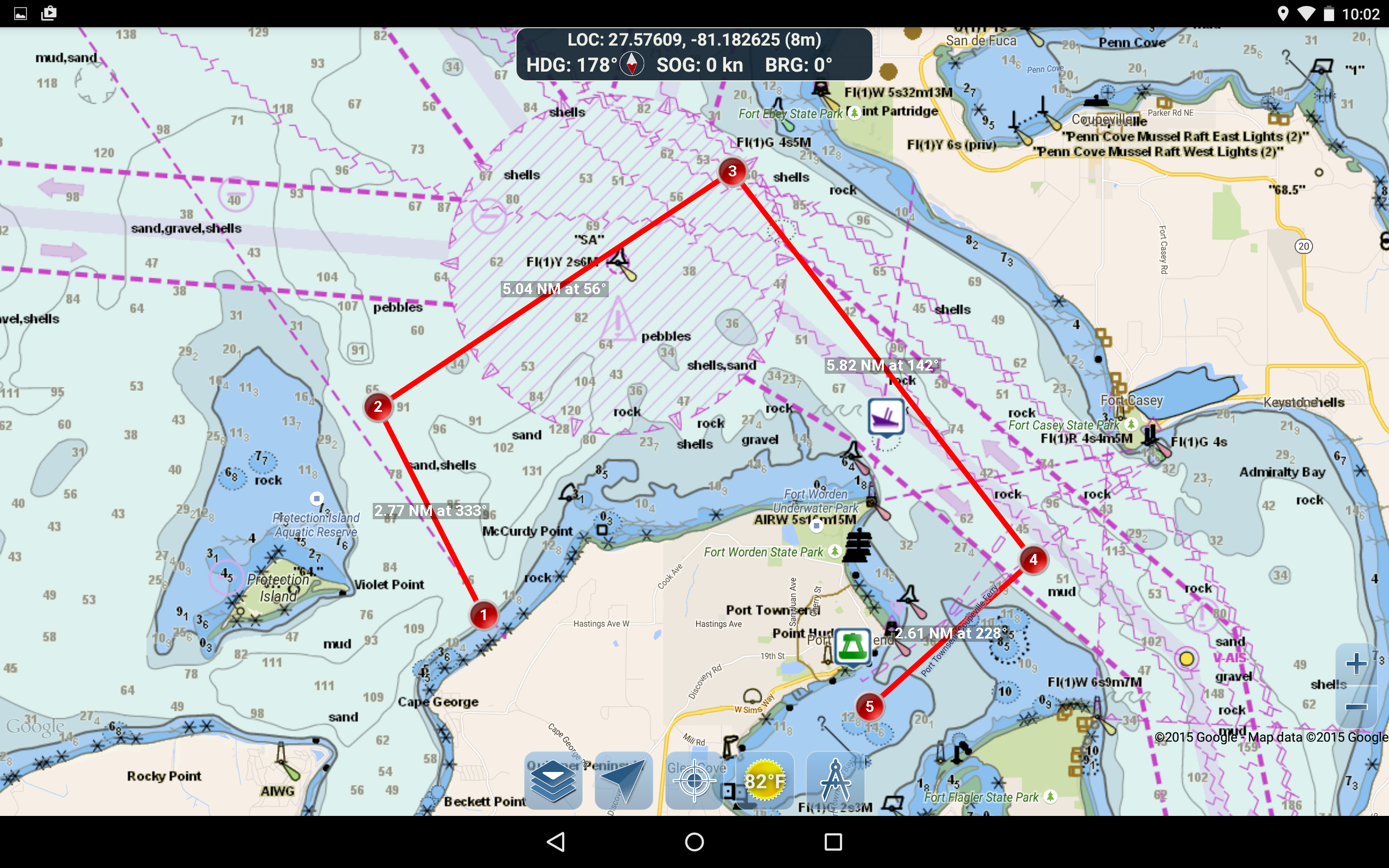
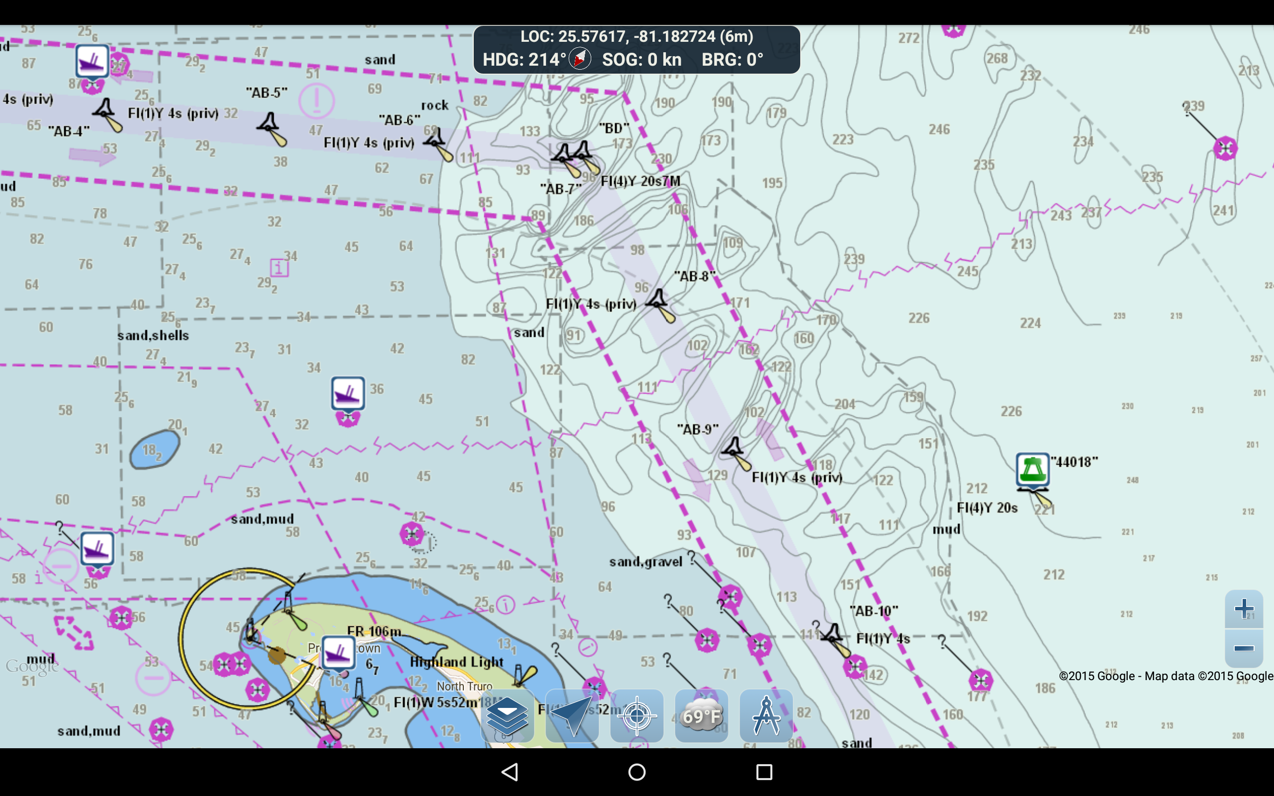
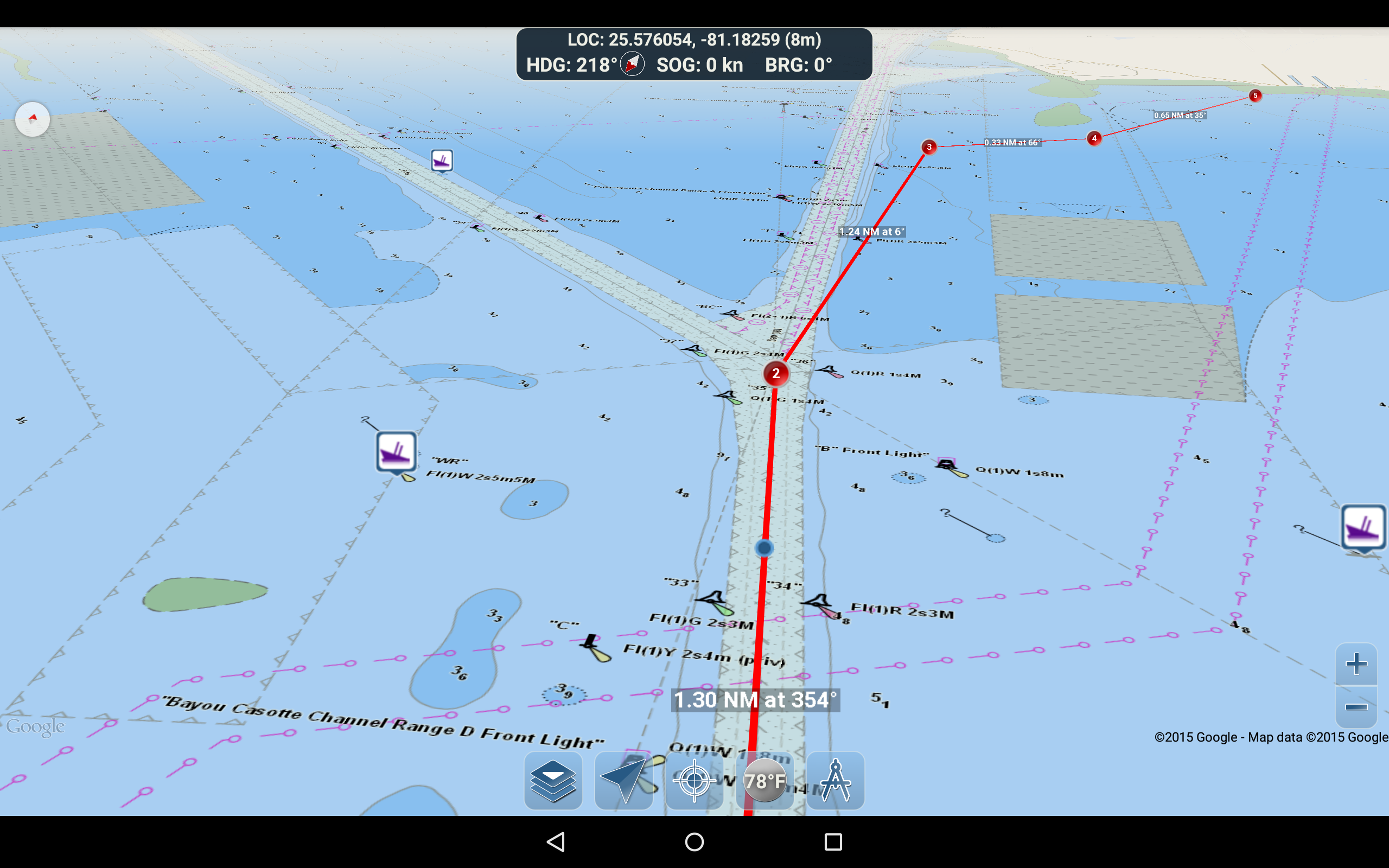
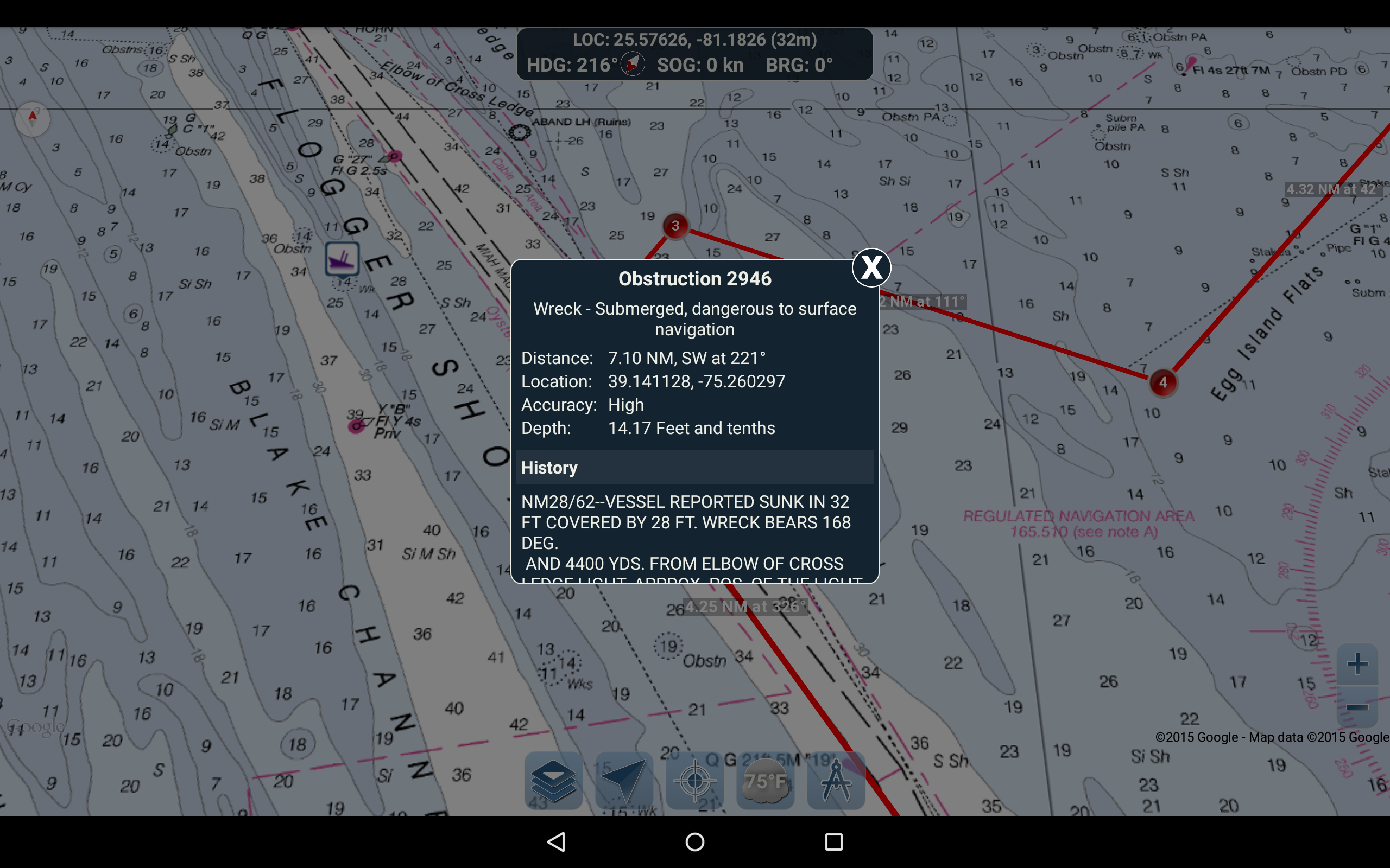
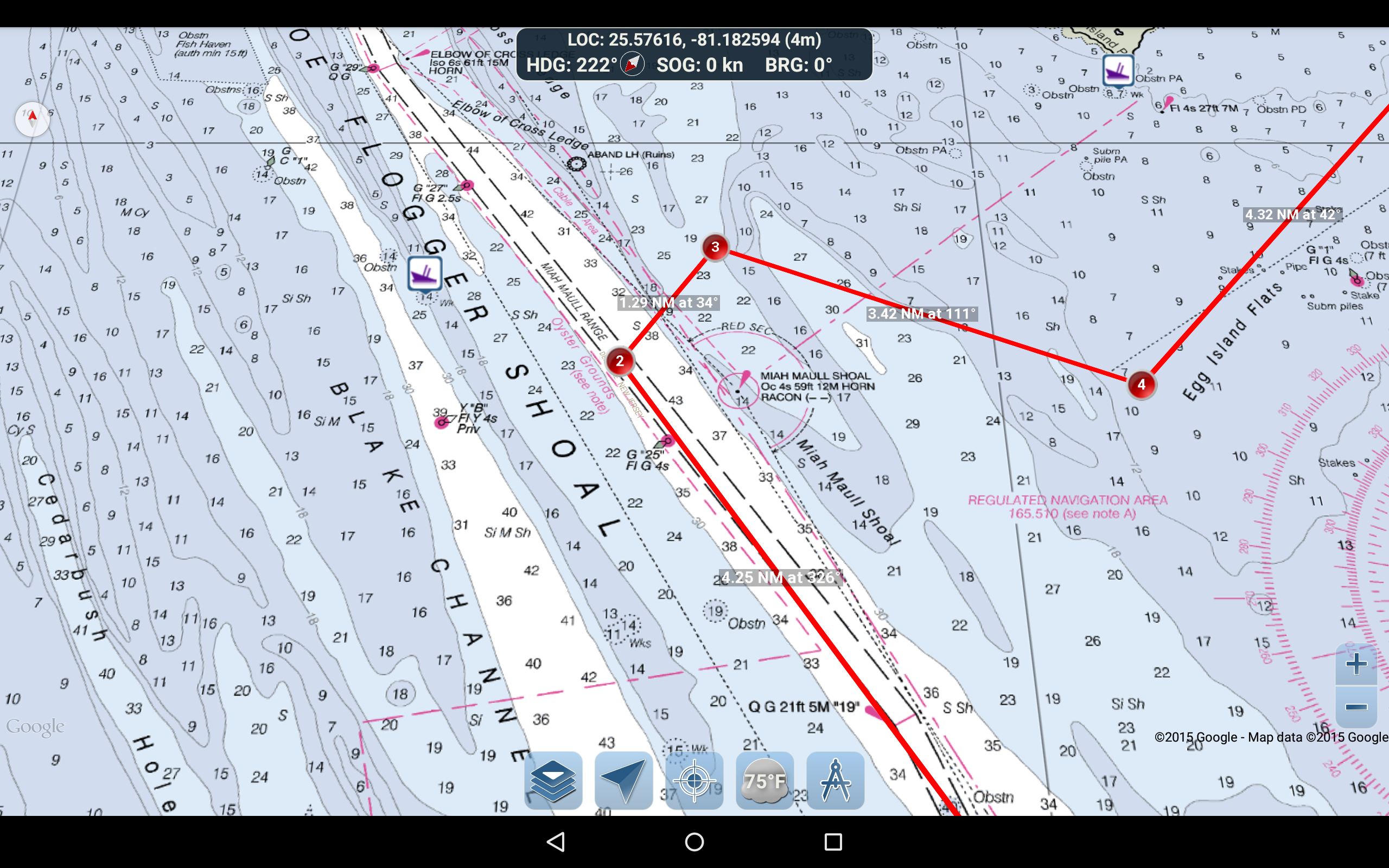
Marine Ways - Nautical Charts

9.0 142

v1.34 by Kernalite

Marine Ways - Nautical Charts APK download Marine Ways - Nautical Charts APK download
Download through APKFab App
Safe & Fast Install • Region Free

About Marine Ways

Marine Ways (Package Name: com.marineways.android) is developed by Kernalite and the latest version of Marine Ways - Nautical Charts 1.34 was updated on March 17, 2024. Marine Ways - Nautical Charts is in the category of Travel & Local. You can check all apps from the developer of Marine Ways - Nautical Charts and find 200 alternative apps to Marine Ways - Nautical Charts on Android. Currently this app is for free. This app can be downloaded on Android 4.4+ on APKFab or Google Play. All APK/XAPK files on APKFab.com are original and 100% safe with fast download.
Marine Ways Boating is the ultimate marine navigation and planning application! In this application you will gain access to:
NAVIGATIONAL CHARTS
- United States charts provided by National Oceanic and Atmospheric Administration (NOAA)
- New Zealand charts provided by Land Information New Zealand (LINZ)
Chart types:
- NOAA Electronic Navigational Charts (ENC) (NOAA's newest and most powerful electronic charting product).
- NOAA classic charts (including Day, Red, Dusk, Night, and Gray versions).
- LINZ charts (available in Day, Dusk, and Night versions only currently)
ROUTE PLANNING TOOLS
-Route Plotting. Tap and hold on the map for one second to plot your waypoints. To form a route, continue to tap and hold on the map in different areas. Distance and bearing are conveniently calculated and displayed for each leg as you add, adjust, or remove waypoints.
-Travel Mode. Automatically centers the map on your current position as you move. Use travel mode to see how closely you are following your plotted route in real time!
-Route Leg Summary. A convenient view containing detailed information of each leg you have plotted, including start and end coordinates, distance, and bearing.
BUOY REPORTS AND OBSTRUCTION INFORMATION
Markers for buoys and obstructions are conveniently plotted in their actual location on the map! Just click on the marker to view their information!
- Buoy Reports: Get complete current conditions and wave reports for fixed and drifting buoys.
- Obstructions: Get location and history information about potentially dangerous, submerged hazards including rocks and sunken vessels.
NAVIGATION DASHBOARD
The navigational dashboard shows various real-time information including:
- Current location (latitude and longitude, with accuracy range)
- Current Heading (includes a small directional compass as well!)
- Current Speed Over Ground
- Current Bearing
MARINE MAP OVERLAYS
Toggle various marine overlay data right onto the map to get a better idea of the current boating conditions!
Overlays include:
- Water Surface Temperature (Global)
- Wind Speeds (US only)
- Wind Gusts (US only)
- Wave Heights (US only)
LOCATION SHARING OVER WATER / VIEW OTHER BOATS
- Display your last known location, speed, bearing, and boat name on the map for other Marine Ways boaters to view.
- View the last known location, speed, bearing, and boat name of other Marine Ways boaters, as well as their distance and bearing from your location.
- Location sharing is turned off by default. When you are ready to share, toggle it on within general settings. To continuously update your location on the map, keep the app opened and focused. The app currently does not update your location in the background.
WEATHER INFORMATION
- Weather Precipitation Radar (US & Hawaii only). Detects any rain and snow in the area.
- Weather Station. Reports the nearest observation station data. Current temperature, humidity, weather conditions, wind, and more! Station observation data is available globally.
- Weather Alerts. Weather station also reports any active weather alerts issued by the National Weather Service such as severe thunderstorm warnings or hurricane warnings. Weather alert information is available for US, Alaska and Hawaii.
- Land Surface Temperature overlay. Shows the current surface temperature on land (US only).
Before using this application, please read and agree to the following terms of use / service and privacy policy:
Terms of Use / Service: http://www.marineways.com/appterms
Privacy policy: http://www.marineways.com/appprivacy
Navigational Charts Disclaimer from NOAA:
NOAA ENC Online is not certified for navigation. Screen captures of the ENCs displayed here do NOT fulfill chart carriage requirements for regulated commercial vessels under Titles 33 and 46 of the Code of Federal Regulations.
Enjoy the app! Marine Ways is also available on the web at http://www.marineways.com

Marine Ways 1.34 Update

Misc adjustments and enhancements.
Read More
Marine Ways Features
Previous Versions More
Marine Ways - Nautical Charts
Marine Ways - Nautical Charts 1.34 APK
March 19, 2024 3.91 MB

Requires Android: Android 4.4+

Screen DPI: 160-480dpi

SHA1: 4c72a799baeb9f25f9a39503de33e7c9ffe9f593

Size: 3.91 MB

What's New:

Misc adjustments and enhancements.
Marine Ways - Nautical Charts
Marine Ways - Nautical Charts 1.33 APK
October 1, 2023 3.91 MB

Requires Android: Android 4.4+

Screen DPI: 160-480dpi

SHA1: a6d7fb792810934f1a82439d1392e502b635ff59

Size: 3.91 MB

What's New:

Upgraded the target android version.
Marine Ways - Nautical Charts
Marine Ways - Nautical Charts 1.32 APK
July 19, 2023 3.91 MB

Requires Android: Android 4.4+

Screen DPI: 160-480dpi

SHA1: 6c7c5581d5ec475423102e6200f3c07171217eb6

Size: 3.91 MB

What's New:

Bug fixes and android library upgrade.
Marine Ways - Nautical Charts
Marine Ways - Nautical Charts 1.30 APK
July 8, 2023 3.81 MB

Requires Android: Android 4.4+

Screen DPI: 160-480dpi

SHA1: 161b62ce750a87abe5608f09a8ba1de250dc6389

Size: 3.81 MB

What's New:

Upgraded android libraries.
More Information

Package Name:

com.marineways.android

Update Date:

Latest Version:

1.34

Need Update:

Submit latest version

Available on:

Google Play

Requirements:

Android 4.4+