onX Hunt (Package Name: onxmaps.hunt) is developed by onXmaps and the latest version of onX Hunt: Offline Hunting Maps 26.26.1 was updated on July 13, 2026. onX Hunt: Offline Hunting Maps is in the category of Sports. You can check all apps from the developer of onX Hunt: Offline Hunting Maps and find 182 alternative apps to onX Hunt: Offline Hunting Maps on Android. Currently this app is for free. This app can be downloaded on Android 8.0+ on APKFab or Google Play. All APK/XAPK files on APKFab.com are original and 100% safe with fast download.
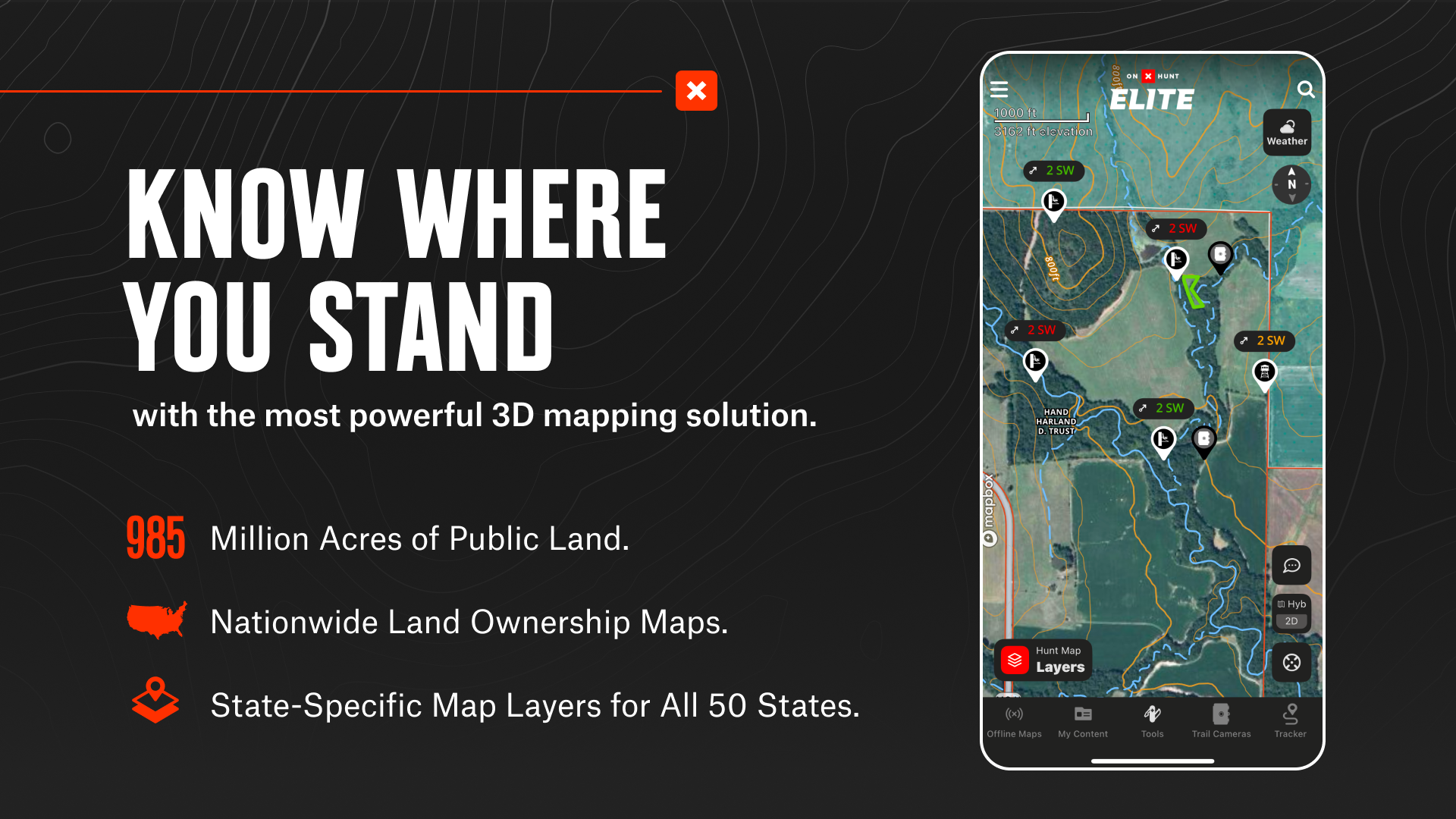
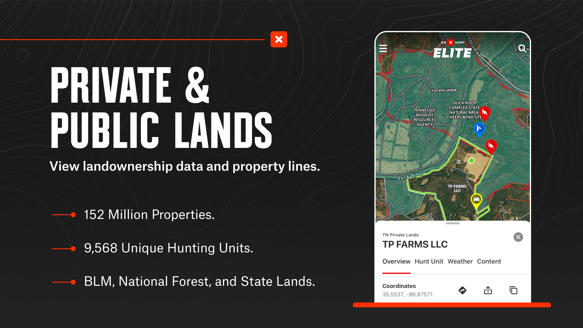
Navigate your next hunt and find more success in the field with onX Hunt. Access GPS navigation, 3D maps, species data, hunting units, and more. Whether you’re a private or public land hunter, know where you stand with nationwide land boundaries.
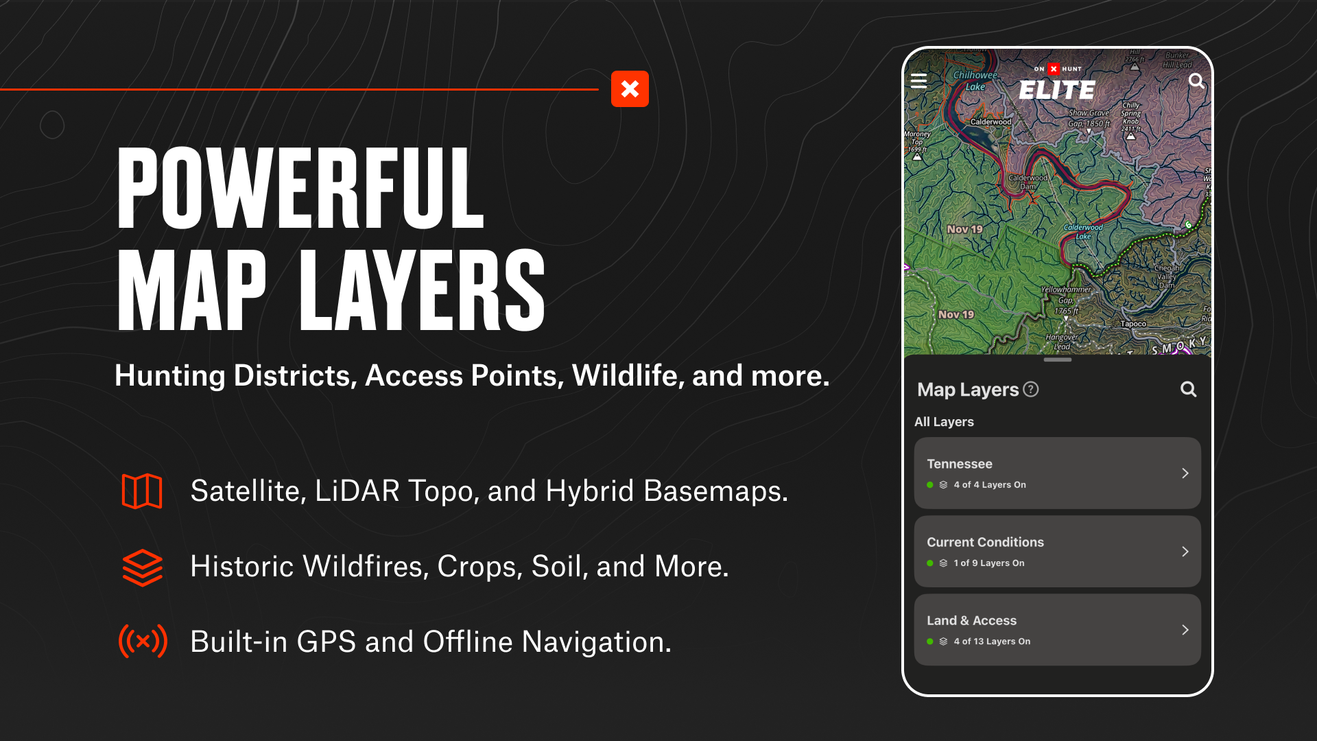
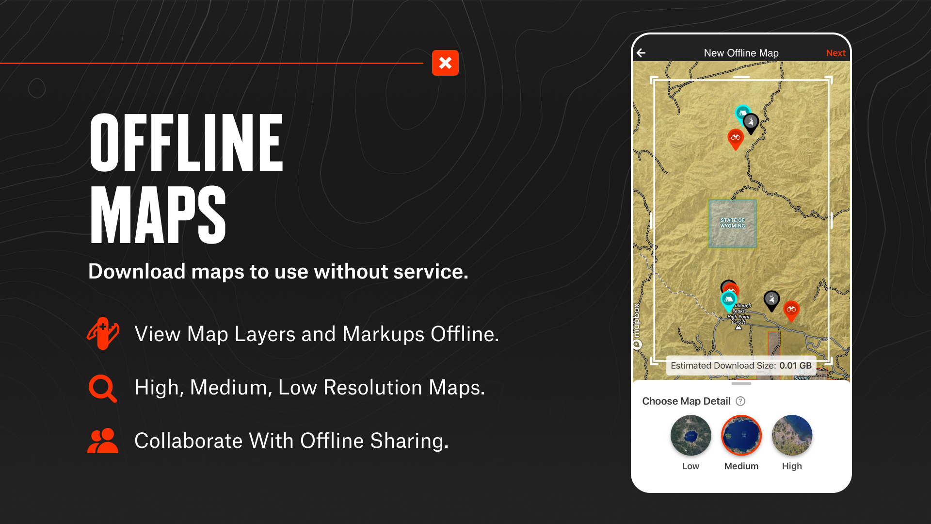
Utilize Lidar Topo, Satellite, or Hybrid Basemaps to understand the landscape. Save Offline Maps, view terrain, and mark crucial locations with Waypoints. Research property lines, monitor optimal weather conditions, and find new opportunities nationwide with custom Map Layers.
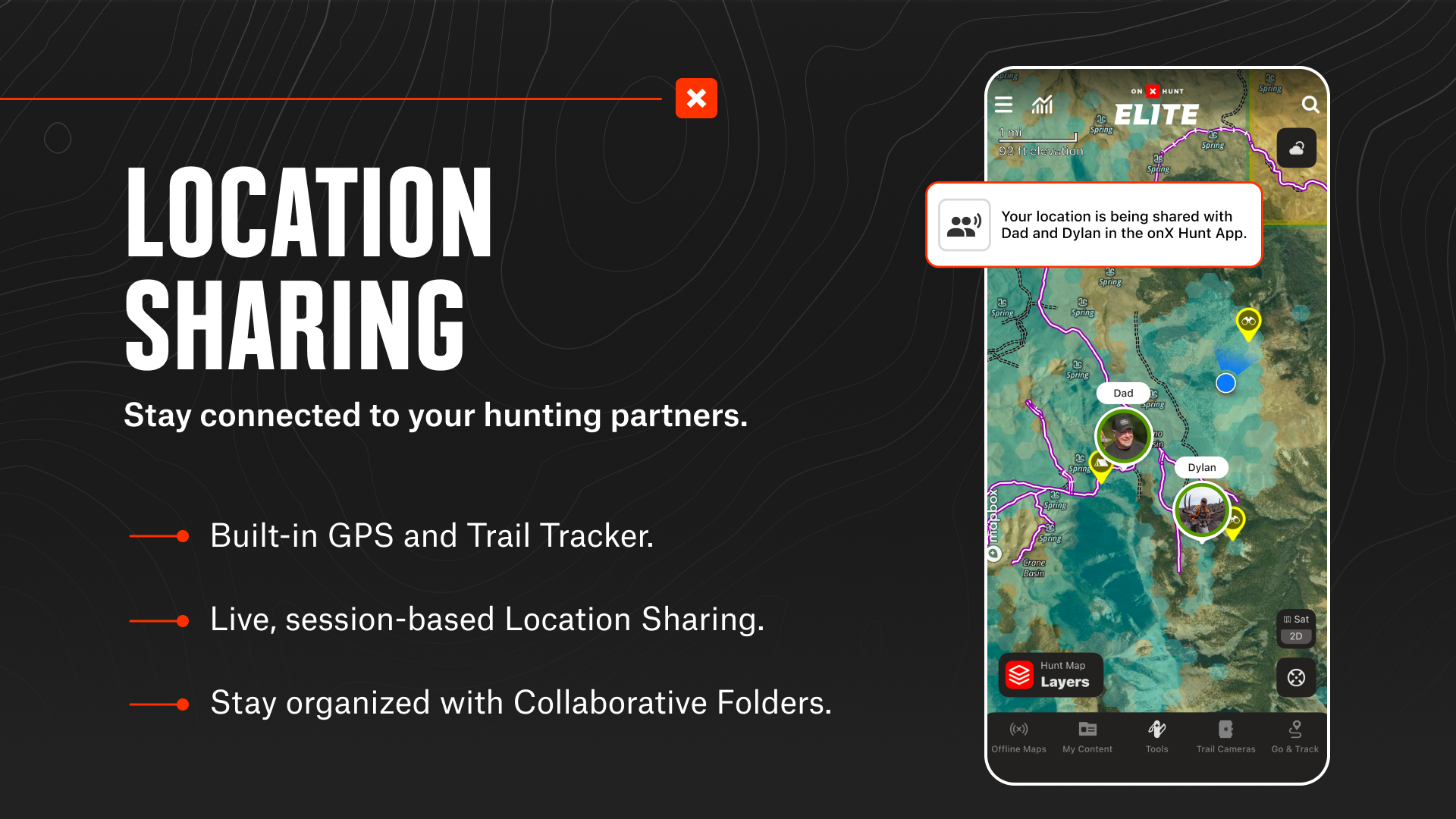
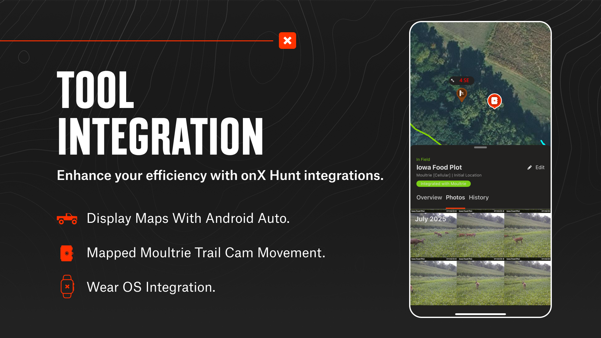
Integrate onX Hunt with compatible tools. View Trail Cameras for recent activity, display routes on your vehicle dash, and sync industry-leading rangefinders and binoculars with the App. See your hunting group’s live locations and share Map Markups with nearby devices on the same platform.
Discover new access, find more game, and hunt smarter with onX Hunt.
onX Hunt Features:
▶ How can you use onX Hunt to prepare for the hunting season?
Use Hunt Research Tools to stack the odds in your favor. Know your draw odds, tag trends, and harvest statistics with onX Hunt on desktop. Access Huntin’ Fool’s expert research as an Elite member and set reminders for application deadlines.
▶ How does onX Hunt help you scout and plan your next hunt?
Check property lines and private land boundary maps with landowner names (U.S. only). Identify GMUs, Hunting Units, public land, and state land hunting maps. View 3D Lidar Topo, Satellite, and Hybrid Basemaps to understand how to move through the landscape.
▶ How can you customize and share your hunt?
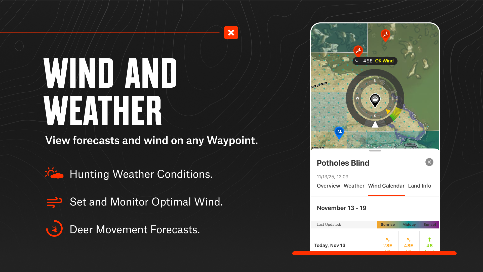
Hunt smarter with terrain analysis tools and scout any tag with state-specific Map Layers. Research conditions, access points, wildlife, trees, soil, and more. Add Markups, set Optimal Wind conditions on any Waypoint, and collaborate by sharing Hunt Areas and Tracks.
▶ How does onX Hunt help you execute in the field and navigate offline?
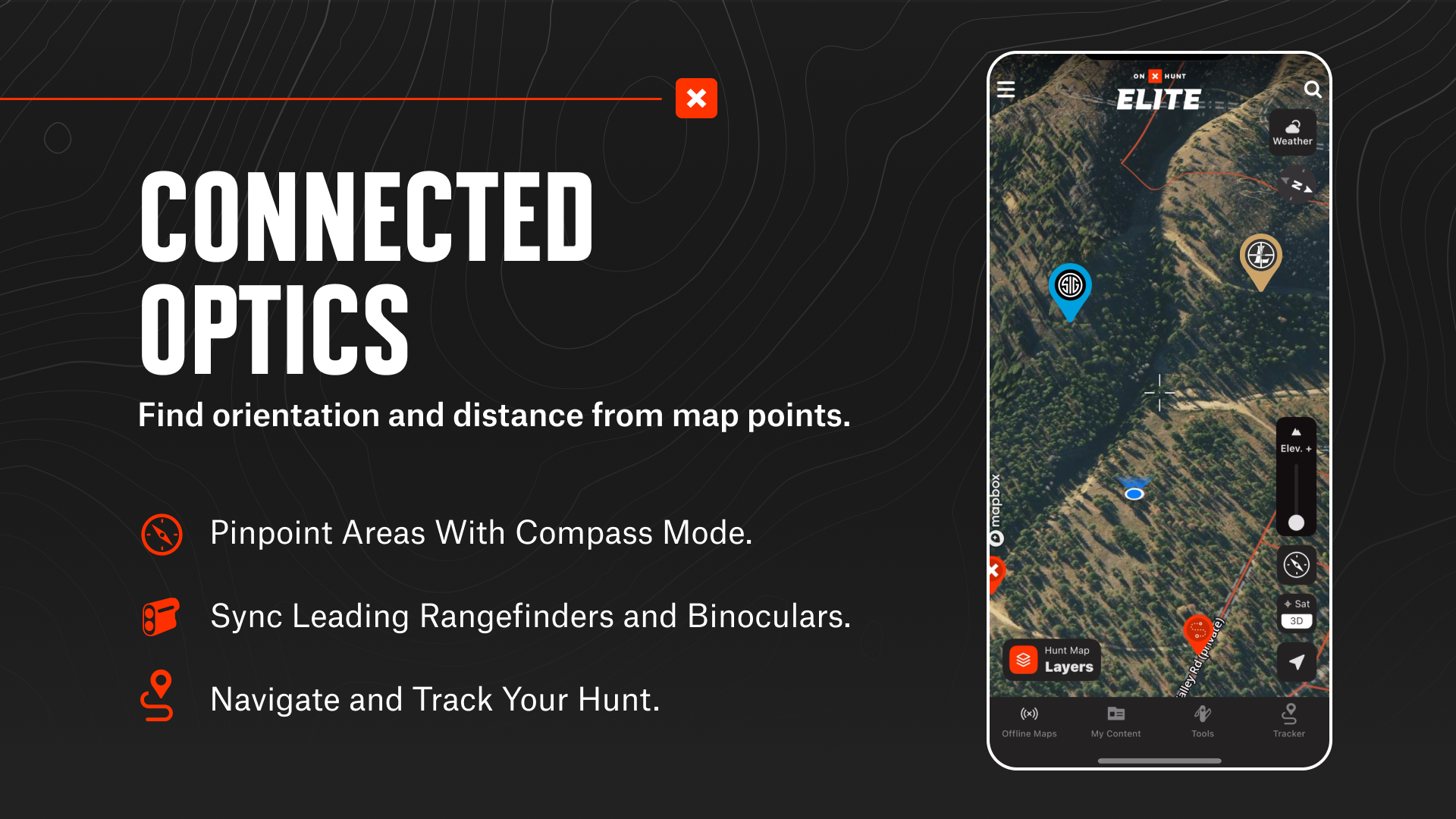
See your partners move with live, session-based Location Sharing. Monitor localized weather forecasts and record your path with Tracker. Maintain your bearings with our built-in GPS and pinpoint areas using Compass Mode. Download Offline Maps to view the details you need, no matter where you are.
▶ Which tools does onX Hunt integrate with?
Display maps on your vehicle’s dash with Android Auto. Drop Waypoints automatically by syncing with compatible rangefinders and binoculars. Connect trail cameras to see images in real-time and receive key insights. Mark your location from your wrist using Wear OS.
▶ Free Trial
Start a free trial when you install the App and select your state of choice.
▶ Premium Membership:
Access all of the features listed above in a single state or Canada. Hunt more game with land ownership maps, custom map layers, offline navigation, and more!
▶ Premium+ Membership:
Get all of the benefits of our Premium Membership, but for two states, or one state plus Canada.
▶ Elite Nationwide Membership:
With an Elite Membership, you get a purpose-built solution for dedicated hunters and the game they pursue, including:
• Proprietary maps for all 50 states and Canada
• TerrainX 3D Viewer, Recent Imagery, Route Builder, Deer Movement Forecast
• In-dash navigation with Android Auto
• Exclusive pro deals and expert resources
• Draw Odds and Application Tools
▶ Government Information & Data Sources
onXmaps, Inc. does not represent any government or political entity, though you may find various links to public information within our services. For more info on any government information found within the services, click on the associated .gov link.
• https://data.fs.usda.gov/geodata/
• https://gbp-blm-egis.hub.arcgis.com/
• https://www.arcgis.com/home/group.html?id=00f2977287f74c79aad558708e3b6649#overview
▶ Terms of Use: https://www.onxmaps.com/tou
▶ Privacy Policy: https://www.onxmaps.com/privacy-policy
▶ Feedback: Have a problem or want to request new features? Please contact us at
[email protected]