FishAngler (Package Name: com.fishangler.fishangler) is developed by FishAngler, LLC and the latest version of FishAngler: Fishing Maps App 5.3.0.261 was updated on October 15, 2026. FishAngler: Fishing Maps App is in the category of Sports. You can check all apps from the developer of FishAngler: Fishing Maps App and find 200 alternative apps to FishAngler: Fishing Maps App on Android. FishAngler: Fishing Maps App is listed in Top 10 Fishing Apps for Android. Currently this app is for free. This app can be downloaded on Android 9.0+ on APKFab or Google Play. All APK/XAPK files on APKFab.com are original and 100% safe with fast download.
Fishing app for anglers with fishing maps, fishing spots, fishing forecast, tides, and AI fish ID. FishAngler is the AI-powered fishing app trusted by millions of anglers across the US and worldwide — find fishing spots near you, plan trips, and log every catch.
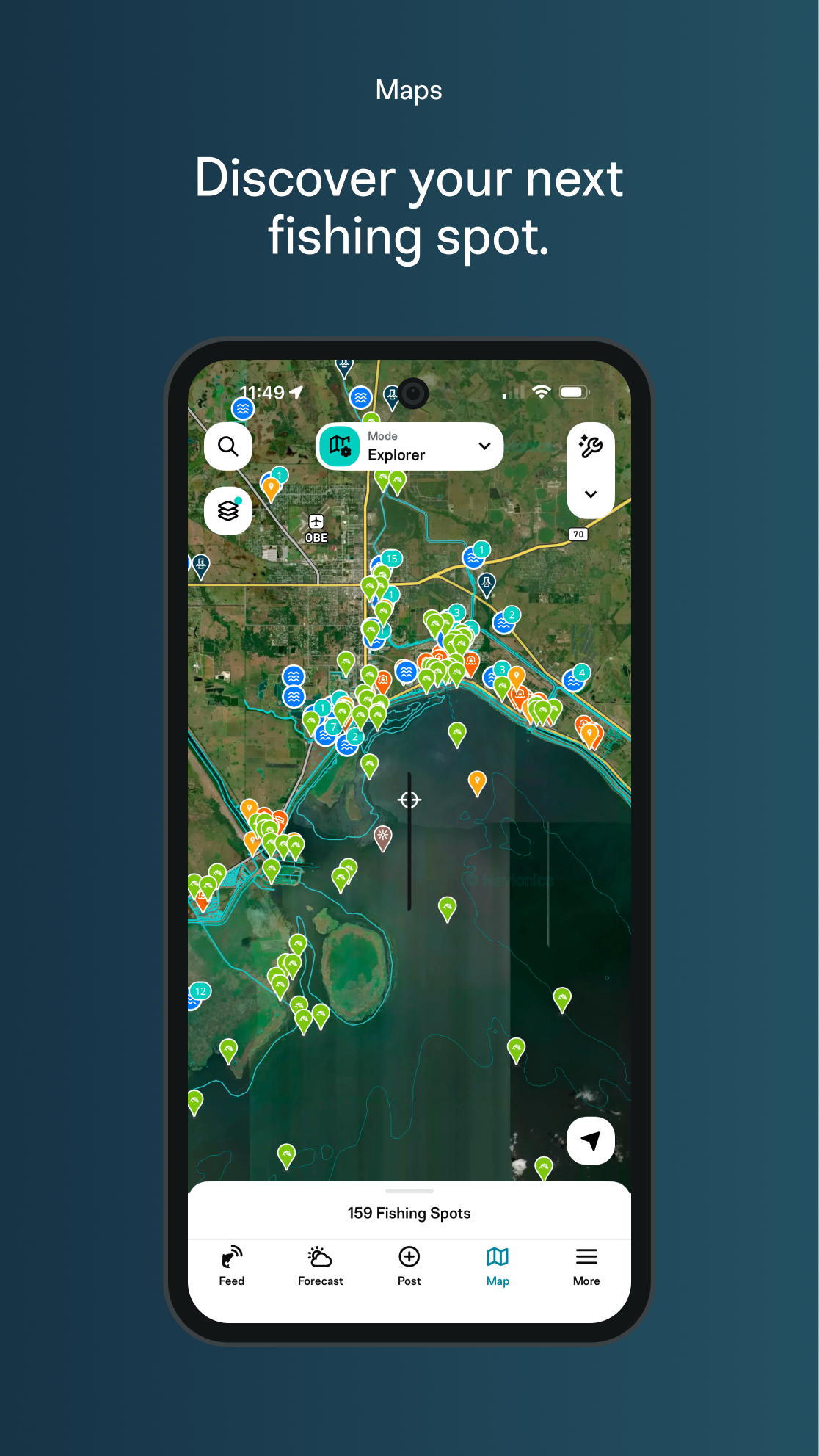
FIND FISHING SPOTS — FRESHWATER & SALTWATER FISHING MAPS
Bass fishing on a local lake, trout fishing a new river, or offshore saltwater fishing — FishAngler's fishing map covers it all.
• Millions of verified fishing spots and fishing locations logged by real anglers
• Lakes, rivers, reservoirs, inshore bays, and offshore fishing waters mapped across the US and beyond
• Fishing access points, boat ramps, buoys, depth charts, and underwater structure
• Property boundary data — know where you can legally fish
• Advanced GPS: copy/paste coordinates, live compass with speed and heading
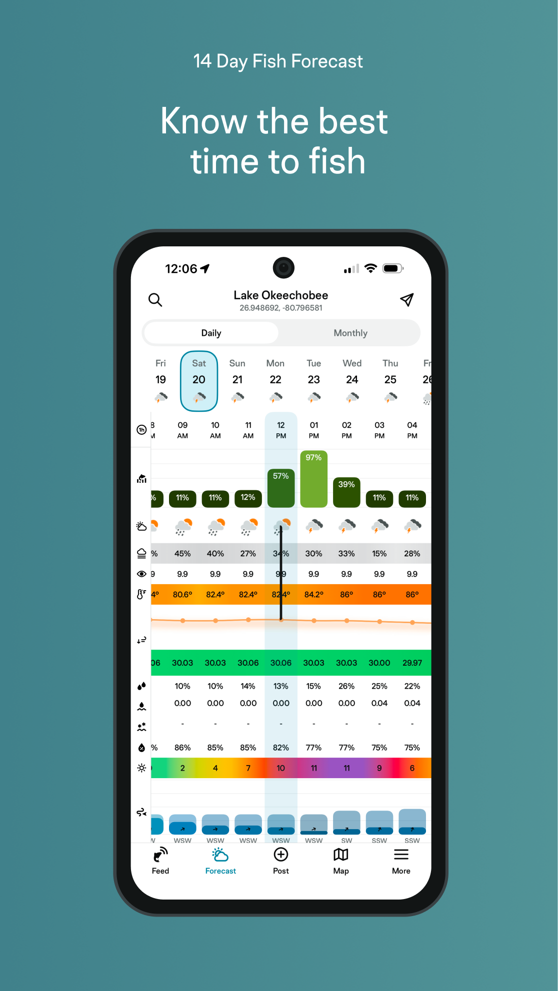
FISHING FORECAST — KNOW BEFORE YOU GO
FishAngler's fishing forecast puts everything you need in one place.
• 7-day fishing weather with hourly wind, temperature, and barometric pressure
• Real-time fishing tide charts and tides for coastal and saltwater fishing
• Moon phases and solunar bite windows — know when fish feed
• Animated weather map layers: radar, wind, current, and cloud cover
CATCH LOG & FISHING LOGBOOK — EVERY FISH TELLS A STORY
Log every catch with 45+ attributes — species, bait, lure, water temperature, fishing conditions, time of day, moon phase, and GPS location.
• Track personal bests, species count, and fishing streaks
• Review historical catch data to surface what's working on your local waters
• Your catch log and location data stay private by default — you choose what to share
AI FISH IDENTIFICATION — 860+ SPECIES INSTANTLY
Not sure what you caught? Snap a photo. FINN™'s fish AI identifier recognizes 860+ freshwater and saltwater species in seconds — bass, trout, redfish, snook, catfish, crappie, carp, salmon, tarpon, tuna, and more. The smartest fish finder in your pocket.
FISHING COMMUNITY — ANGLERS WHO KNOW YOUR WATER
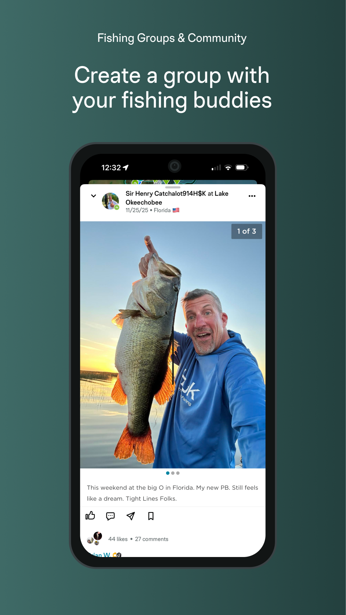
FishAngler is where fishing communities live. Get fishing tips and fishing techniques from anglers on the same waters, not strangers in another state.
• Local catch reports and real-time fishing activity around your waters
• Angler fishing groups organized by region, species, and water body
• Public catch feed with bait, conditions, and location context
• Share catches, stories, and fishing insights with your community
UPGRADE TO VIP — UNLOCK FINN™
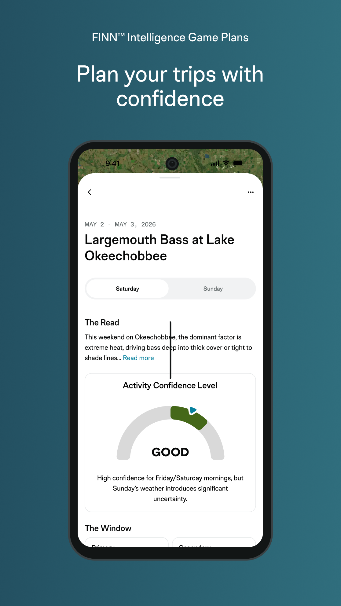
FINN™ GAME PLANS — YOUR PERSONALIZED AI FISHING PLAN
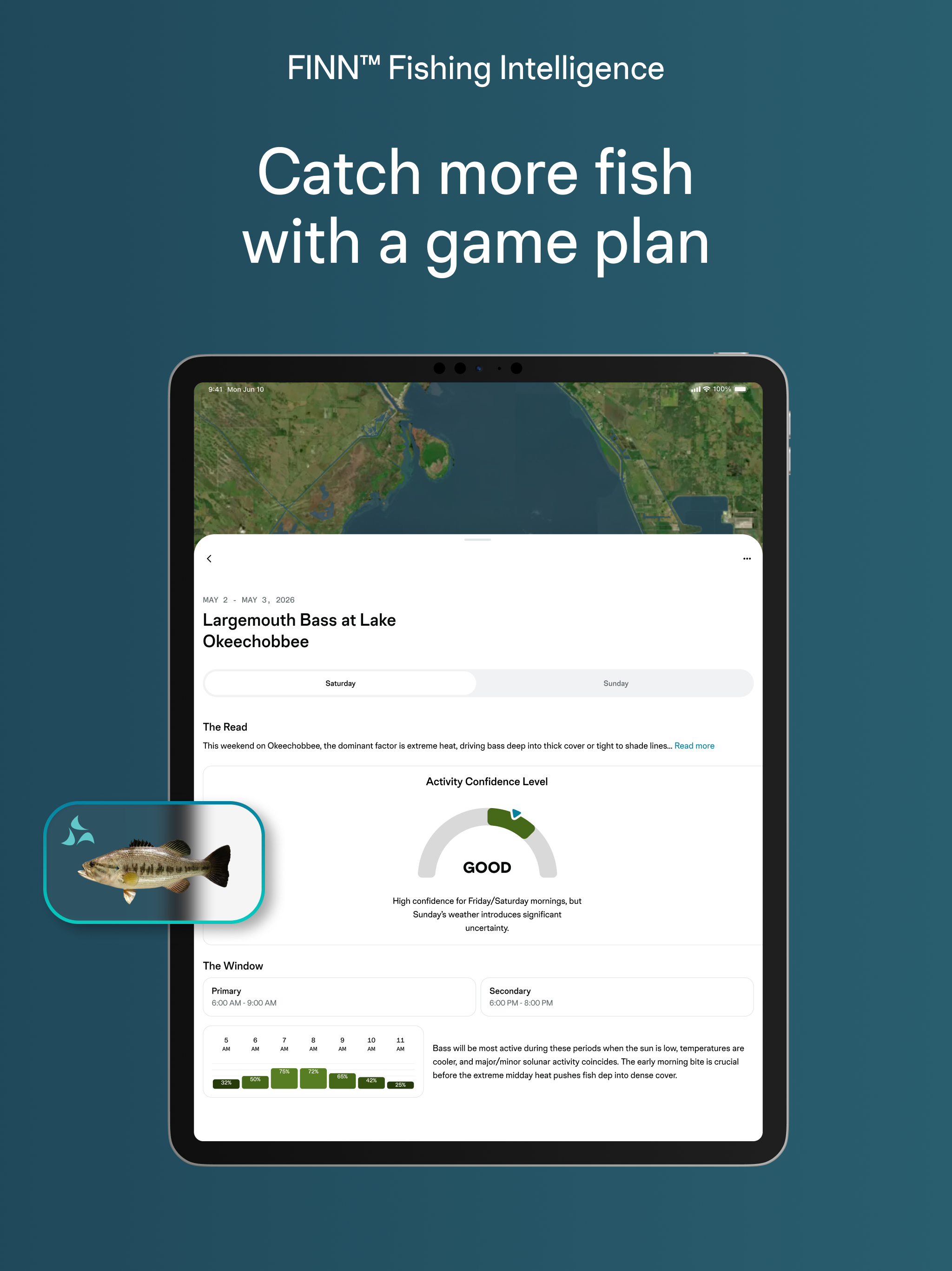
FINN™ combines your catch history, local conditions, tides, moon phase, barometric pressure, and species behavior to tell you when to go, where to fish, and how to work your spots.
FISHFORECAST™ — ADVANCED SOLUNAR BITE WINDOWS
Know exactly when fish will feed — down to the hour. Stop fishing the wrong hours.
BAIT & LURE INTELLIGENCE
Species-specific top baits and lure recommendations based on season, conditions, and real catch reports from local anglers.
VERIFIED EXACT CATCH LOCATIONS
See precise GPS coordinates of recent confirmed catches — logged by real anglers, verified by catch data.
PREMIUM 3D LAKE & OCEAN MAPS
3D lake maps, ocean floor mapping, shaded relief, and Garmin Navionics bathymetric charts. Explore structure and depth like a pro.
14-DAY FORECAST + ANIMATED MAP LAYERS
Extended fishing weather with animated radar, wind, currents, and tidal overlays.
PRIVATE WAYPOINTS & MAPMODES™
Build custom map setups — save preferred layers, tools, and species filters for one-tap access on the water.
MEMBER PERKS & AD-FREE
Exclusive discounts with participating brands, outfitters, and fishing experiences.
RATED #1 FISHING APP
Trusted by millions of anglers from bass fishing reservoirs to offshore saltwater grounds.
Download free. Log your first catch. Let FINN™ change how you fish.
Questions? Email:
[email protected]