Germany Topo Maps (Package Name: com.atlogis.germany) is developed by ATLOGIS Geoinformatics GmbH & Co. KG and the latest version of German Topo Maps 7.8.9 was updated on June 13, 2026. German Topo Maps is in the category of Maps & Navigation. You can check all apps from the developer of German Topo Maps and find 193 alternative apps to German Topo Maps on Android. Currently this app is for free. This app can be downloaded on Android 9.0+ on APKFab or Google Play. All APK/XAPK files on APKFab.com are original and 100% safe with fast download.
Offline GPS Navigation with Topographic Maps and Aerial Imagery for Germany
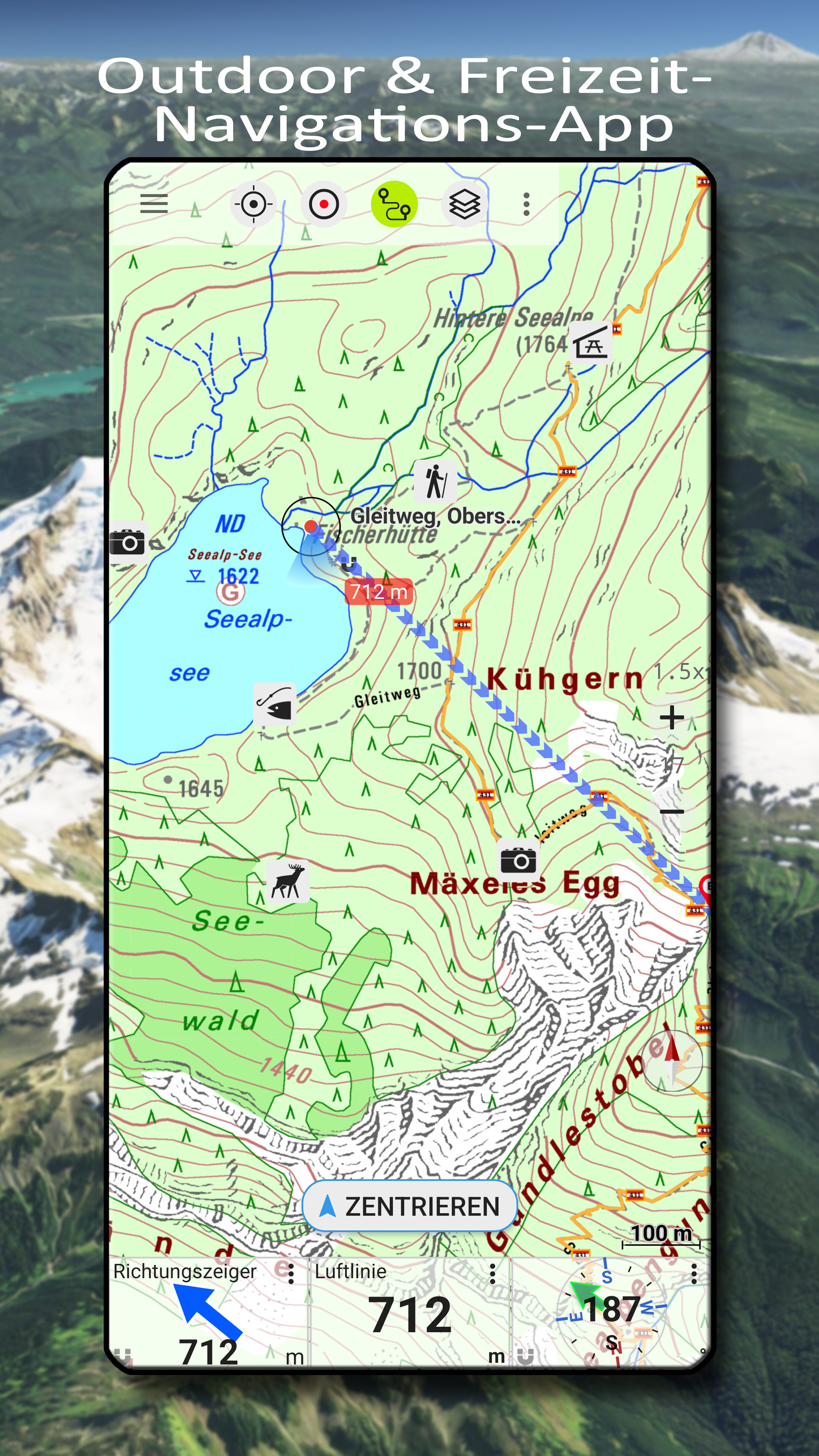
Powerful and easy-to-use outdoor navigation app with high-resolution topographic maps, official aerial imagery, and advanced navigation tools – ideal for hiking, cycling, and all outdoor activities.
High-Resolution Maps for Germany
Access the best available map sources:
• Basemap LiDAR Hillshade: Based on ATKIS Base-DLM data, enhanced with fine hillshading
• DTK Topo LiDAR Hillshade: Topographic maps (DTK series) with detailed shading
• TopPlus: Based on ATKIS Base-DLM data with an alternative cartographic style, also available across Europe (reduced resolution)
• Aerial imagery with up to 20 cm resolution
Maps are sourced from BKG (Bundesamt für Kartographie und Geodäsie), OpenStreetMap contributors, ESRI, Google Maps Platform, Microsoft Bing Maps, and state surveying offices (Landesvermessungsämter) of the German federal states.
Discover even the smallest terrain features such as historic paths, foundations, or former border lines.
Worldwide Maps and Additional Layers
• AtloMaps Hillshading v4: High-resolution digital terrain model (1 m resolution)
• AtloMaps OSM: Topographic map based on OpenStreetMap data (often more detailed than official maps), with hillshading and global coverage
• CyclOSM: Cycling map
• ESRI Topographic, Aerial, and Street maps
• Bing Maps and Satellite (online only)
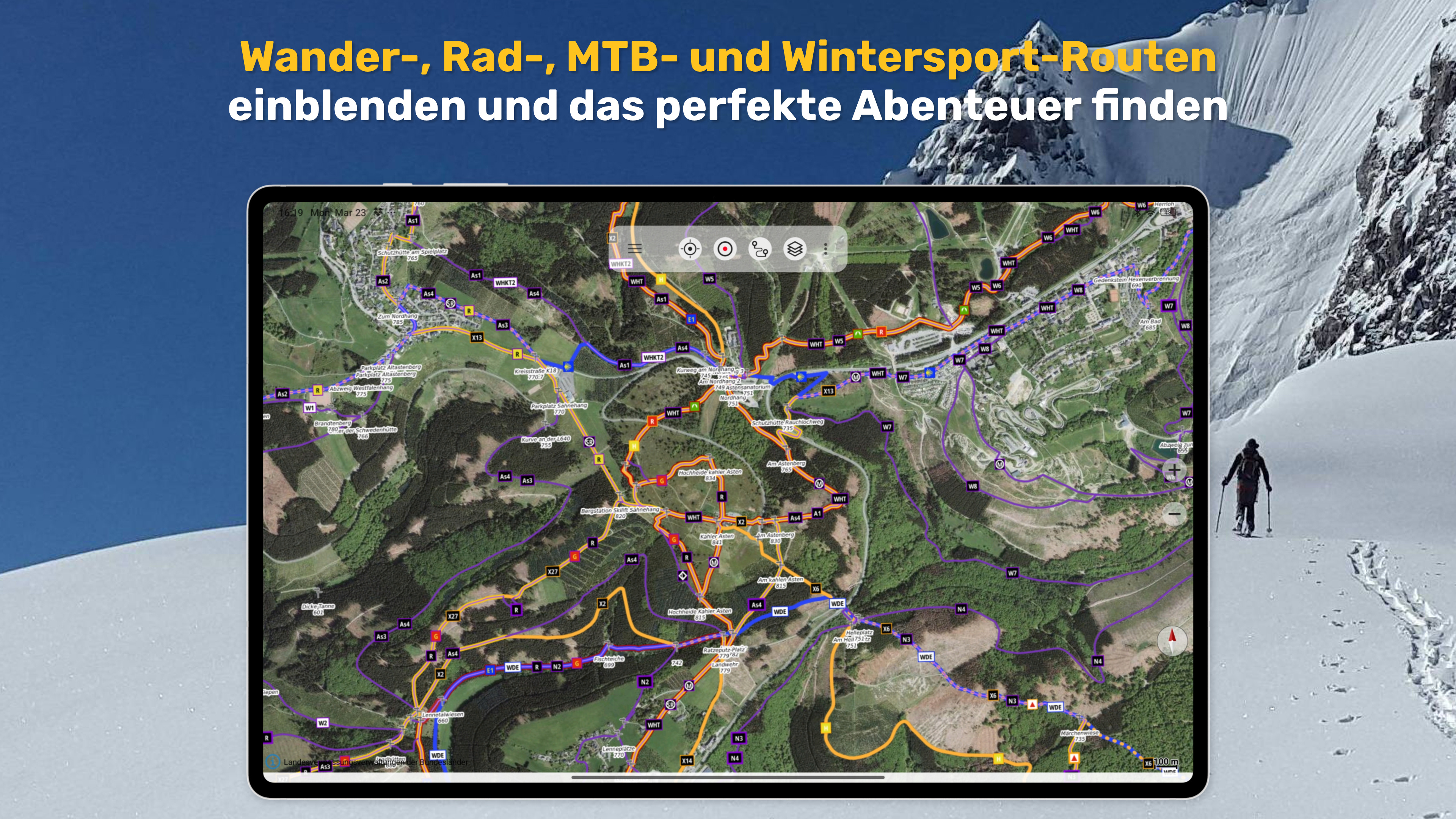
• Various overlays such as hiking and cycling routes, hillshade, and water features
More than 60 map types for Germany plus additional global maps available.
• Regional Maps
• Aerial imagery (10–40 cm resolution)
• Topographic maps (DTK10, DTK25, DTK50, DTK100)
• Digital terrain models (DGM) and surface models (DOM)
• Cadastral maps (parcel maps)
• Additional overlays such as water networks and hiking trails
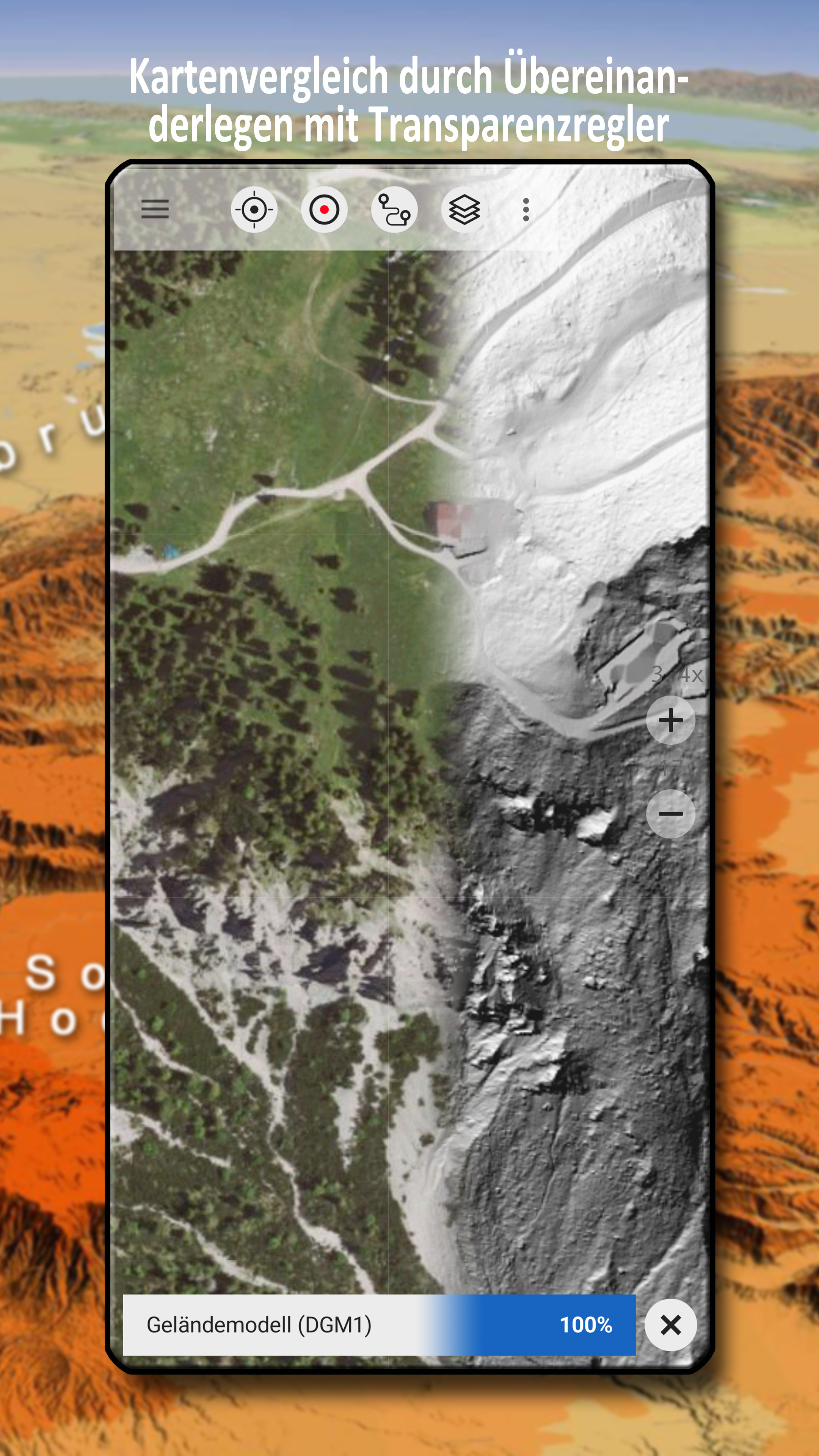
Compare and Combine Maps
• Combine multiple maps as overlays
• Compare maps using a transparency slider
• Choose the best map depending on region and use case
There is no single perfect map – compare multiple sources directly within the app.
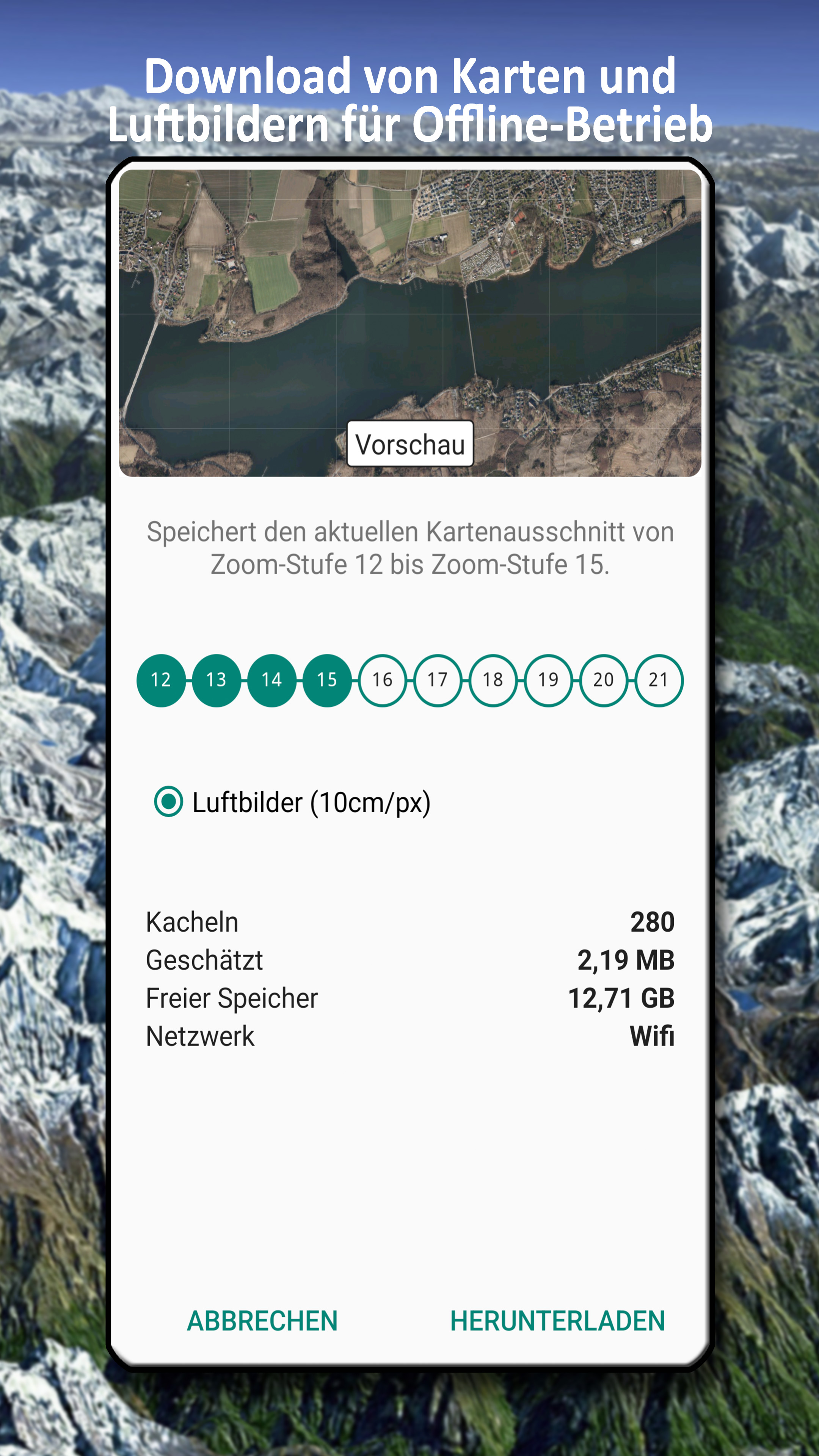
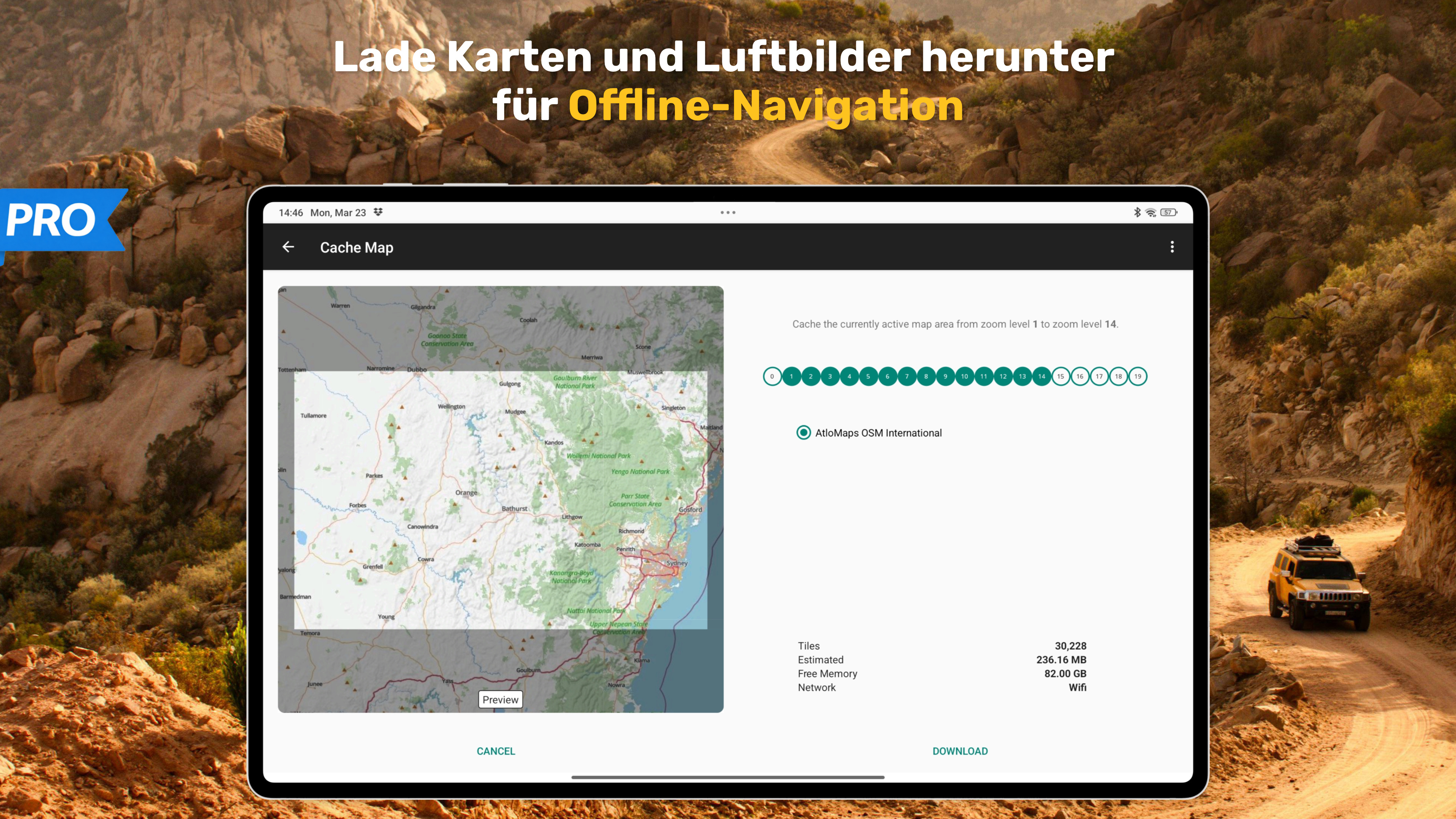
Offline Maps and Navigation
• Download maps for selected regions
• Full offline usage without internet connection
• Automatic caching of viewed maps
• No roaming costs
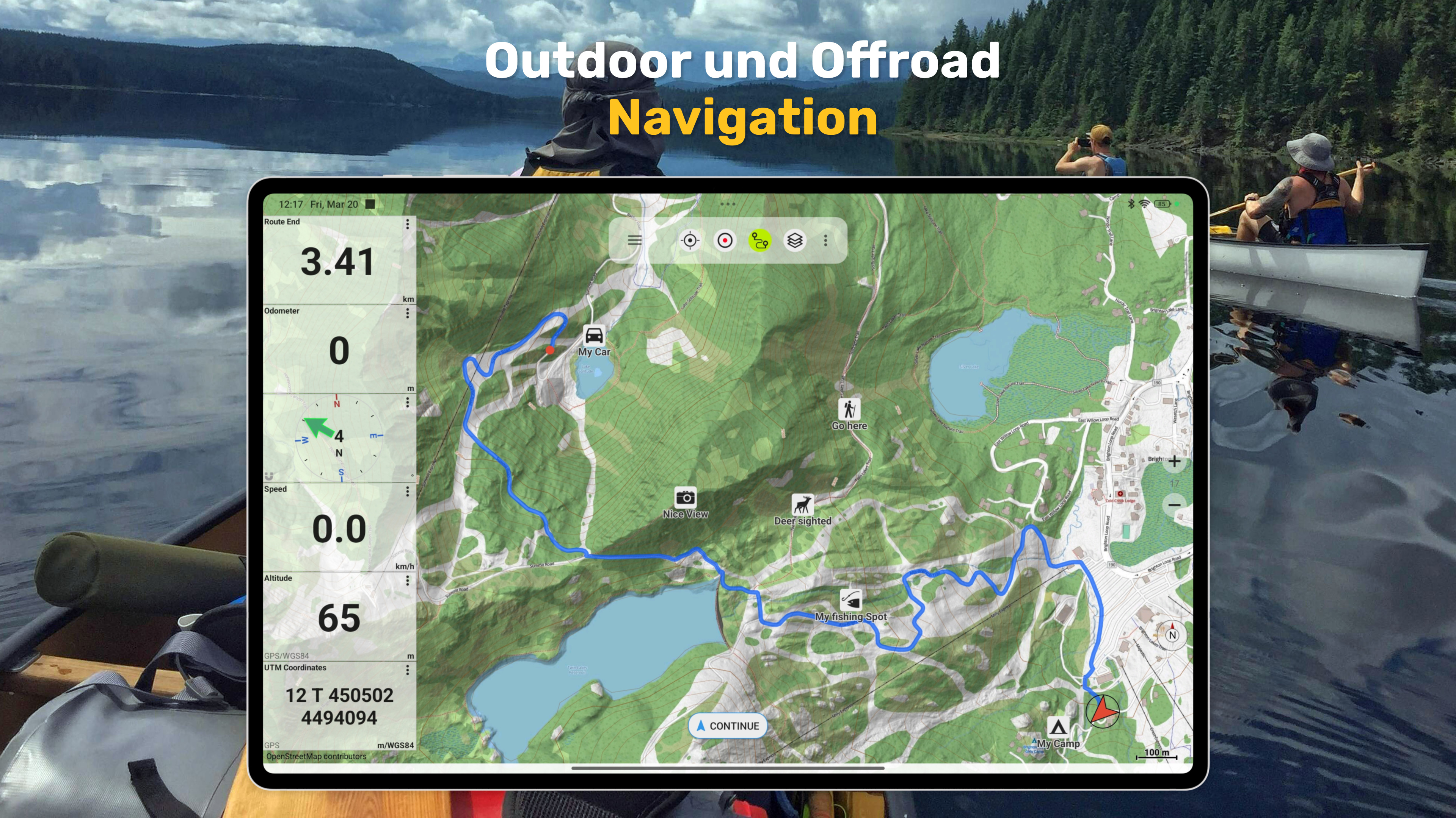
GPS Navigation for Outdoor Activities
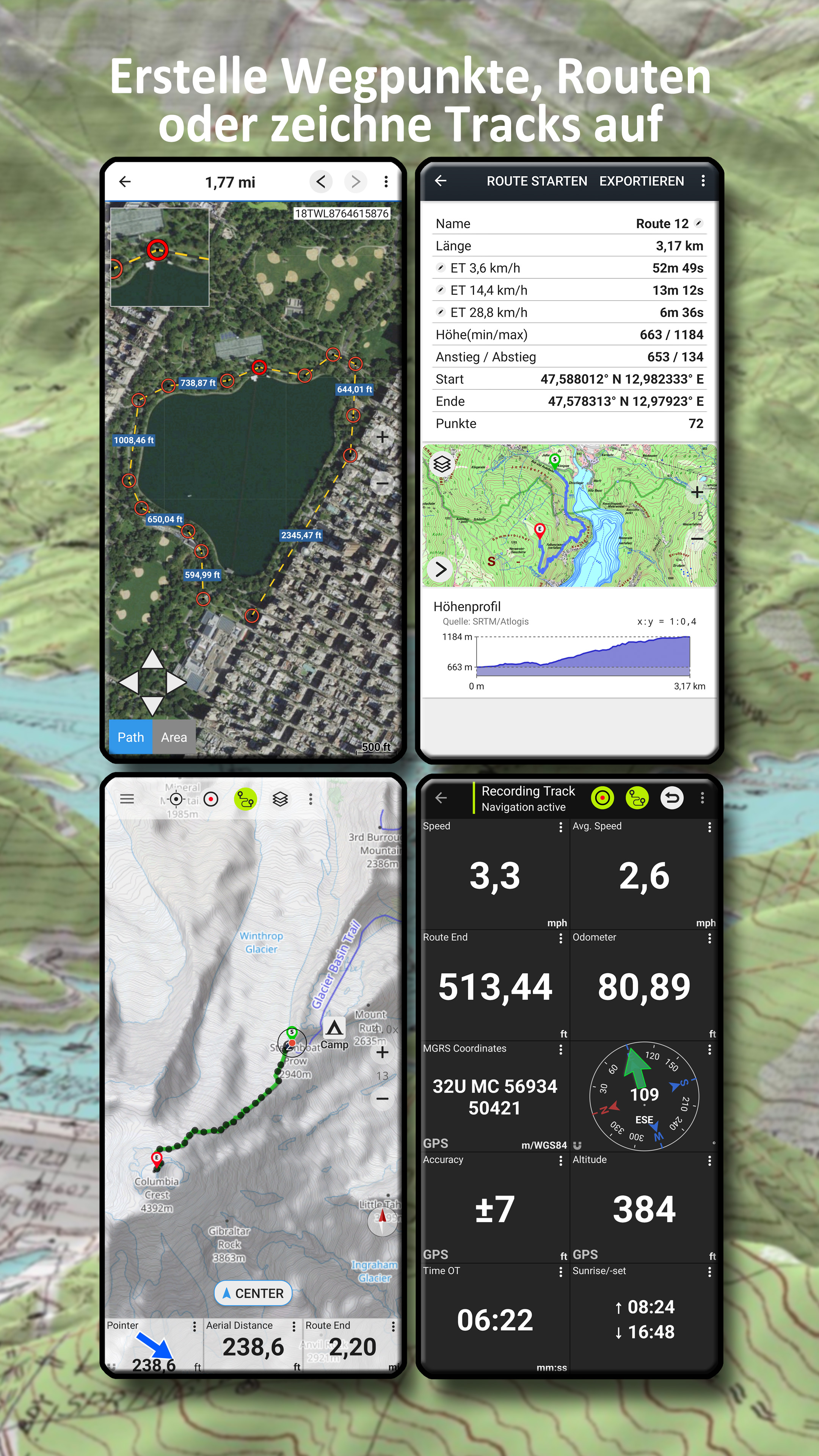
• Record GPS tracks (distance, speed, elevation, accuracy)
• Create and manage waypoints
• Navigate directly to waypoints
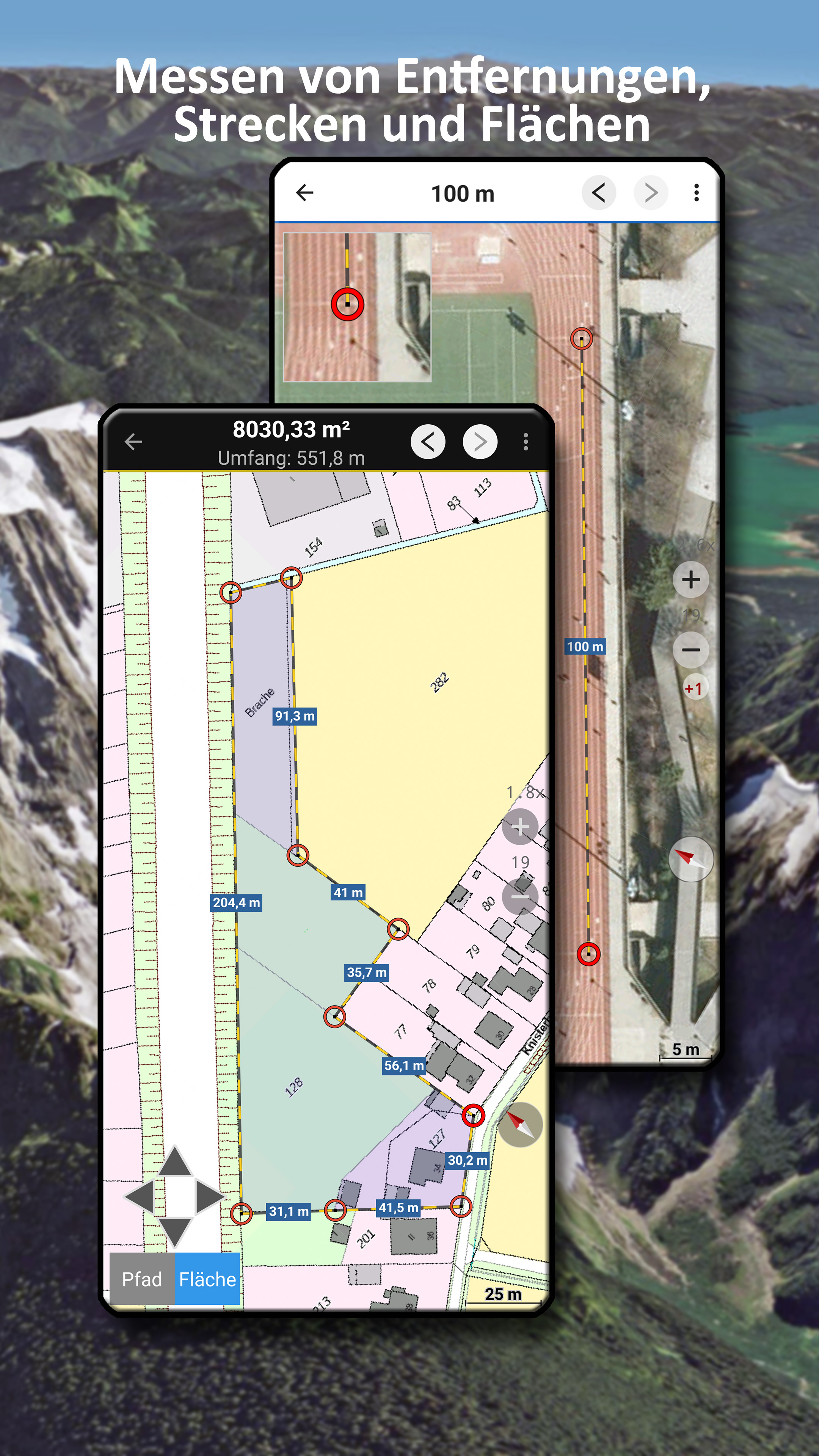
• Measure distances and areas
• Tap the map to get elevation and distance
• Track replay
• Customizable data fields (e.g. compass, distance, bearing)
• Search for places and addresses
• Coordinate formats: WGS84, UTM, MGRS
Import and Export
• Import and export GPX, KML, and KMZ files
• Share tracks, routes, and waypoints (e.g. via email or messaging apps)
Pro Features
• Full offline navigation
• Easy download of large map areas
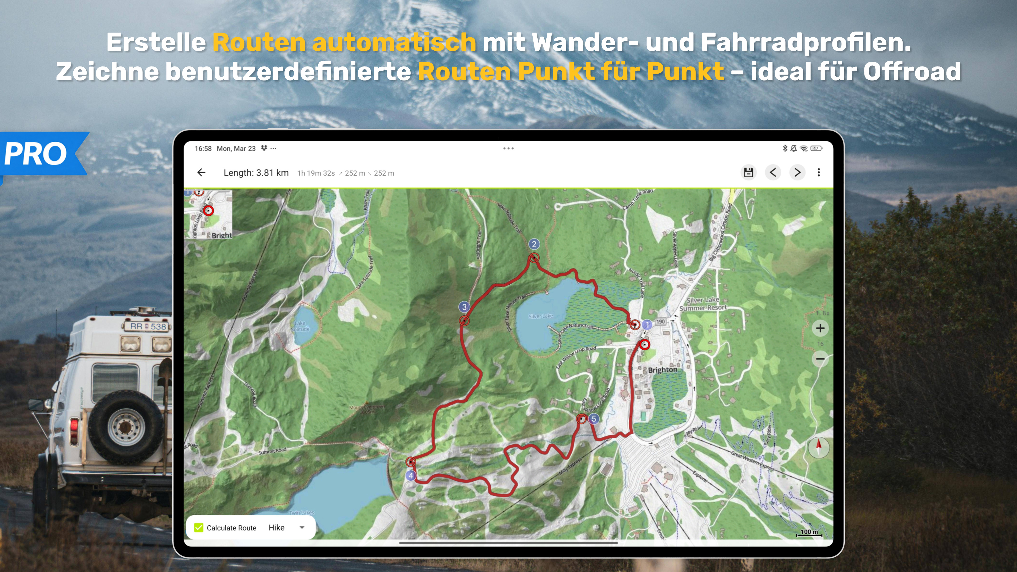
• Create and edit routes
• Route navigation (point-to-point and automatic routing)
• Unlimited waypoints and tracks
• Add custom map sources (WMS, tile servers, MBTiles)
• Ad-free experience
Ideal For
Hiking, cycling, mountain biking, camping, geocaching, skiing, climbing, off-road navigation, hunting, aviation, and search & rescue (SAR).
Privacy
No tracking. No data collection.
Your location data stays on your device.
Support:
[email protected]