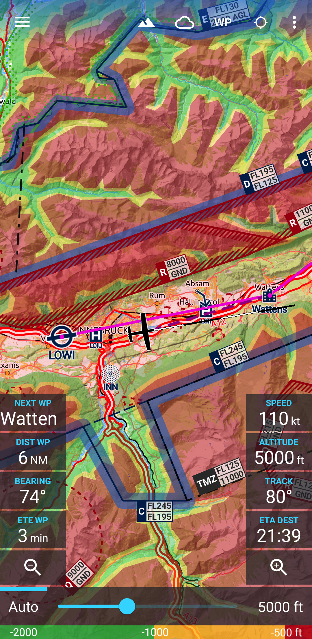
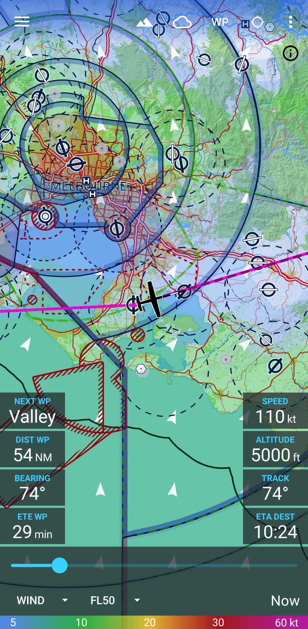
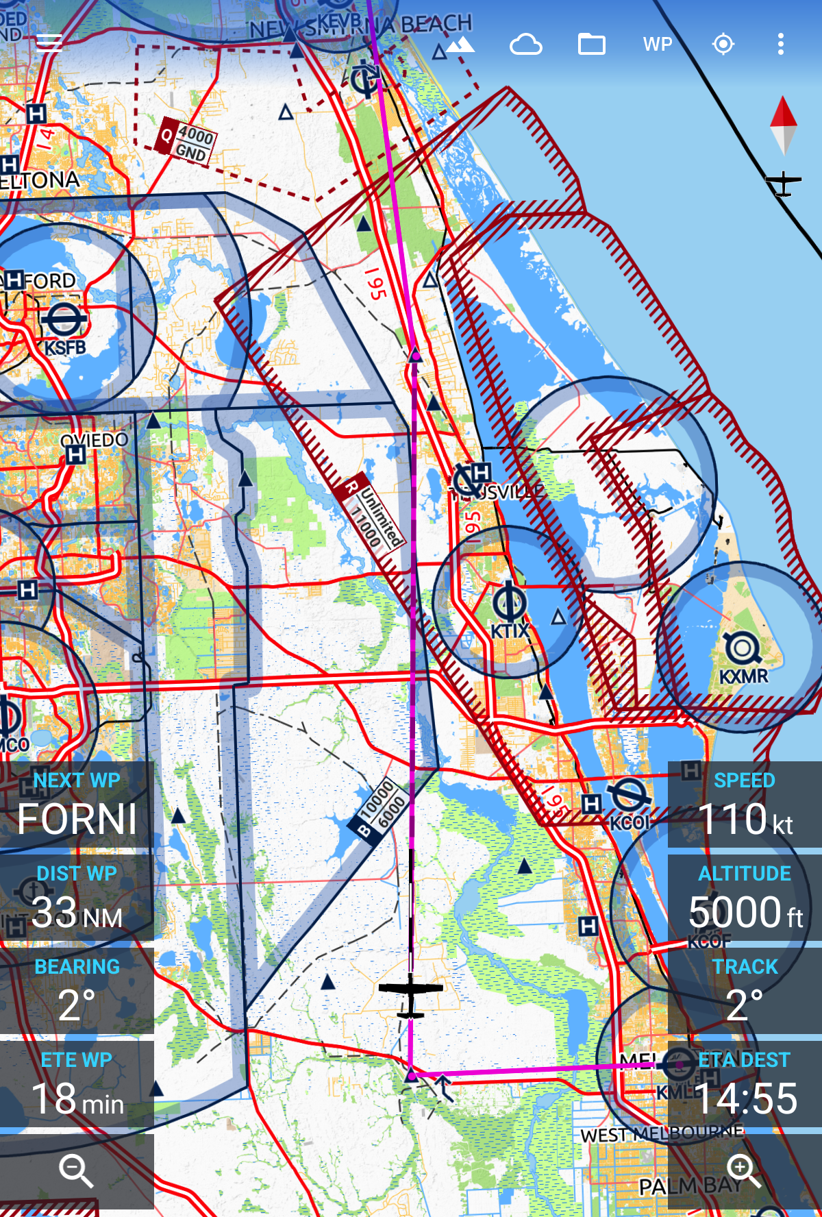
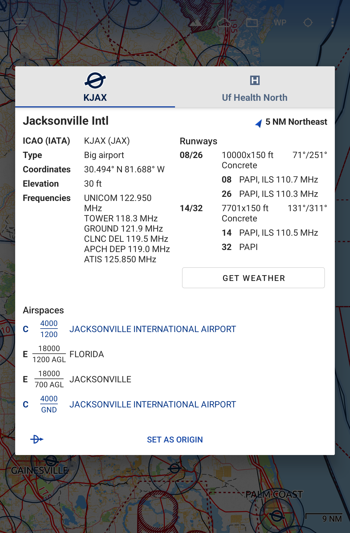
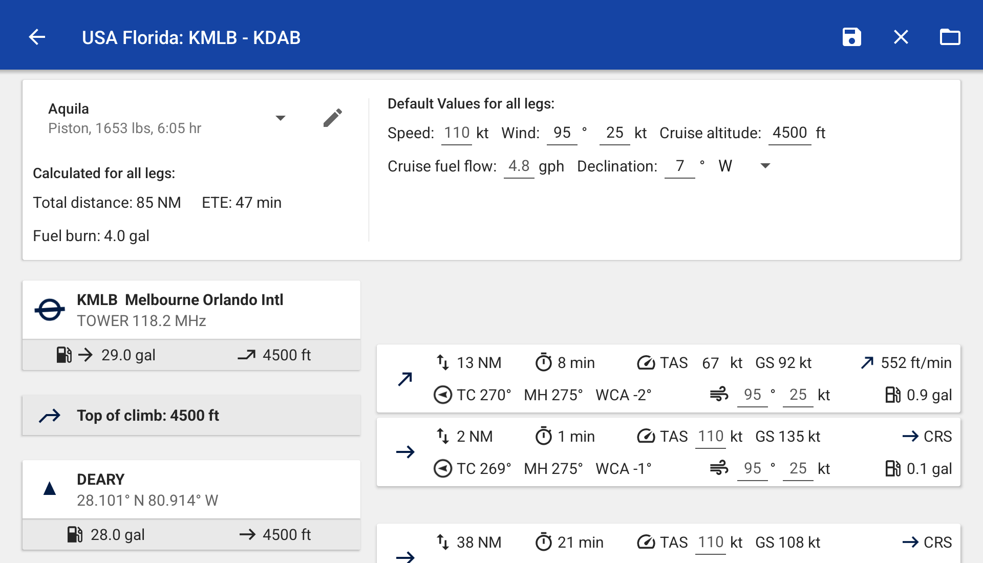
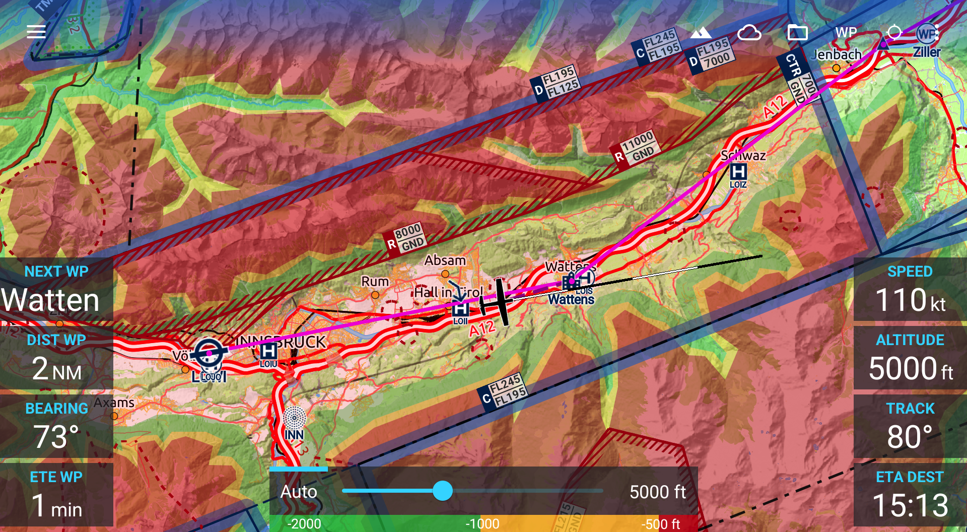
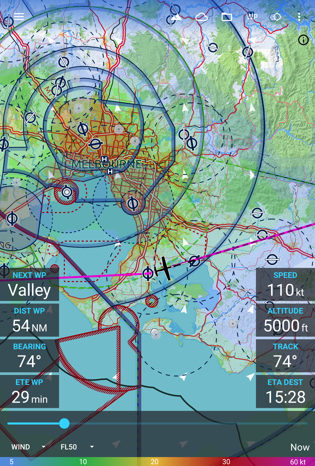
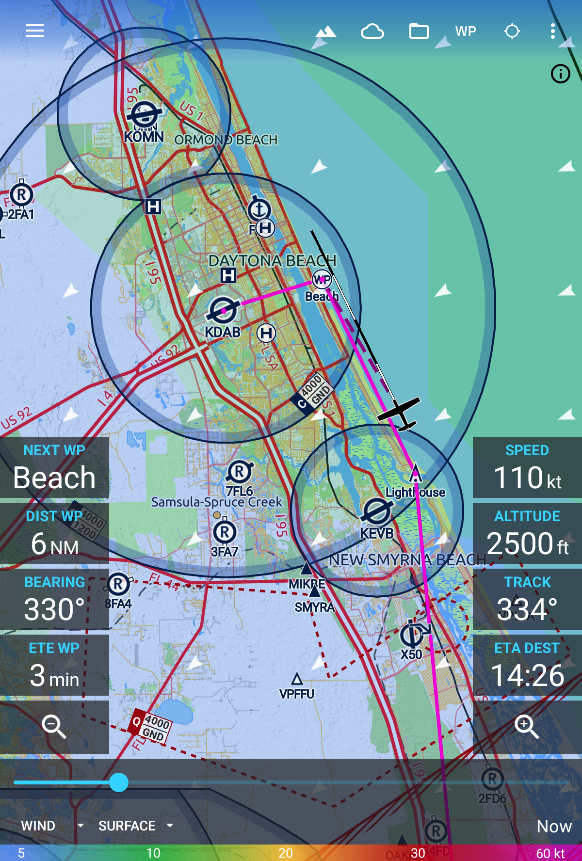
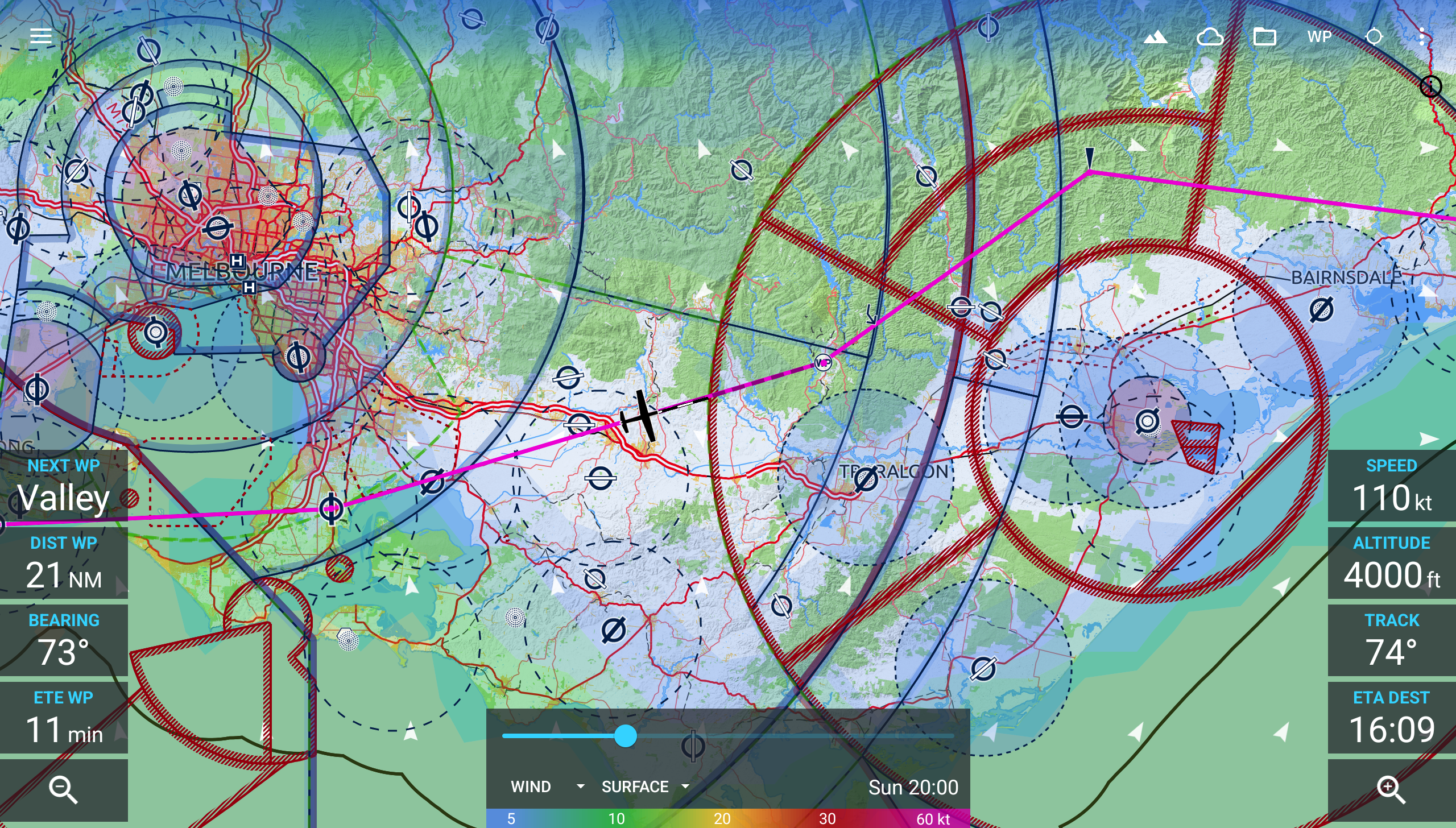
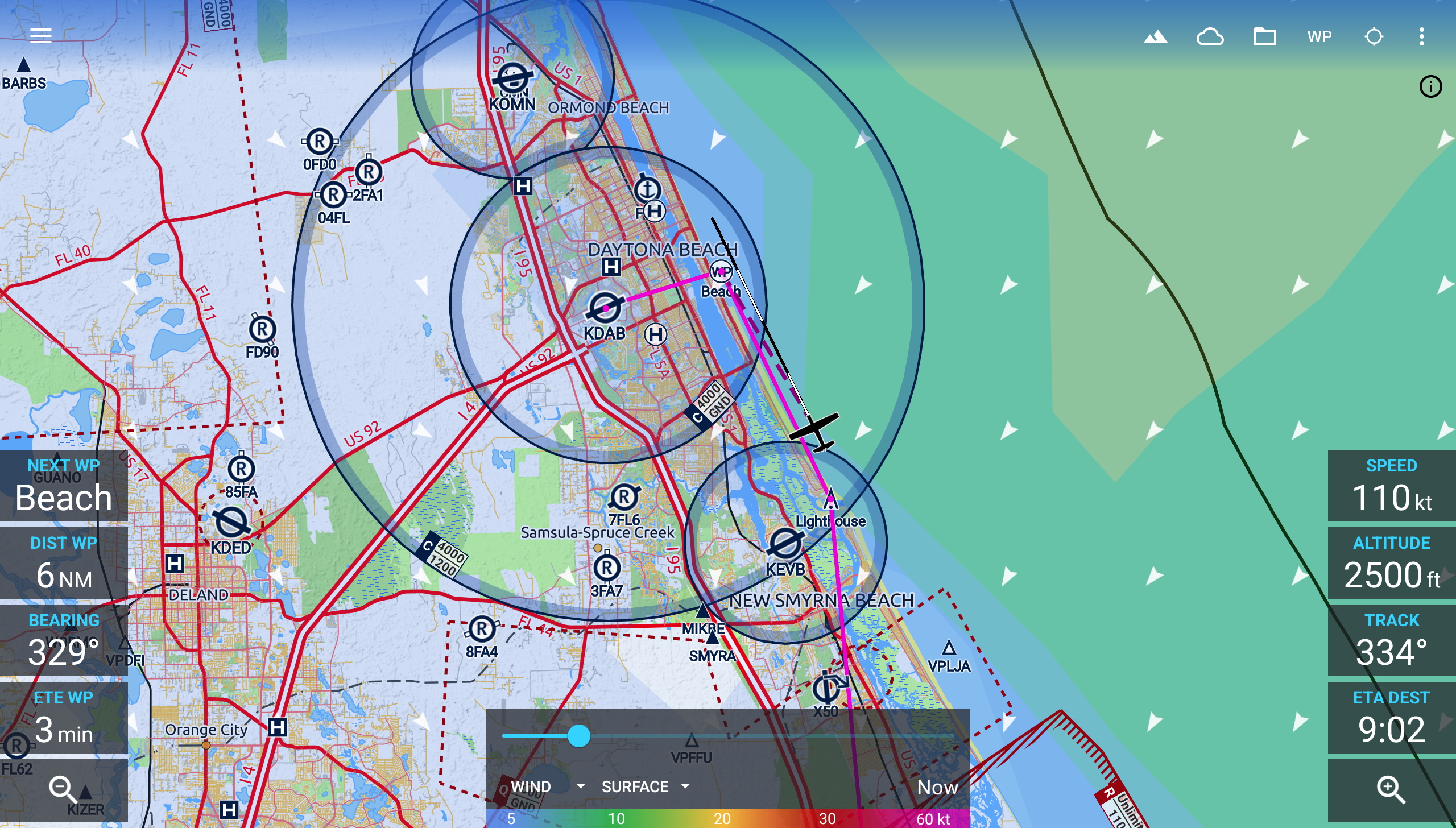
Avia Maps Aeronautical Charts
8.6 186
v4.0.1 by Remy Webservices UG
8.6 186
v4.0.1 by Remy Webservices UG


Architecture: arm64-v8a, armeabi-v7a, x86, x86_64
Screen DPI: 120-640dpi
SHA1: 7d08c6ebf576af74eb194efc0b0bab369baf0f66
Size: 58.17 MB
What's New:
Requires Android: Android 8.0+
Architecture: arm64-v8a, armeabi-v7a, x86, x86_64
Screen DPI: 120-640dpi
SHA1: c6f02bd9ef32c298cb35db66b992c5c1223f0208
Size: 41.26 MB
What's New:
Requires Android: Android 8.0+
Architecture: arm64-v8a, armeabi-v7a, x86, x86_64
Screen DPI: 120-640dpi
SHA1: 560850ead565ffe0579c8bd64268bd1b18f0bea9
Size: 41.24 MB
What's New:
Package Name:
Category:
Update Date:
2026-04-14
Latest Version:
4.0.1
Need Update:
Available on:
Requirements:
Android 8.0+
Report:
Earthmate
Text and Navigate with inReach
3.9 104
MA GPX: Create, Edit GPS track
MA GPX is a hiking GPS that reads, edits, modifies, records all of your tracks
4.4 16
Racing Calendar 2026 + Ranking
F1™ 2026 standing, races, teams, drivers. Full version without any ads
9.6 572
Spoke (Circuit) Dispatch
Formerly Circuit for Teams. Your boss can buy a subscription to Spoke Dispatch.
9.5 206
StreetComplete
OpenStreetMap surveyor app
9.7 118
Dronecast - Weather & Fly Map
Fly safe - Weather forecast for your Drone/UAV, No Fly Zones and Wind breakdown
9.4 377
AirNav Radar – Flight Tracker
Plane tracker, airplanes finder, navigation. Track flights overhead in real time
8.8 540
AirData UAV
Automatically capture your drone flights and discover early signs of problems
8.4 41
UAV Forecast for Drone Pilots
Weather for drones: winds aloft, GPS, Kp index, No-Fly Zones and TFRs
8.4 1K+