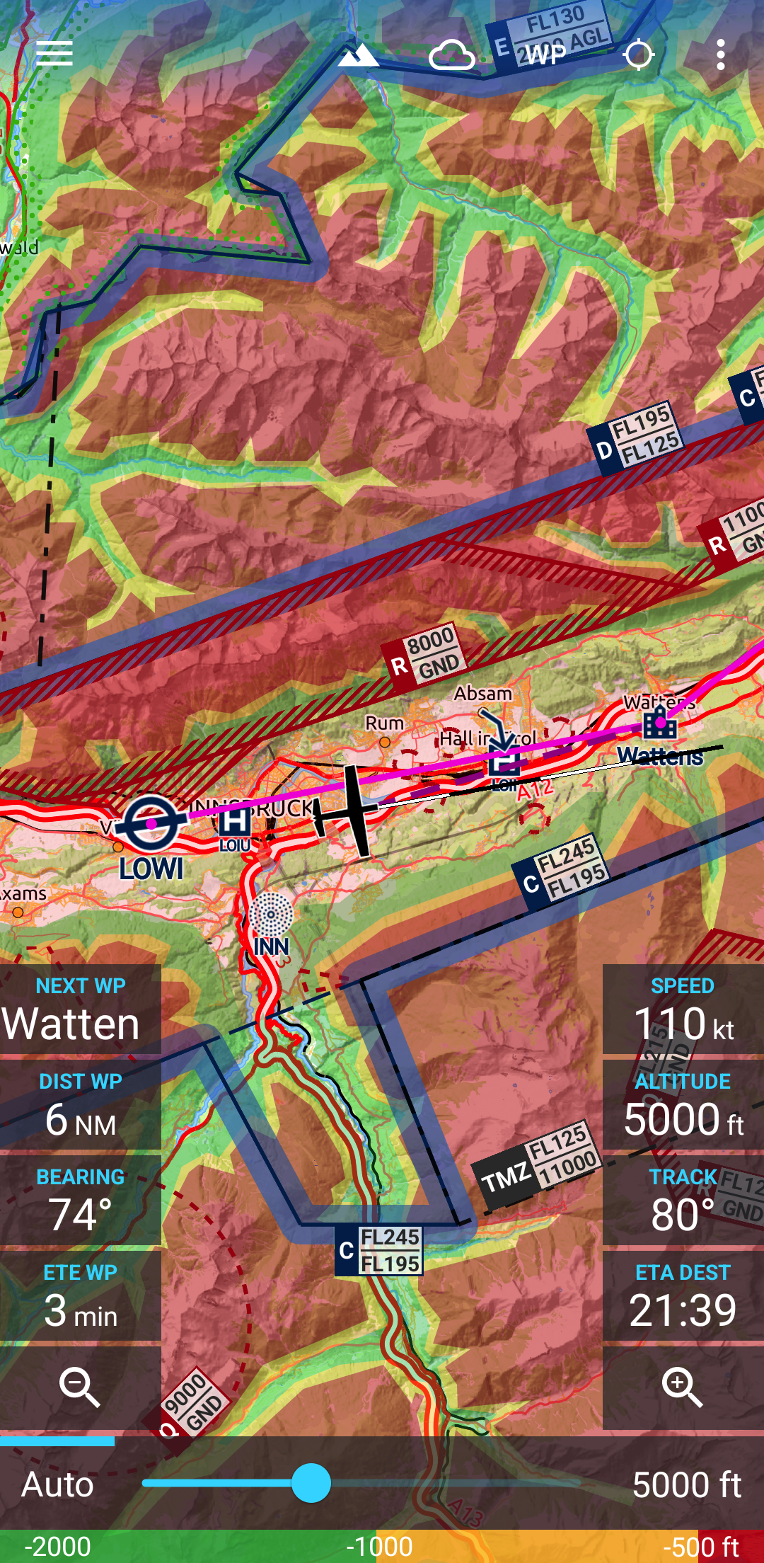
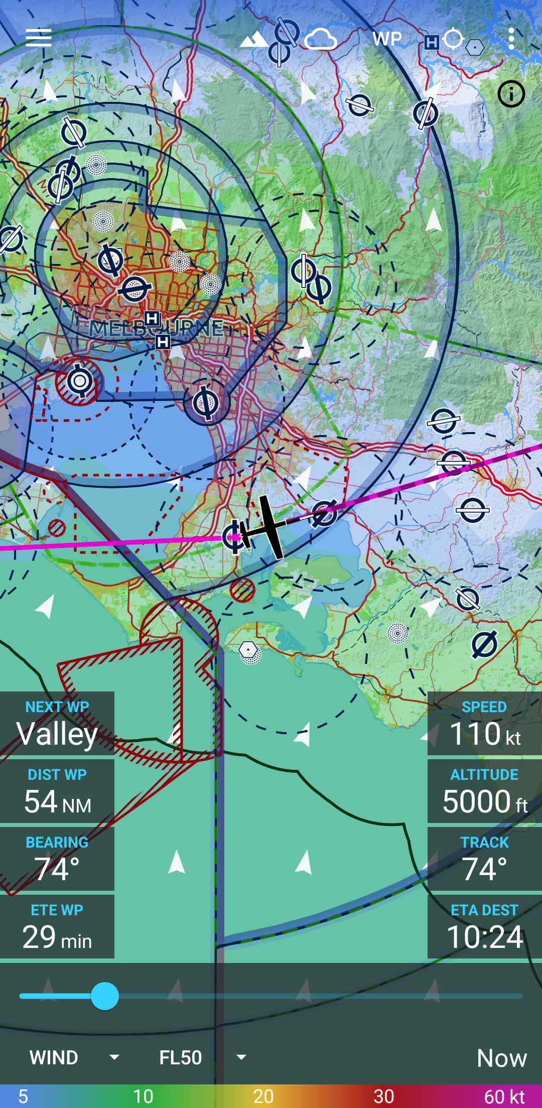
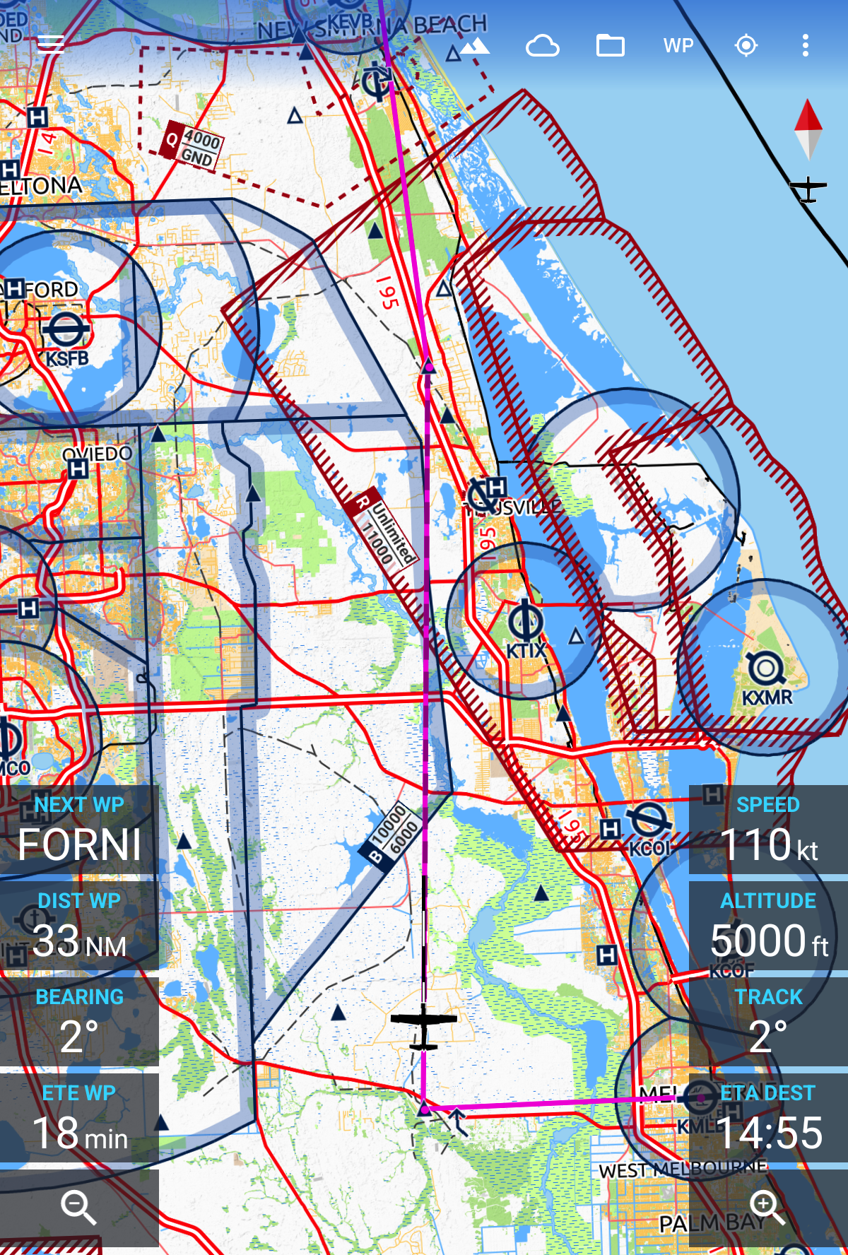
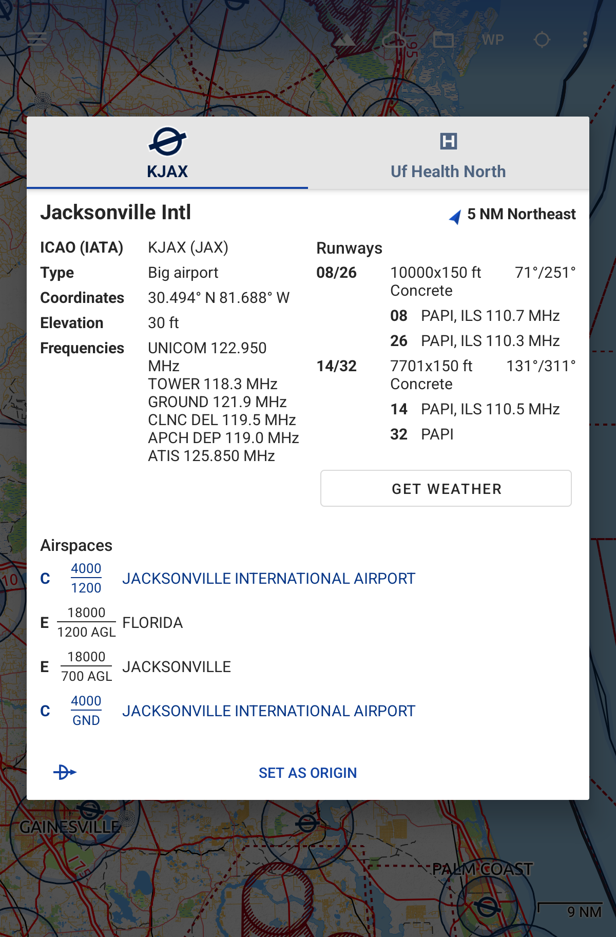
Le mappe aeronautiche affidabili e dirette per i piloti e gli appassionati di aerospaziale di tutto il mondo. L'app è adatta per la pianificazione pre-volo e per la navigazione in volo. Scegli semplicemente un'area di 5 gradi per 5 gradi sulla terra e scarica i dati rilevanti per l'utilizzo offline. La mappa presenta oltre 65000 aeroporti, 9000 aiuti alla navigazione e 15000 waypoint in tutto il mondo, proprio come gli spazi aerei per attualmente 62 paesi in tutti i continenti (tranne l'Antartide). I paesi con dati sullo spazio aereo includono Stati Uniti e Canada, Europa, Australia e Nuova Zelanda. Le previsioni meteorologiche globali ad alta risoluzione del DWD tedesco e del NOAA americano degli Stati Uniti forniscono livelli di mappa accurati per copertura nuvolosa, soffitto, precipitazioni, vento al suolo e in alto. I dati vengono scaricati sul dispositivo, quindi puoi controllare le previsioni anche durante il volo senza ricezione cellulare. Per recuperare gli ultimi METAR e TAF nell'aeroporto di destinazione, è integrato con Avia Weather. Un modello di elevazione digitale ti supporta nella pianificazione del tuo percorso in montagna. Durante il volo, la sovrapposizione del terreno colorerà dinamicamente le colline e le montagne sulla mappa a seconda dell'altitudine attuale per aumentare la consapevolezza della situazione. Per migliorare la sicurezza, Avia Maps può visualizzare le informazioni sul traffico dal tuo ricevitore ADS-B preferito o dall'app SafeSky direttamente sulla mappa. Supporta la ricezione di dati sul traffico utilizzando il formato GDL90, supportato dalla maggior parte dei ricevitori ADS-B portatili come SkyEcho o Stratux. Se non si dispone di un ricevitore, SafeSky può fornire dati sul traffico utilizzando solo una connessione Internet. Per i calcoli delle prestazioni più accurati è possibile creare più profili di aeromobili dai valori del manuale per le prestazioni di salita, il consumo di carburante, ecc. I calcoli del percorso utilizzeranno questi profili e considereranno anche il tipo di motore e il consumo di carburante per le prestazioni di salita, utilizzando formule comuni utilizzate nell'ingegneria aerospaziale. Da un minimo di quattro punti dati scelti con cura, l'app può ricreare accuratamente il diagramma delle prestazioni di salita nel tuo POH. Per chiarezza e comunanza con le carte nautiche cartacee, la mappa è tematizzata nello stile dell'allegato 4 dell'ICAO (carte aeronautiche). Se utilizzi l'app su più dispositivi, puoi sincronizzare le tue rotte, i profili dell'aeromobile e i waypoint dell'utente tra di loro. Questa è un'app di prova con funzionalità complete. Dopo un periodo di valutazione di 30 giorni dovrai acquistare una licenza perpetua dall'interno dell'app o abbonarti al livello professionale.
Aggiornamento Avia Maps 3.17.1
NEW: Dark/Night theme. You can choose when to activate it (automatically by the system or manual), as well as the night map theme via the in-app settings. Bugfix: Clear route highlighting when closing the route. Bugfix: Deadlock in check route dialog in case of invalid airspace data. (Some CTR had identical top and bottom height. The data error is now corrected.) Bugfix: Input fields at the bottom of the screen will no longer be hidden behind the keyboard.
NEW: Added plus/minus buttons to terrain and weather overlay control views Change: Several performance improvements to increase responsiveness and drawing speed of map overlays. Bugfix: Possible deadlock when opening waypoint dialog
NEW: "Check route" dialog to get a list of crossed airspaces and minimum clearances. NEW: Highlight an airspace on the map when touching it in the waypoint dialog. NEW: Quickly switch the aircraft model by touching the route info in the waypoint drawer. Change: Redesigned route info section in the waypoint drawer to display more information. Change: Airspace info in dialogs is now colored to allow getting useful information at a glance. Updated color scheme. Support for Android 15.
NEW: You can now set a target descent altitude (e.g. traffic pattern altitude) for the destination airport. NEW: Lock the map at your location by pressing the lock icon below the compass. After manually panning the map, it will then move back and keep following your location. NEW: Added setting to disable map rotation. NEW: Added display of the map scale. Change: Added button to the waypoint dialog to add waypoint at the end of the route as destination (like previously).
APKFab.com e il link per il download di questa app sono sicuri al 100%. Tutti i link per il download delle app elencate su APKFab.com provengono da Google Play Store o sono inviati dagli utenti. Per le app da Google Play Store, APKFab.com non le modificherà in alcun modo. Per le app inviate dagli utenti, APKFab.com verificherà la sicurezza della firma APK prima di rilasciarle sul nostro sito web.