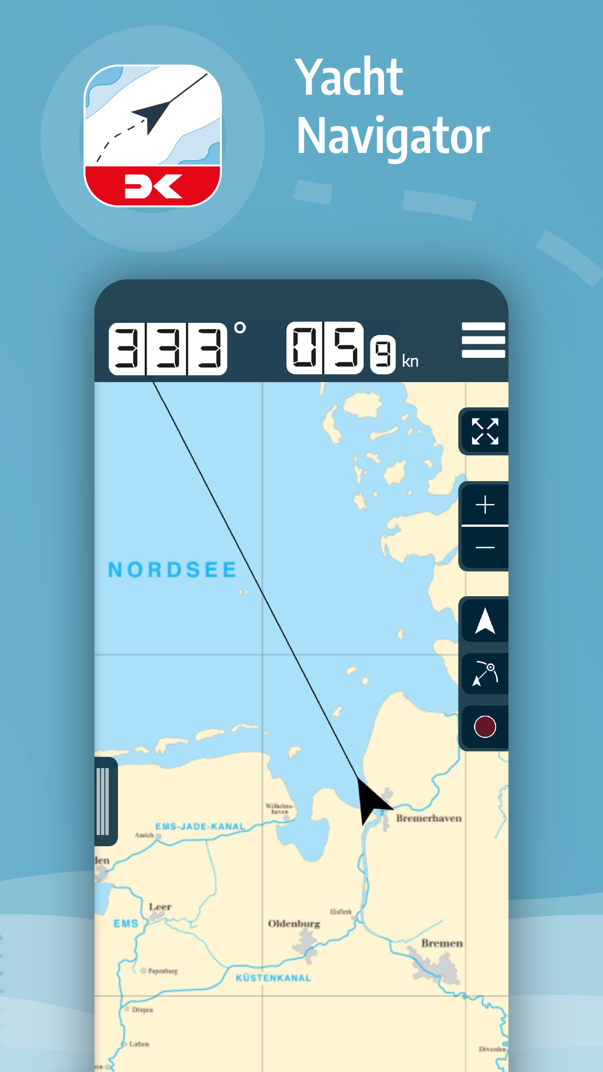
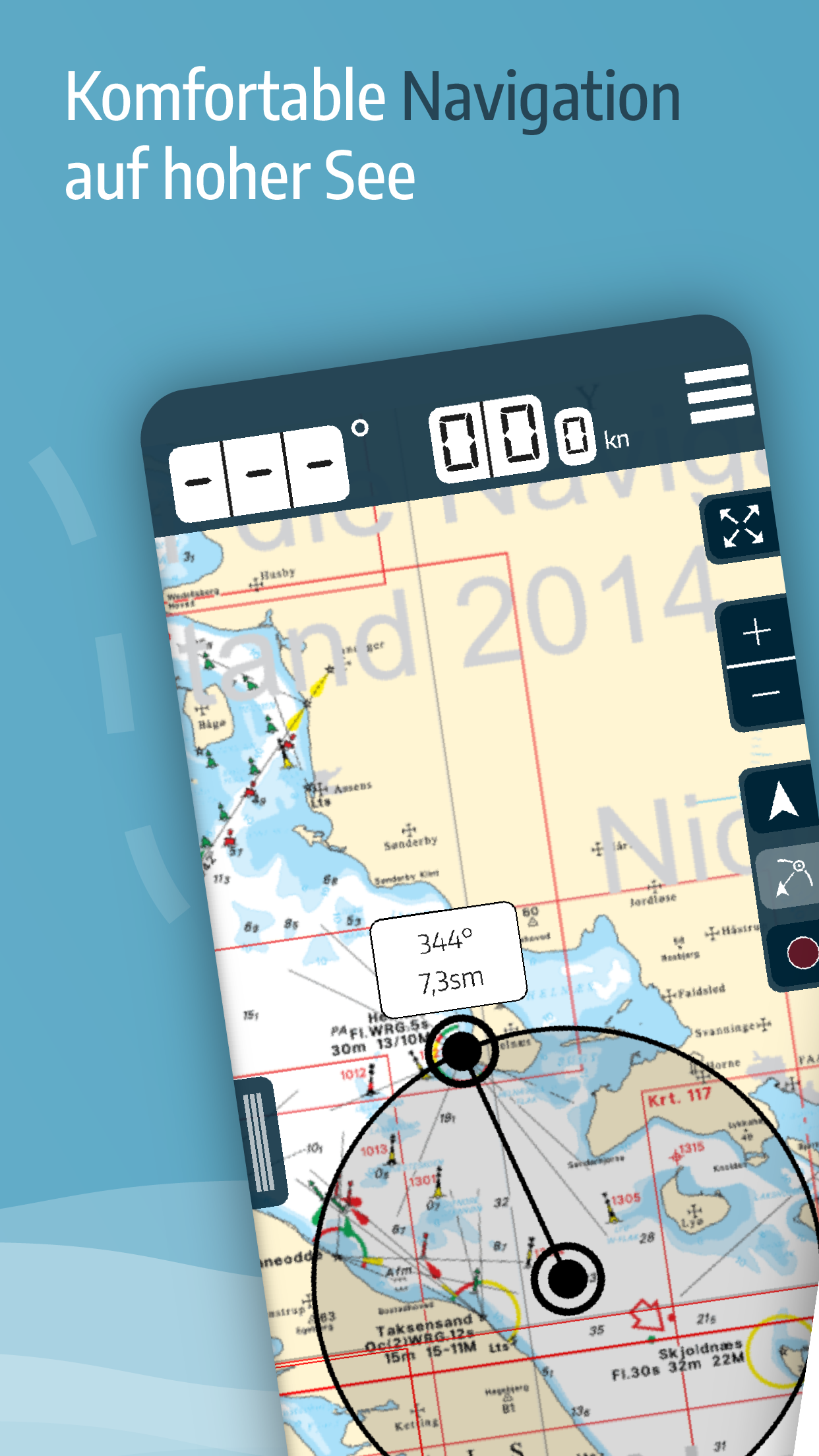
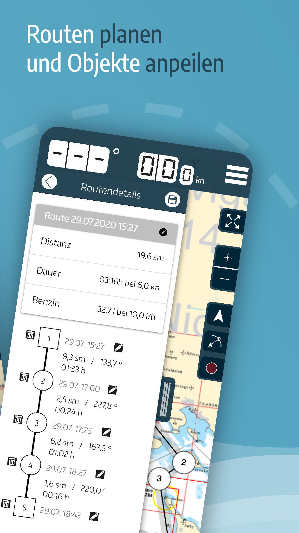
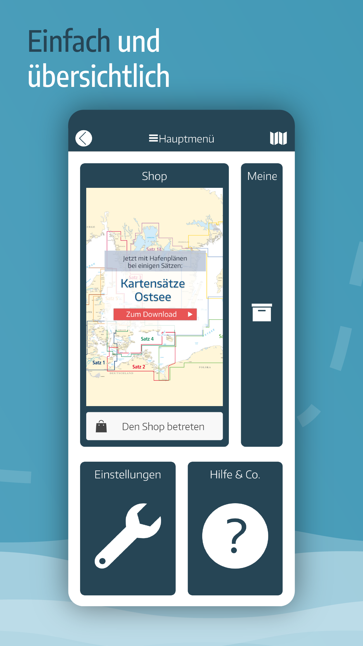
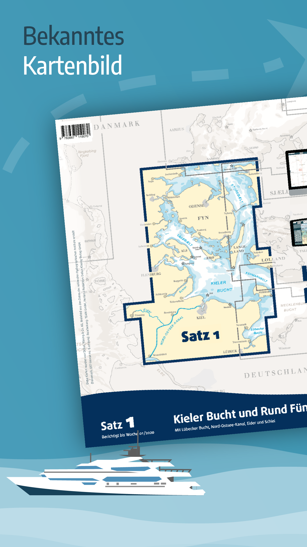
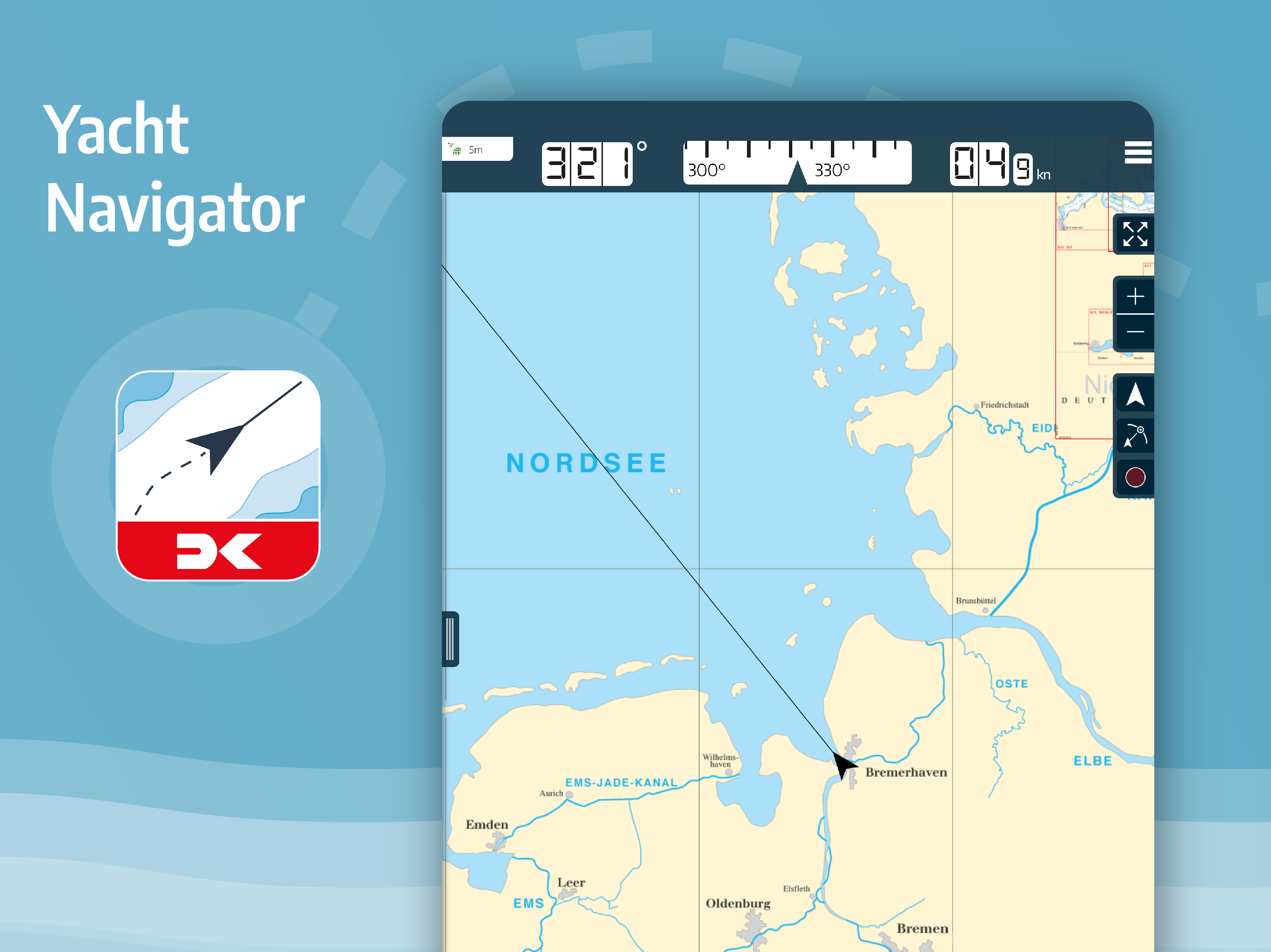
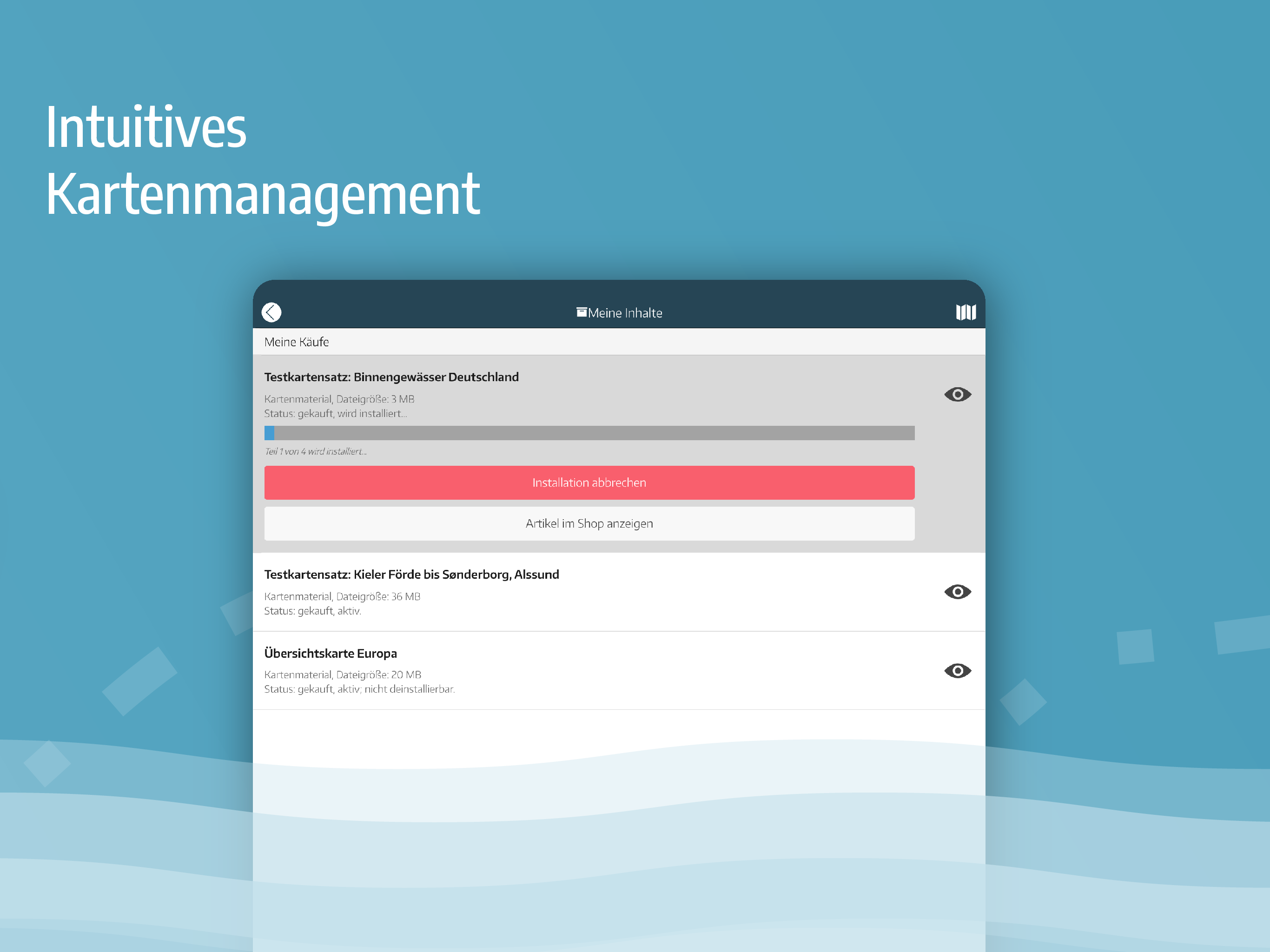
Yacht Navigator | Kartenplotte
5.4 69
v1.9.1 by Delius Klasing Verlag
5.4 69
v1.9.1 by Delius Klasing Verlag


Requires Android: Android 4.2+
Architecture: armeabi-v7a
Screen DPI: 120-640dpi
SHA1: feef5aa6d58ff3fc4acb81b4beb9e75b11fd4577
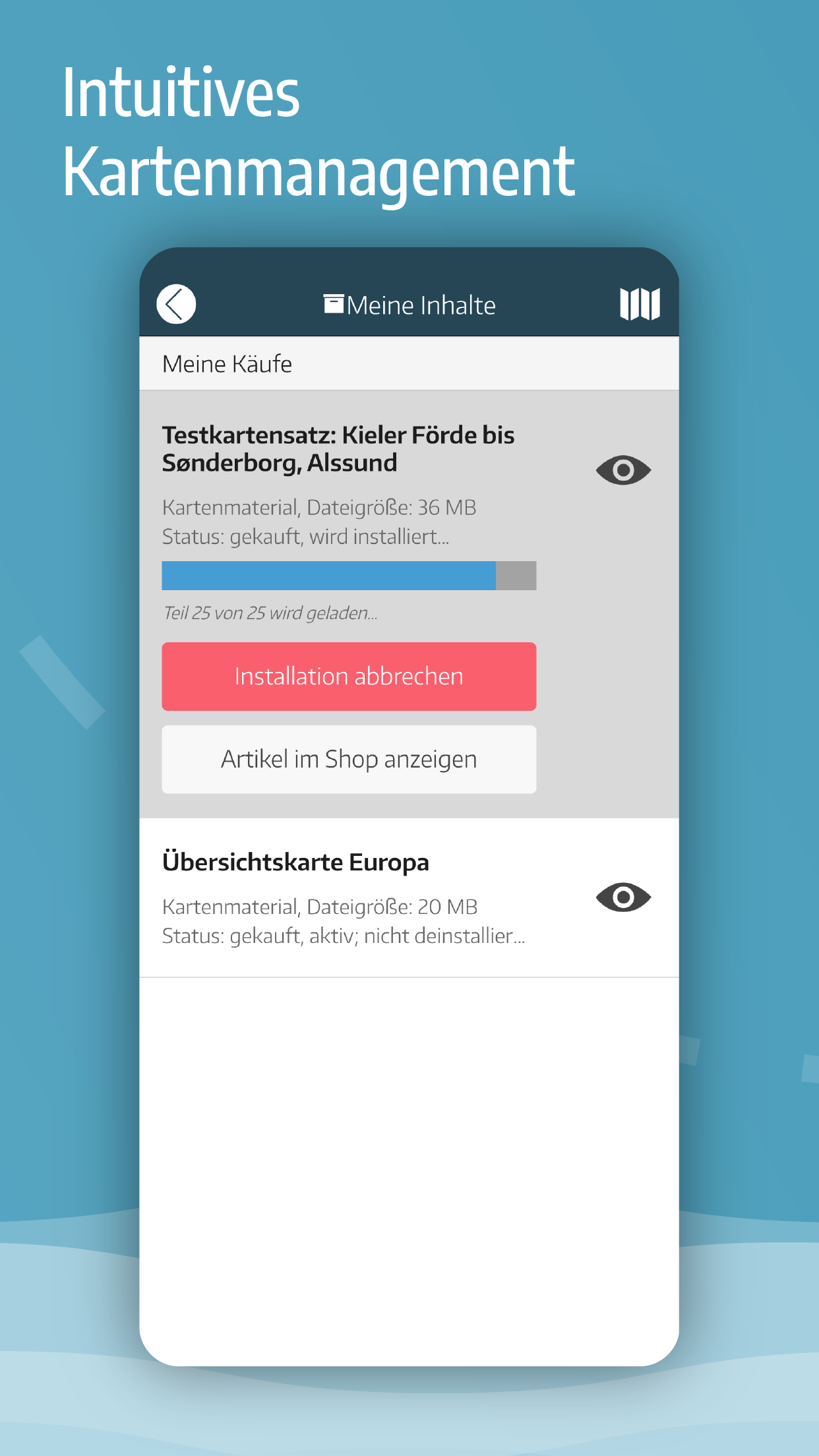
Size: 39.71 MB
What's New:
Requires Android: Android 4.2+
Architecture: armeabi-v7a
Screen DPI: 120-640dpi
SHA1: d5e6d711e1c8df3c83ed233d96e4f248464ffd7e
Size: 40 MB
What's New:
Requires Android: Android 4.2+
Architecture: armeabi-v7a
Screen DPI: 120-640dpi
SHA1: f2537660f5e30c9abaf545e4dc6f328e87efb4c7
Size: 39.99 MB
What's New:
Requires Android: Android 4.0+
Architecture: armeabi-v7a
Screen DPI: 120-640dpi
SHA1: 352d6bfd3a890b40d2ccfa119b245b70428028a2
Size: 38.63 MB
What's New:
Vielen Dank für die zahlreichen Kommentare und Anregungen.
APP STORE
Bitte hinterlassen Sie einen Kommentar oder eine Bewertung im App-Store. Es hilft uns und anderen Kunden.
FRAGEN? PROBLEME? WÜNSCHE?
Wir freuen uns über Ihre Nachricht und Wünsche unter [email protected]
Package Name:
Category:
Update Date:
2023-11-14
Latest Version:
1.9.1
Need Update:
Available on:
Requirements:
Android 5.1+
Report:
NavShip - Waterway Routing
Your waterway route assistant for all European and American waterways
8.2 169
MarineTraffic - Ship Tracking
World’s #1 vessel tracker. Live AIS with ship ETAs, fleet & port data worldwide.
5.8 8K+
Savvy Navvy Boating Navigation
Sailing & Fishing Nautical charts. Marine Weather & Tides. Boat GPS & Depth Map
8.4 213
The Tides - the Netherlands
The most complete tidal app for the Netherlands, North Sea and inland waterways
111
WinGPS™ Marine
Your tablet, smartphone or watch as a personal navigation system on board.
6.3 122
Nautical map (The Netherlands)
Nautical map (The Netherlands) is an online waterway chart and almanac
6.4 208