TcpGPS Lite (Package Name: com.aplitop.tcpandroidlite) is developed by APLITOP and the latest version of TcpGPS Lite 1.5.1 was updated on April 11, 2016. TcpGPS Lite is in the category of Tools. You can check all apps from the developer of TcpGPS Lite and find 57 alternative apps to TcpGPS Lite on Android. Currently this app is for free. This app can be downloaded on Android 4.0.3+ on APKFab or Google Play. All APK/XAPK files on APKFab.com are original and 100% safe with fast download.
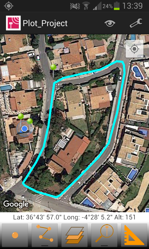
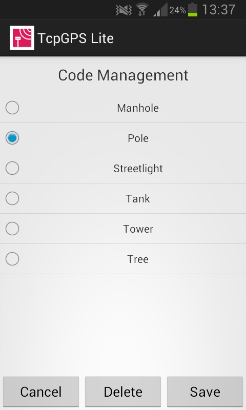
Fast Surveys with Tablet or Smartphone. INTRODUCTION This application, installed on a mobile device with Android operating system, allows the user to make surveys using integrated GPS with its nominal precision, in a fast and easy way. It can be used by surveyors and other technicians for surveys consisting on measuring lots, paths, crops, pipes, electrical lines, urban furniture... Google MapsTM is used as background, and can be represented in standard, satellite, hybrid and relief modes. Geographic or UTM projected coordinates are shown at all times. POINT SURVEY The application allows data collection of single points, whose coordinates are got from the GPS, showing the estimated precision by a circle, as is usual in location-based programs. The points are automatically numbered and is registered the latitude, longitude and date/time. Optionally, you can be separated into different layers and also you can be associated to a picture, a comment and codes to differentiate it. The application stores the values most habitually to these codes and allows choosing them from a quick list. CONTINUOUS SURVEY It is also possible to perform a continuous survey, recording vertices automatically by an interval of time, distance or height difference. At any time you can view the polyline data, such as minimum and maximum heights, length and area. Vertex information can be displayed as well. You can work with multiple layers, with different names and colors. MEASURING DISTANCES From control panel also it is available the tool for measuring distances, through which, you can measure distances between vertices of a polyline or between a points that you have captured previously. RESULTS The result can be stored on several files, depending which you have selected. KML file, for Google Earth. DXF file, for CAD software. TXT file All this files can be sent by email from the application, through menu and selecting “Export Files”. Besides, these files can be sent through of Bluetooth, WiFi or LAN, from the app. These files can also be imported by TcpMDT and other CAD and GIS applications. SETTINGS Editing preferences lets you to change the appearance of map, points and lines captured. It also sets parameters for data collection, information displayed in real time and others. REQUIREMENTS • Operating System: Android 4.0.3 or higher • Integrated GPS • Touch screen • Internet access
* Now it’s possible to link a picture or a comment to a point, through “Point Properties” dialog. * Added new function for measuring distances between vertices of a polyline or between points that you have captured previously. * New export formats: DXF, KML and TXT, sending them by email.
APKFab.com and the download link of this app are 100% safe. All download links of apps listed on APKFab.com are from Google Play Store or submitted by users. For the app from Google Play Store, APKFab.com won't modify it in any way. For the app submitted by users, APKFab.com will verify its APK signature safety before release it on our website.