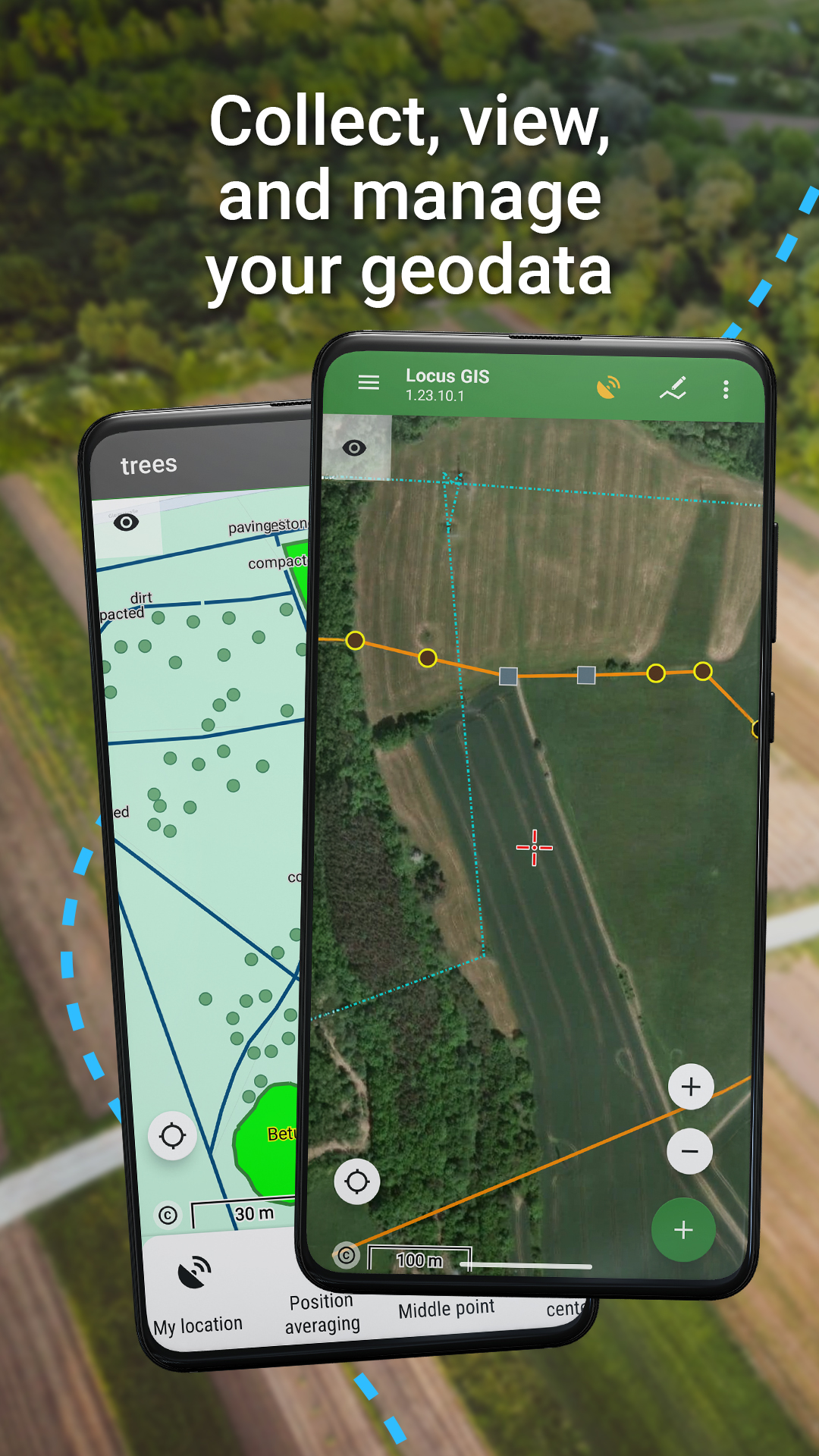
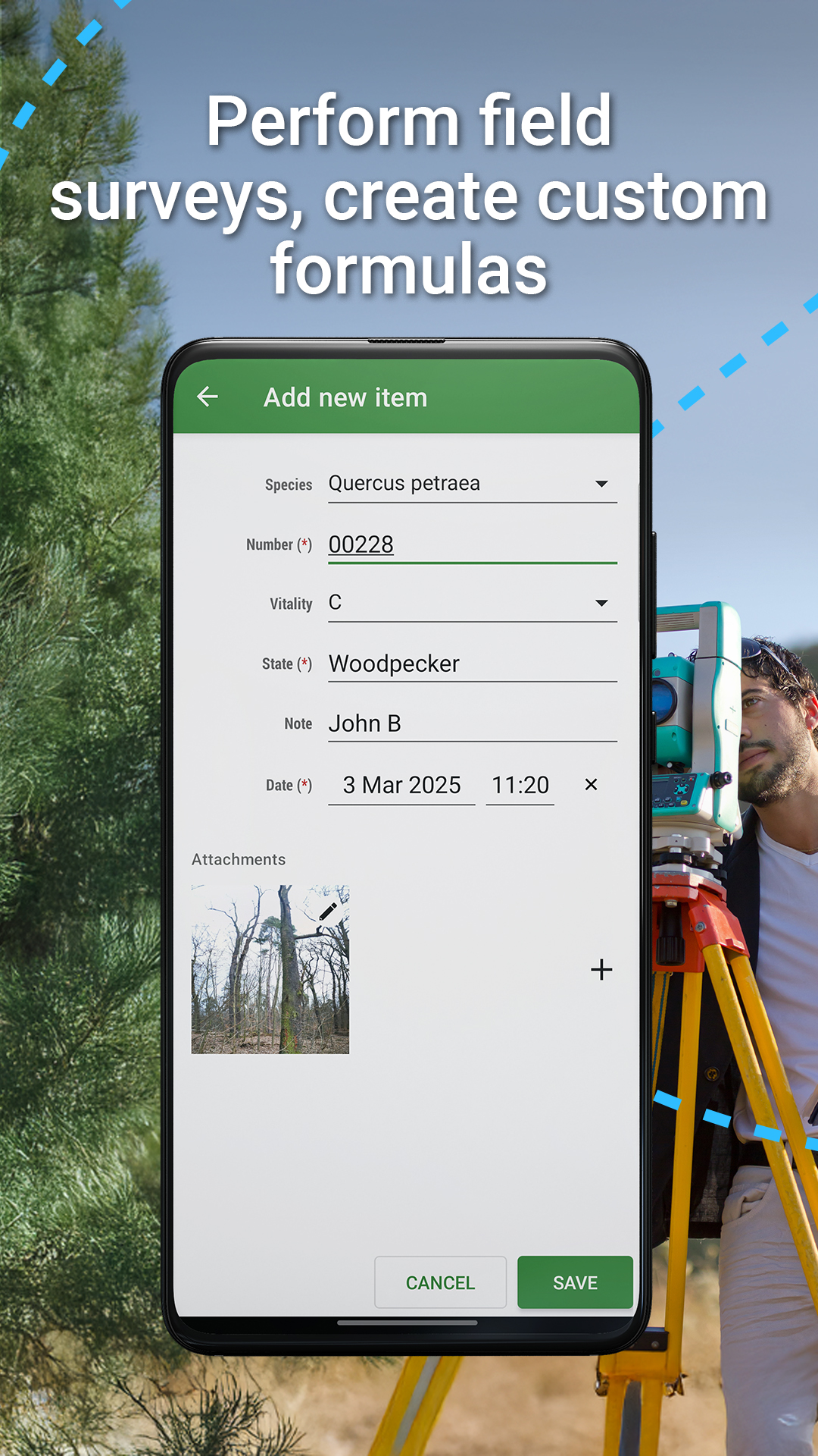
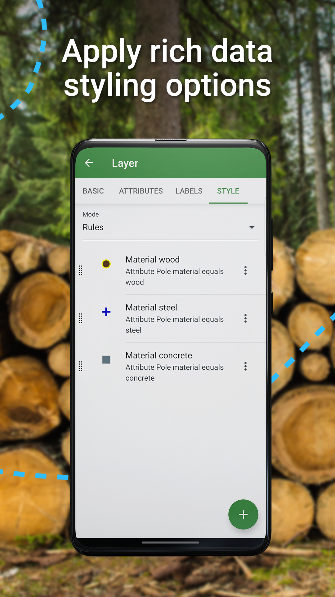
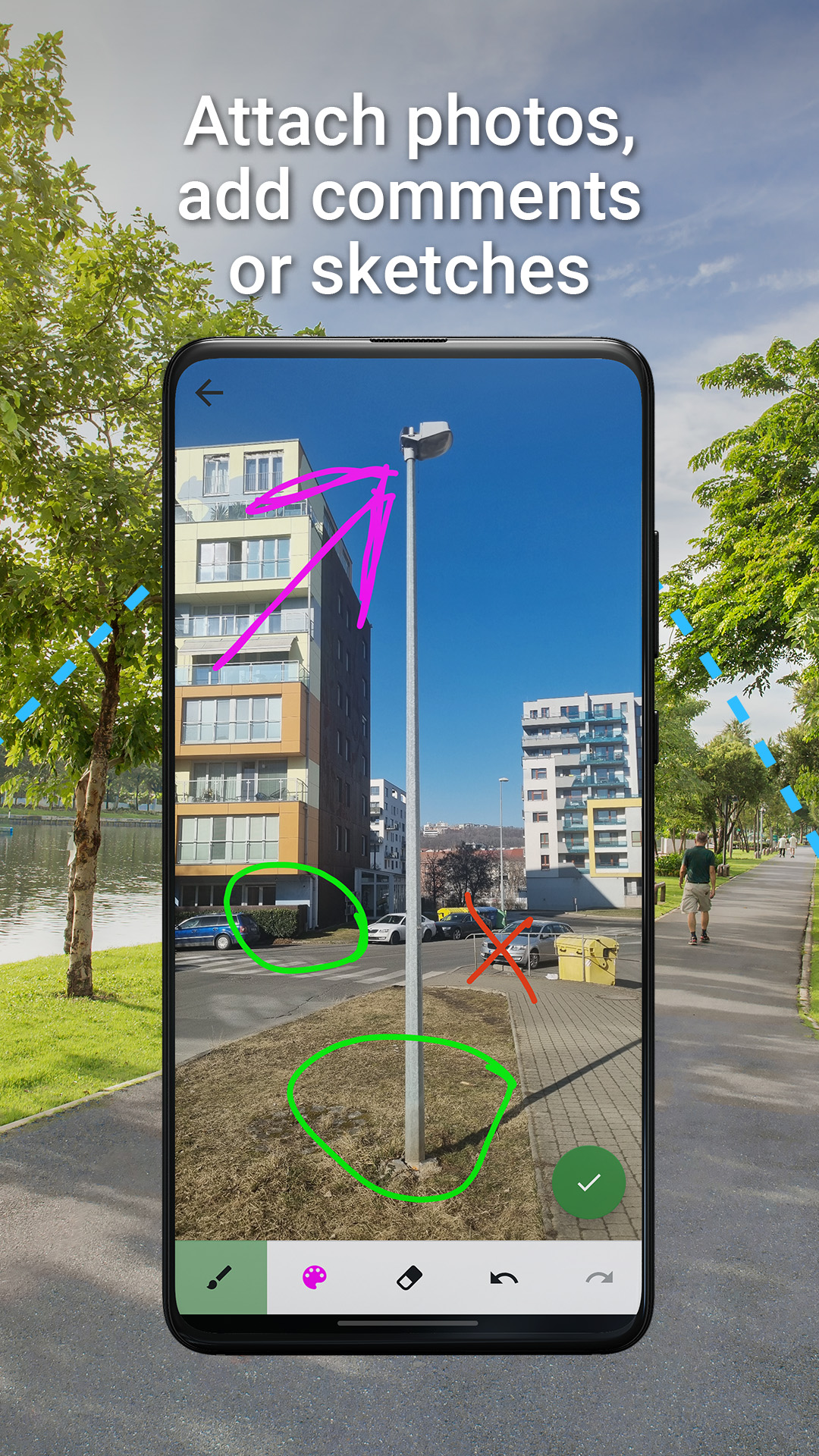
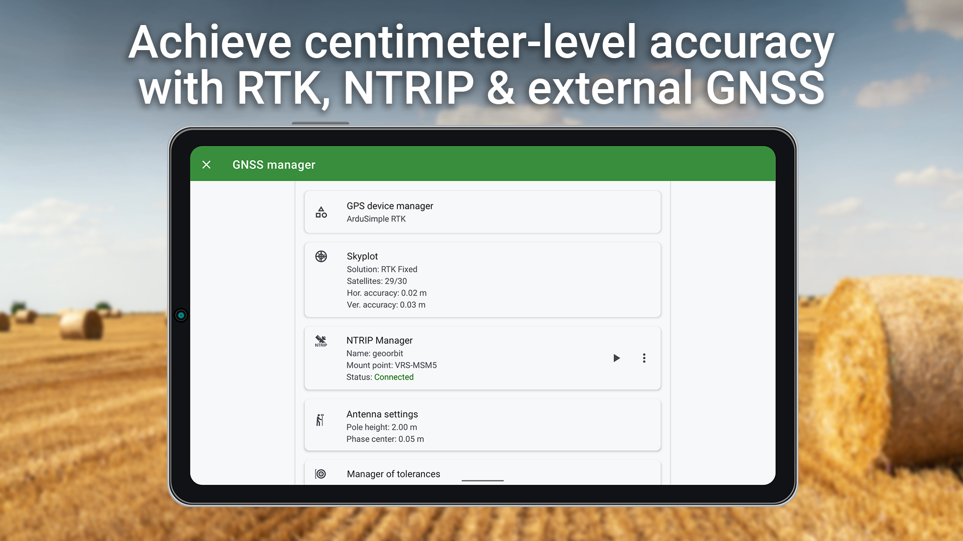
Locus GIS Offline Land Survey
7.9 147
v1.27.2 by Asamm Software, s. r. o.


Requires Android: Android 7.0+
Architecture: armeabi-v7a
Screen DPI: nodpi
SHA1: 286253619413f6f21be548860a087217f4cbe775
Size: 68.63 MB
What's New:
Requires Android: Android 6.0+
Architecture: armeabi-v7a
Screen DPI: nodpi
SHA1: a964bdebed462e47a64c09093c35ae84b8fb3187
Size: 35.99 MB
What's New:
Requires Android: Android 6.0+
Architecture: armeabi-v7a
Screen DPI: nodpi
SHA1: ead626bedec994eb4a4df2667d26101e88b03c68
Size: 35.83 MB
What's New:
Package Name:
Category:
Update Date:
2026-03-21
Latest Version:
1.27.2
Need Update:
Available on:
Requirements:
Android 7.0+
Report:
Spotify: Music and Podcasts
Listen to songs, play podcasts, create playlists and discover music you'll love
8.7 2M+
NewsBreak: Local News & Alerts
Reconnect with your neighborhood! Daily news alerts for local news headlines!
9.3 51K+
Hulu: Stream TV shows & movies
Watch TV series, stream the latest live sports & download movies you love
9.1 154K+
Locus Map Outdoor Navigation
Plan hikes, navigate bike rides, hunt for geocaches, and track your workouts.
8.7 5K+
Augm. Reality for Locus Map
Add-on for visualization of selected points in the phone camera view. OpenSource
8.6 68
Contacts for Locus Map
A simple add-on for Locus Map enabling displaying phone contacts on a map.
9.1 73
Munzee for Locus Map
Add-on enabling playing the Munzee game with Locus Map - outdoor navigation
6.5 12
SmartWatch2 for Locus Map
SmartWatch2 add-on is suitable for Smart Watch 2 only, not for Smart Watch 3 !!!
5.2 16
Locus Map Watch
Record your bike trips and navigate your hiking routes right from your wrist!
7.2 39
