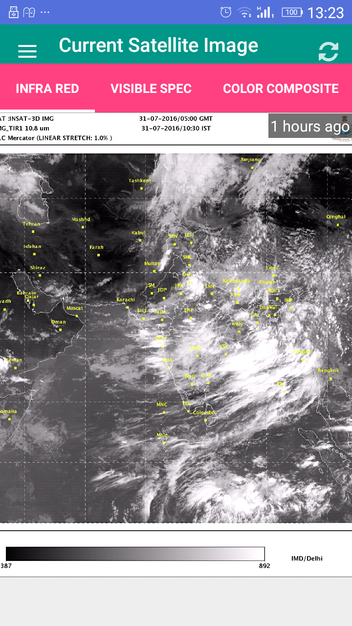
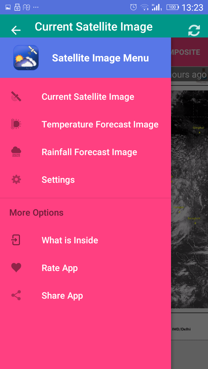
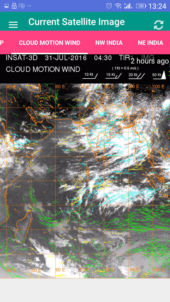
Satellite Image India
7.5 19
v1.0 по YellowCup


Requires Android: Android 4.0+
Screen DPI: 160-640dpi
SHA1: b52303e7c393e48aa464fa9c300862374ca69912
Size: 4.65 MB
Имя пакета:
Категория:
Дата обновления:
2016-07-31
Последняя Версия:
1.0
Требуется обновление:
Требования:
Android 4.0+
Пожаловаться:
The Weather Channel
Получите местный прогноз на The Weather Channel
9.2 296K+
Погода 14 дней - Метеоред
Прогноз погоды, Карта дождя и снега , предупреждения , дождевой радар , виджеты.
9.5 291K+
Погода & Радар
Вся погода на одном радаре. Дождь, солнце, грозы. Радарный прогноз.
9.8 243K+
AccuWeather прогноз погоды
Дождь и град не помешают вашим планам, если вы знаете точный прогноз погоды
7.0 171K+
Виджет погоды и часов
Полноценный информер текущих погодных условий и прогноза погоды.
8.4 191K+
WeatherBug: Weather Forecast
Карта метеорологического радара, предупреждения о летних штормах, отслеживание ветра, прогнозы осадков и новости США.
9.2 128K+
All Hindi News Hindi Newspaper
Все новости хинди и хинди газеты прямо на экране Вашего мобильного. (Хинди Новости)
8.2 349
All Punjabi News Newspapers
Получить все панджаби Новости и пенджабский газет по всему миру в одном приложении.
8.5 42
Gujarati News All Newspapers
Получить все онлайн гуджарати Новости и гуджарати газеты в одном приложении.
9.1 17
All English Newspapers India
Получить все новости на английском опубликованную из источников дифф прямо на экране мобильного телефона
8.0 139
Suryanamaskar Yoga With Timer
Учиться и делать Сурья Намаскар (Приветствие Солнцу) Йога и начать делать с таймером.
7.6 73
Pranayama Yoga With Timer
Заявка на обучение и делать Пранаяма Йога с таймером.
13