Planit (Package Name: com.yingwen.photographertools) is developed by JIDE Software and the latest version of Planit: Photo Planner 11.0.12 was updated on July 10, 2026. Planit: Photo Planner is in the category of Photography. You can check all apps from the developer of Planit: Photo Planner and find 200 alternative apps to Planit: Photo Planner on Android. Currently this app is for free. This app can be downloaded on Android 7.0+ on APKFab or Google Play. All APK/XAPK files on APKFab.com are original and 100% safe with fast download.
In this free version, the Ephemeris feature is provided as an in-app purchase. After the purchase, it will be the same as the paid PlanIt Pro. Some screenshots listed here have Ephemeris features enabled. The free version can actually do a lot of things than you thought. It is a plan/marker file reader, a focal length estimator on the map, a DoF and panorama calculator and can even preview the aerial view for your drone. The Ephemeris feature is so highly integrated that it is hard for us to provide some of them in the free version and ask you to pay for the rest. You can see how many users give us a one-star rating simply because we didn't provide a trial. I think that's not fair. But as we said, although we didn't provide a trial, please feel free to purchase to try it. We can refund you at any time if you don't like it.
Please email
[email protected] for bug reports or feature requests. Please also remember to visit https://youtu.be/JFpSi1u0-is for more video tutorials. Each video only lasts a few minutes but you will sure learn a lot from them. You can also reach us through Instagram or Facebook. Links are under the menu inside the app.
This is a special call to landscape photographers, travel photographers, nature photographers and those who are interested in night photography, city photography, time-lapse, star-trails, milky way or astro-photography: look no more, this is the ultimate app for you - the Planit Pro. It only costs you a cup of Frappuccino but will save you tons of time and effort and a lot of gas money. Most importantly, it will make you enjoying landscape photography even more.
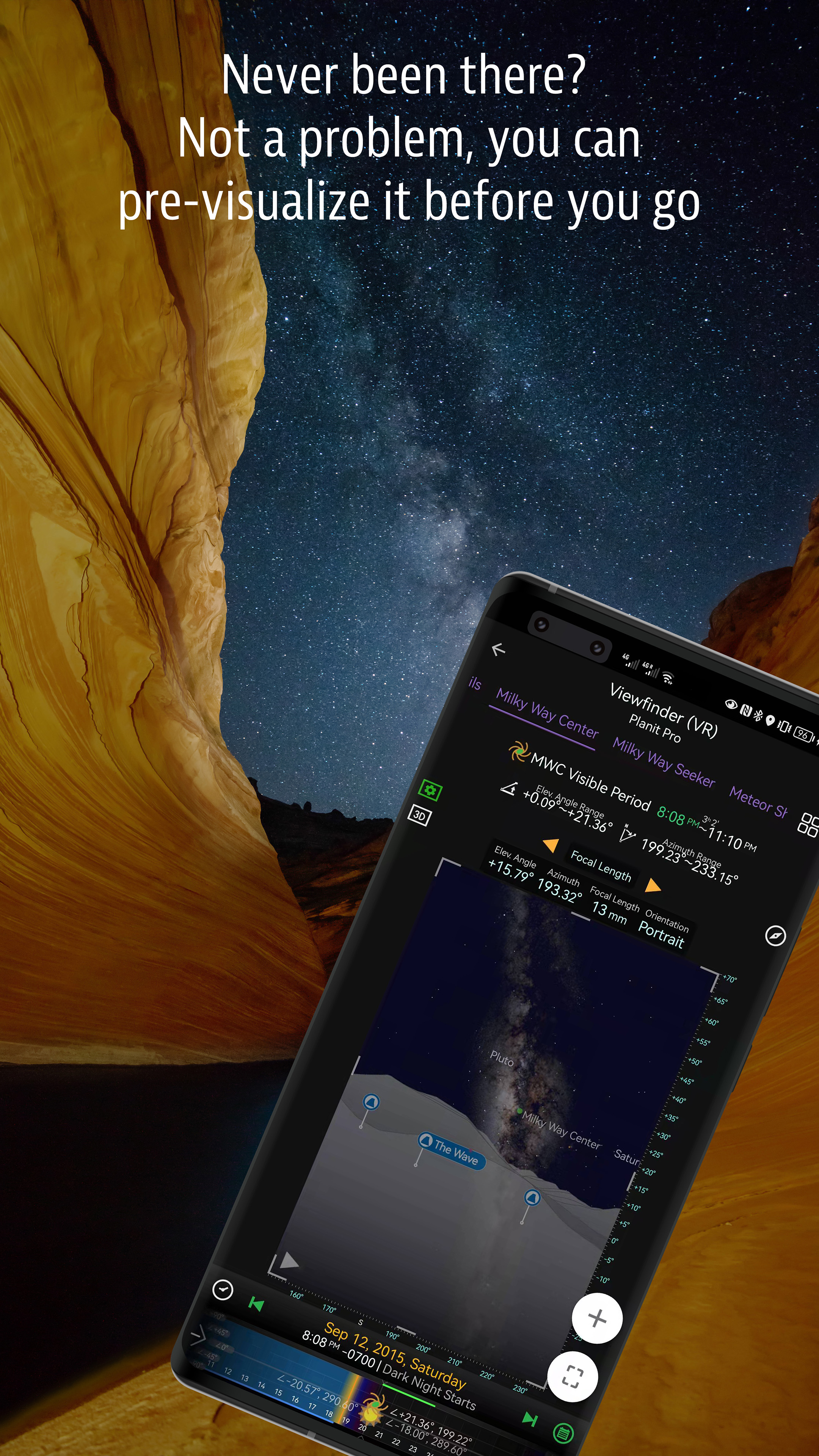
Ansel Adams dedicates the beginning of his first book "Taos Pueblo" to visualization. He introduced the idea of "previsualization", which involved the photographer imagining what he wanted his final print to look like before he even took the shot. Of course, there are many great photos which were taken impromptu. However, for landscape photographers, being able to previsualize the scene before going there will greatly reduce the chance of being caught unprepared and will greatly increase the chance of getting better shots.
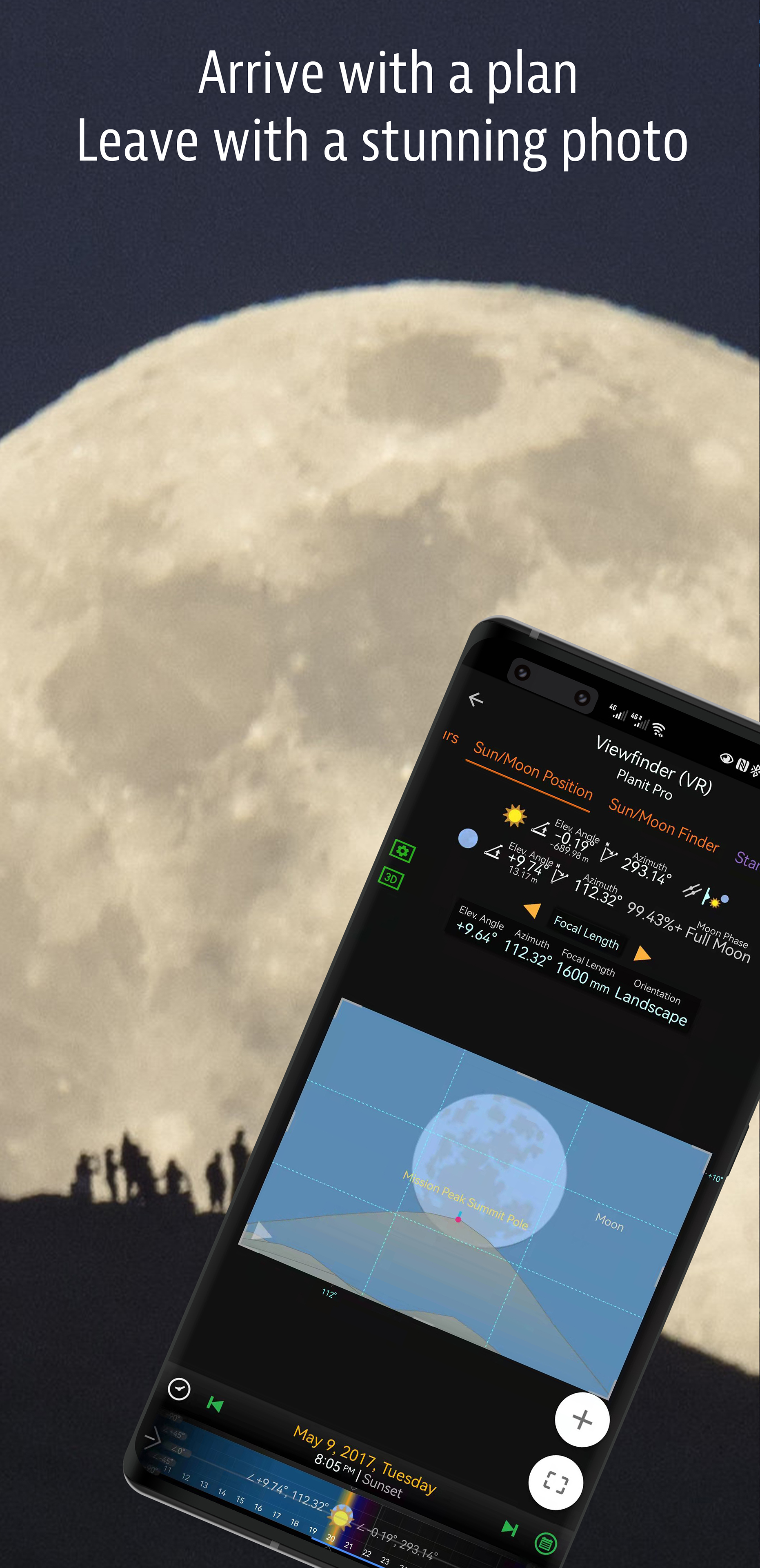
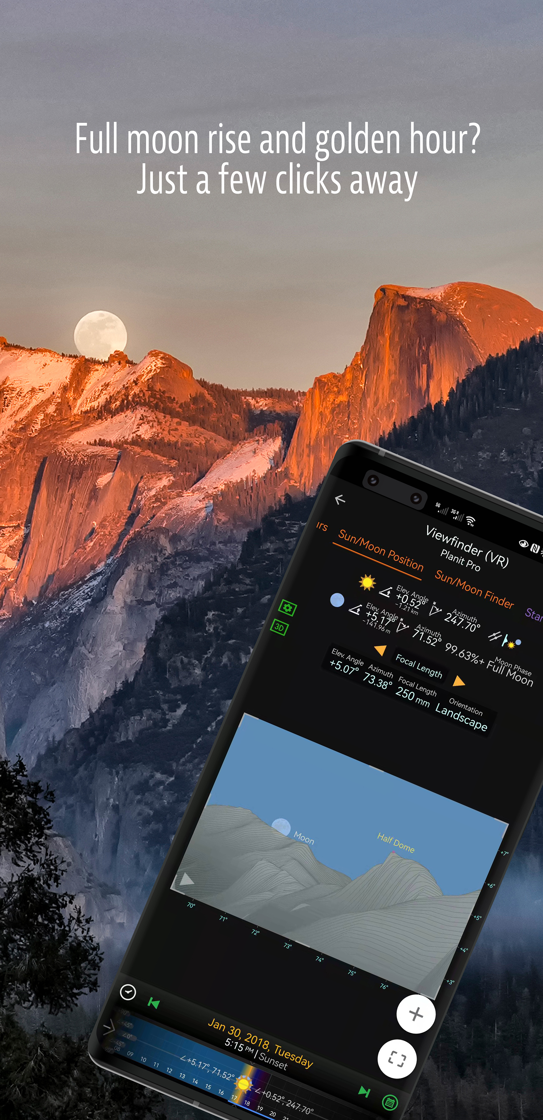
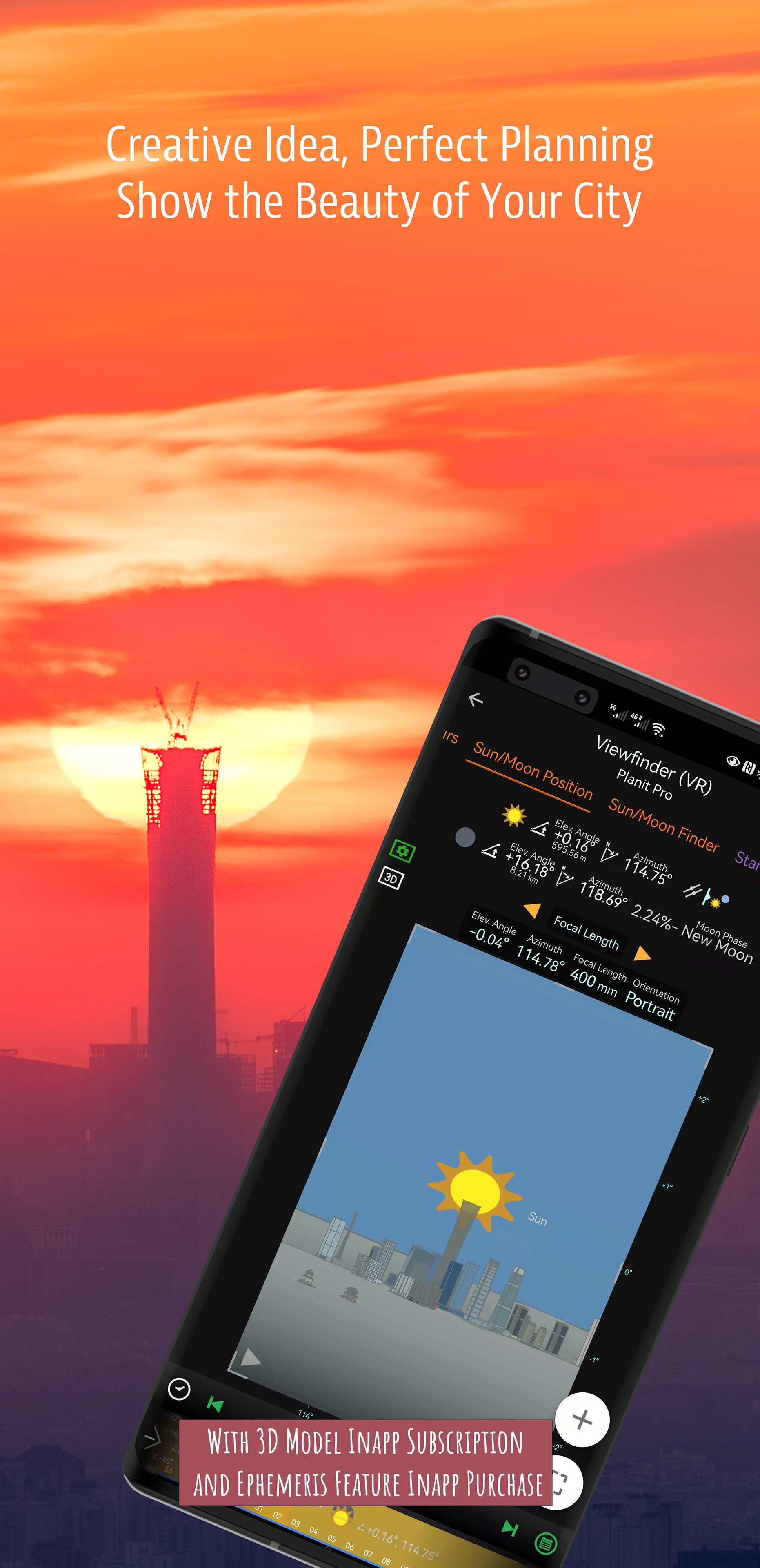
Photographers use various tools to help them pre-visualizing the scene. Nowadays, many of those tools are phone apps. Planit Pro is an all-in-one solution that is designed to leverage the map and simulated viewfinder technologies to provide the necessary tools for photographers to pre-visualize the scene in combination with the ground subjects and the celestial objects such as the Sun, the Moon, Stars, Star-trails and Milky Way.
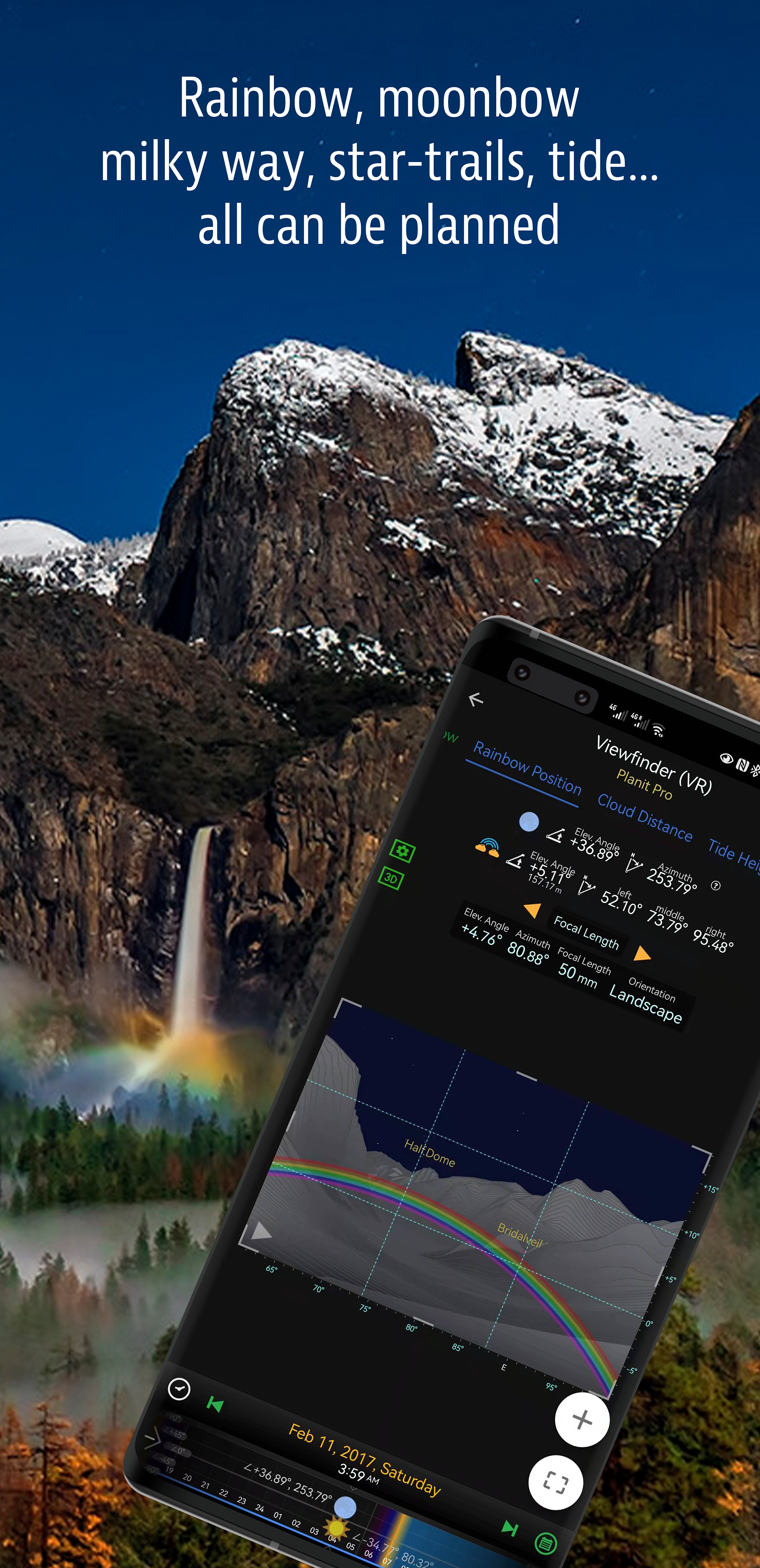
In the Planit Pro app, we packed it with features - from location scouting such as GPS coordinates, elevations, distance, elevation gain, clear view, focal length, depth of field (DoF), hyperfocal distance, panorama and aerial photography, to the Ephemeris features such as the sunrise, sunset, moonrise, moonset time and direction, twilight time, special hours of the day, sun/moon finder, major stars, constellations, nebulae azimuth and elevation angle, star trail planning, time-lapse calculation and simulation, sequence calculation and simulation, milky way searching, solar eclipse and lunar eclipse, exposure/ND filter calculator, light meter, rainbow position prediction, tide height and tide search etc. All the information are either represented on the map as an overlay or visually presented in simulated viewfinders (VR, AR, picture, or street view), just like you look through your camera's viewfinder. Whatever you want for your landscape photography, it is there in the Planit Pro.
Landscape photography is an adventure in the nature world. We understand sometimes there won't be any network connection when you are out exploring. Planit Pro was designed for have it in mind. If you preload the offline elevation files and the offline mbtiles maps, you can use the app fully offline without the need for network connections.