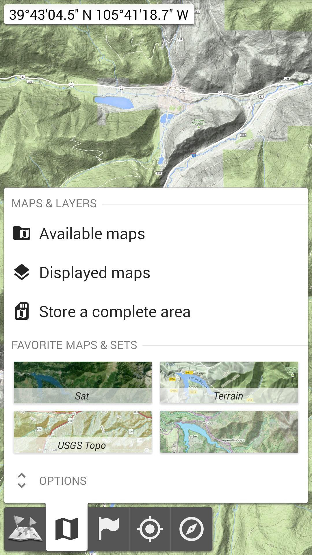
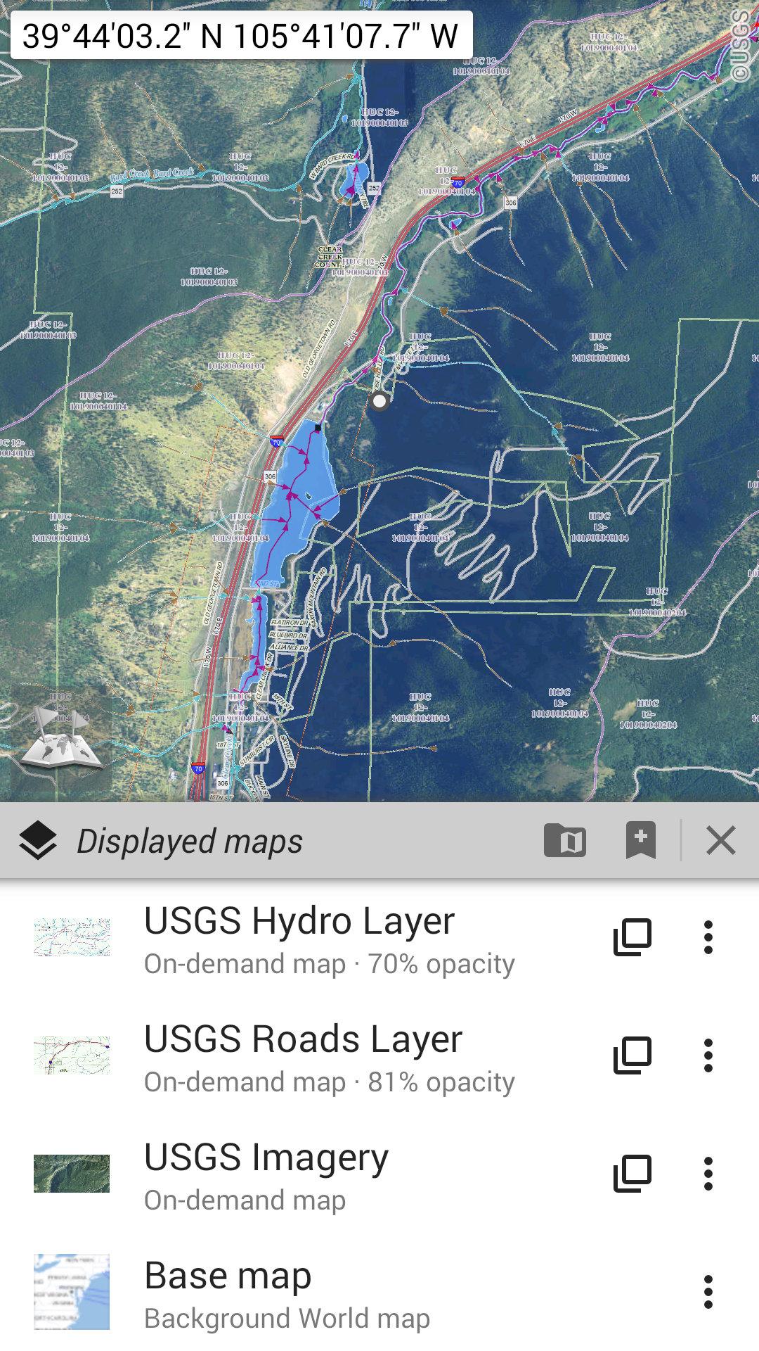
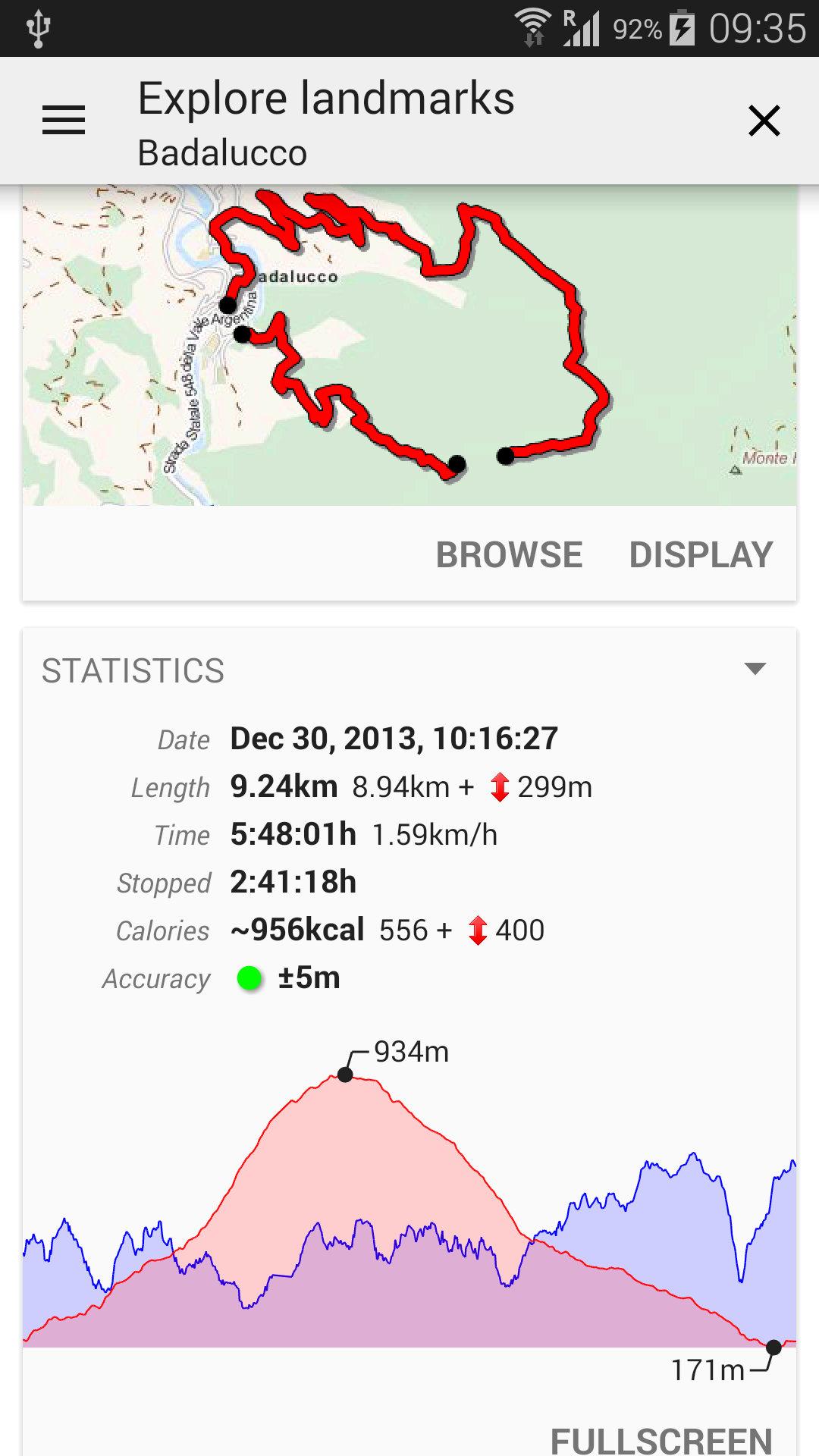
Nessuna pubblicità ~ Nessuna condivisione e monetizzazione dei dati ~ Nessuna analisi ~ Nessuna libreria di terze parti Annoiato di aspettare la visualizzazione delle mappe? Utilizza le mappe offline tutto in uno! Una volta visualizzate, le mappe vengono archiviate e rimangono disponibili, rapidamente, anche senza accesso alla rete. • Vuoi qualcosa di più delle semplici strade sulle tue mappe? Troverai ciò di cui hai bisogno qui; • Andavi in posti con scarsa copertura di rete? Tutto resterà disponibile; • Andavi all'estero? Non ti perderai più; • Hai un limite massimo di dati? Ridurrà il tuo utilizzo. ★★ Mappe ★★ Sono disponibili molte mappe, incluse mappe stradali classiche, mappe topografiche, mappe aeree (satellitari) e vari livelli che possono essere aggiunti su qualsiasi mappa: OpenStreetMap (Strade, Topo), Mappa nazionale USGS (Topo ad alta risoluzione, Immagini aeree) , Mappe topografiche militari sovietiche in tutto il mondo, ecc. • Tutte le mappe possono essere impilate in livelli, con un preciso controllo dell'opacità; • Selezionare e archiviare grandi aree in pochi click; • Lo spazio archiviato è libero e può essere facilmente eliminato. ★★ Visualizza, archivia e recupera segnaposto illimitati ★★ Puoi aggiungere vari elementi sulla mappa come waypoint, icone, percorsi, aree e tracce. Puoi gestirli facilmente utilizzando il potente SD-Card Placemarks Explorer. ★★ Posizione e orientamento GPS sulla mappa ★★ La tua posizione e direzione reali sono chiaramente visualizzate sulla mappa, che può essere ruotata per corrispondere al tuo orientamento reale (dipende dalle capacità del dispositivo). Facile accensione/spegnimento per risparmiare batteria. E anche: • Unità di distanza metriche, imperiali e ibride; • Formati di latitudine/longitudine GPS e coordinate di griglia (UTM, MGRS, USNG, OSGB Grid, Irish Grid, Swiss Grid, Lambert Grid, DFCI Grid, QTH Maidenhead Locator System, …); • Possibilità di importare centinaia di formati di coordinate da https://www.spatialreference.org; • Visualizzazione delle griglie sulla mappa; • Visualizzazione della mappa a schermo intero; • Zoom multitouch; •… ★★ Hai bisogno di altro? ★★ Se sei un vero avventuriero, prova AlpineQuest Off-Road Explorer, la soluzione outdoor completa basata su mappe offline all-in-one, caricata con un potente registratore di tracce GPS e altro ancora: https://www. alpinequest.net/google-play
Aggiornamento All-In-One Offline Maps 3.18c
The complete list is available in the changelog inside the application. 3.18c • Improved the community maps list; • And more
The complete list is available in the changelog inside the application. 3.17b • Improved map display on devices with screen cutout (notch); • Fixed in-app purchases; 3.17a • A small eye icon is visible in the placemarks explorer for items currently displayed on the map; • Added SK32 coordinates systems; • Improved DFCI grid; • Online account: added a button in case of forgotten login or password; • And more
The complete list is available in the changelog inside the application. 3.17b • Improved map display on devices with screen cutout (notch); • Fixed in-app purchases; 3.17a • A small eye icon is visible in the placemarks explorer for items currently displayed on the map; • Added SK32 coordinates systems; • Improved DFCI grid; • Online account: added a button in case of forgotten login or password; • And more
APKFab.com e il link per il download di questa app sono sicuri al 100%. Tutti i link per il download delle app elencate su APKFab.com provengono da Google Play Store o sono inviati dagli utenti. Per le app da Google Play Store, APKFab.com non le modificherà in alcun modo. Per le app inviate dagli utenti, APKFab.com verificherà la sicurezza della firma APK prima di rilasciarle sul nostro sito web.