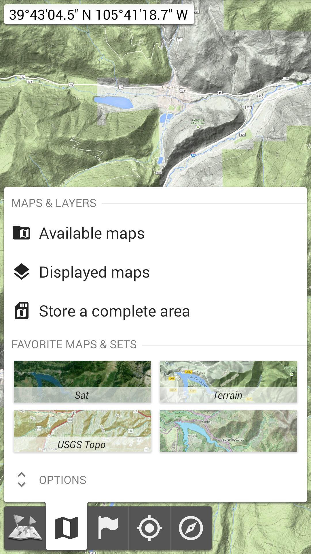
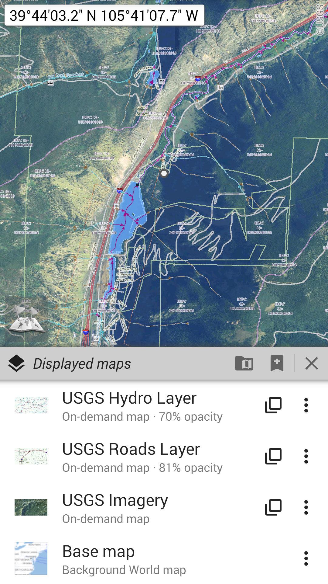
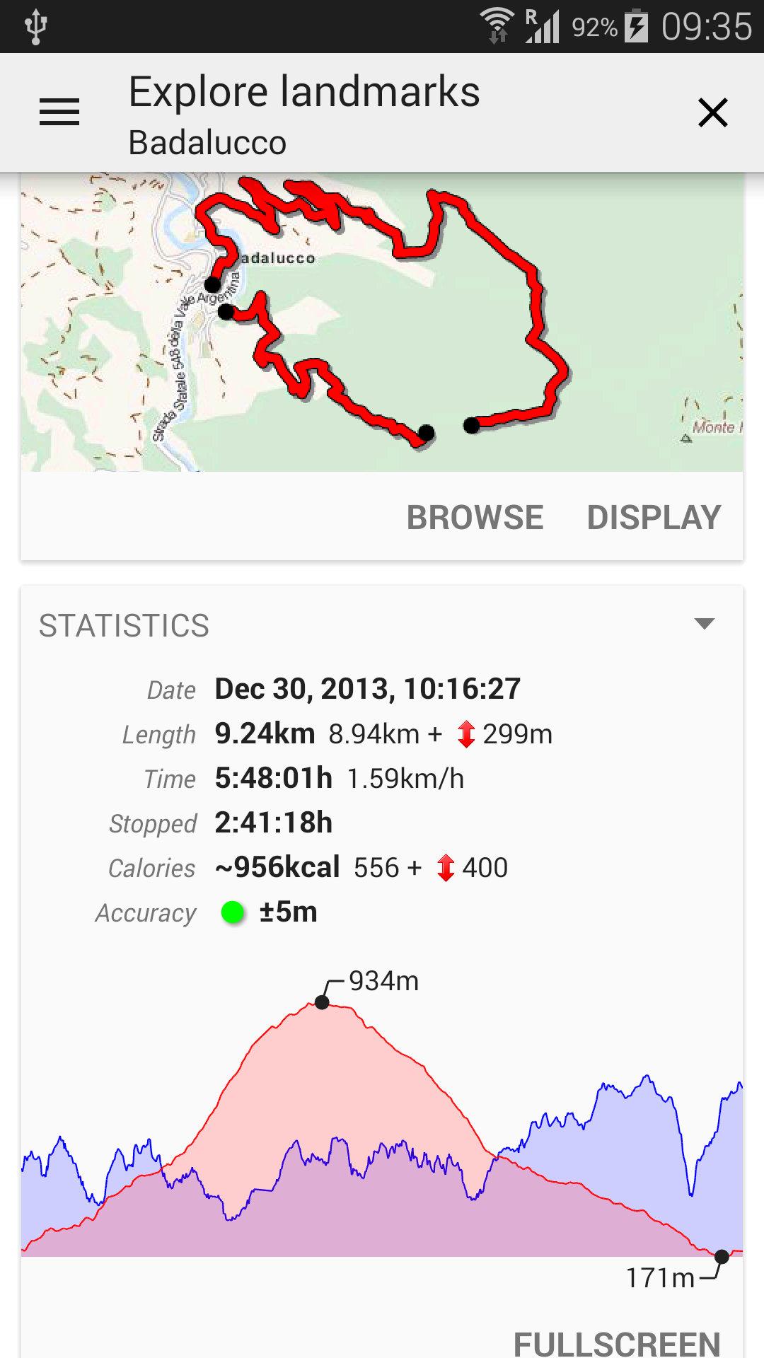
All-In-One Offline Maps
8.7 4K+
v3.18c von Psyberia
8.7 4K+
v3.18c von Psyberia


Requires Android: Android 2.1+
Screen DPI: nodpi
SHA1: 8a64aaee08070c2fe079ec55a2cc09b11b1f4b31
Size: 8.89 MB
What's New:
Requires Android: Android 2.1+
Screen DPI: nodpi
SHA1: 7bdbf88a2ba4899149fbd60add2cc2945808730c
Size: 8.89 MB
What's New:
Paketnamen:
Verfügbar bei:
Aktualisierungsdatum:
2026-03-24
Letzte Version:
3.18c
Update brauchen:
Erwerben:
Anforderungen:
Android 2.1+
Meldung:
Topography APP
Landesaufnahme und Georeferenzierung Land, Weitere Projekte
6.5 171
GPS Karten & Mein Standort
Die einfachste Navigations-App aller Zeiten!
8.9 776
NavShip Boot-Routenplaner
Mehr Sicherheit auf dem Wasser - mit dem Allround-Talent NavShip
8.2 169
Polarsteps
Reiseplaner für deine Reisen | Reisetagebuch zum Festhalten der Reise mit Karten
9.5 18K+
Wikiloc - Trails der Welt
Erkunde, erstelle und teile GPS Tracks mit Deinem Telefon
9.2 10K+
GPX Viewer: Wandern & Fahrrad
GPS-Karten für GPX/KML-Tracks, Routen und Outdoor-Aktivitäten
9.0 3K+
Meine Tracks
Planen Sie eine Route, zeichnen Sie auf, teilen Sie und folgen Sie.
7.3 1K+
GPS-Navigation: Karte Richtung
GPS-Navigation und Routenplaner Route Finder App ist einer der besten kostenlose
8.1 6K+
Google Maps
Google Maps ist ein präzises, benutzerfreundliches Navigationssystem für Routenplanung und lokale Entdeckungen.
6.5 1M+
AlpineQuest Explorer Lite
Verwandeln Sie Ihr Gerät in ein vollwertiges Offroad GPS mit Offline-Topo-Karten
9.1 1K+
SMS Locations Receiver
Display locations received in text messages on a map in one click.
8.2
AlpineQuest Off-Road Explorer
Verwandeln Sie Ihr Gerät in ein vollwertiges Offroad GPS mit Offline-Topo-Karten
8.8 956