Geographica (Package Name: jp.keiziweb.geographica) is developed by keiziweb and the latest version of Geographica [Offline GPS APP] 2.1.54 was updated on July 12, 2026. Geographica [Offline GPS APP] is in the category of Maps & Navigation. You can check all apps from the developer of Geographica [Offline GPS APP] and find 15 alternative apps to Geographica [Offline GPS APP] on Android. Currently this app is for free. This app can be downloaded on Android 9.0+ on APKFab or Google Play. All APK/XAPK files on APKFab.com are original and 100% safe with fast download.
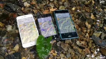
- Geographica: GPS map app which can use even offline. Geographica is a [Map Caching Offline GPS app] for mountaineering. Once you viewed a map image on the screen, that will be stored in your device. Therefore with this app you can check maps even in the wilderness without mobile phone signal or internet connection. Moreover, you can use GPS navigation offline. *Features -Cached Maps are usable even though offline. -Several types of maps available such as OpenStreetMap, etc. -Usable as GPS logger. -Create Markers, a.k.a. POI, and show them. -Navigation function using Markers and Routes. -UTM coordinate format available. -Support units; meter, mile, nautical mile, knot, foot -Speech function lets you know time, coordinates, speed, etc. with a voice. *System Requirements -Android OS 8.0 or later.Required GPS,e-compass,Accelerometer. *Cautions; Please be sure to read the following. - Developer do not take any responsibility for damage caused by using Geographica (will write as "this app" in the following). - Developer do not take any responsibility for accuracy, reliability and usefulness of the information provided by this app. Please use at your own risk. - At the time of the first start-up, iPhone would ask you whether you allow this app to use the Location Services. Although you should allow always. If you do not allow, your device cannot receive the Location information. In that case, set your SmartPhone as below; Turn on [Access my location] and , [Settings] > [Location access(service)] > [Location mode] > Turn on [Use GPS,Wi-Fi,mobile network] or [Use GPS only(Device onky)] - Continued use of GPS running in the background can dramatically decrease battery life. - This app use the background audio. For the record confirmation of track log and voice guide. - This app is using Google Maps SDK, and web services from Geographical Survey Institute, OpenStreetMaps, etc. - Please note that this app may be in unusable status due to each web service's operation status or specification changes. - This app use Apache Software License 2.0 CWAC,TouchListView. *Maps license - Geographical Survey Institute of Japan - Asia Air Survey Co., Ltd. - Open street map. - Thunderforest - Google
Geographica 2.1.54 Update
Ver 2.1.54 - Improvements based on crash reports. Ver 2.1.53 - You can now change the nickname you set when registering for Geographica Cloud. - Improved GPS positioning stability. - Improved shape data loading process.
Ver 2.1.54 - Improvements based on crash reports. Ver 2.1.53 - You can now change the nickname you set when registering for Geographica Cloud. - Improved GPS positioning stability. - Improved shape data loading process.
Ver 2.1.54 - Improvements based on crash reports. Ver 2.1.53 - You can now change the nickname you set when registering for Geographica Cloud. - Improved GPS positioning stability. - Improved shape data loading process.
- You can now change the nickname you set when registering for Geographica Cloud. - Improved GPS positioning stability. - Improved shape data loading process.
- You can now change the nickname you set when registering for Geographica Cloud. - Improved GPS positioning stability. - Improved shape data loading process.
・Shape files imported from CollaboMap ZIP files now update automatically when changed in CollaboMap. ・Added “Generate Itinerary” to the menu when selecting one track. It creates text from track times and markers.
・Improved the search function that appears when sliding the coordinate banner. ・Added a magnifying glass button to the top right of the track list, marker list, and other lists, allowing you to search by various names. ・Fixed bugs.
・Improved the search function that appears when sliding the coordinate banner. ・Added a magnifying glass button to the top right of the track list, marker list, and other lists, allowing you to search by various names. ・Fixed bugs.
APKFab.com and the download link of this app are 100% safe. All download links of apps listed on APKFab.com are from Google Play Store or submitted by users. For the app from Google Play Store, APKFab.com won't modify it in any way. For the app submitted by users, APKFab.com will verify its APK signature safety before release it on our website.
![Geographica [Offline GPS APP] XAPK download](https://image.winudf.com/v2/image1/anAua2Vpeml3ZWIuZ2VvZ3JhcGhpY2Ffc2NyZWVuXzBfMTc4MTAxNDM3MV8wMTU/screen-0.jpg?fakeurl=1)
![Geographica [Offline GPS APP] XAPK download](https://image.winudf.com/v2/image1/anAua2Vpeml3ZWIuZ2VvZ3JhcGhpY2Ffc2NyZWVuXzFfMTc4MTAxNDM3Ml8wNDM/screen-1.jpg?fakeurl=1)
![Geographica [Offline GPS APP] XAPK download](https://image.winudf.com/v2/image1/anAua2Vpeml3ZWIuZ2VvZ3JhcGhpY2Ffc2NyZWVuXzJfMTc4MTAxNDM3NF8wODY/screen-2.jpg?fakeurl=1)
![Geographica [Offline GPS APP] XAPK download](https://image.winudf.com/v2/image1/anAua2Vpeml3ZWIuZ2VvZ3JhcGhpY2Ffc2NyZWVuXzNfMTc4MTAxNDM4MF8wNjY/screen-3.jpg?fakeurl=1)
![Geographica [Offline GPS APP] XAPK download](https://image.winudf.com/v2/image1/anAua2Vpeml3ZWIuZ2VvZ3JhcGhpY2Ffc2NyZWVuXzRfMTc4MTAxNDM4Ml8wNTE/screen-4.jpg?fakeurl=1)