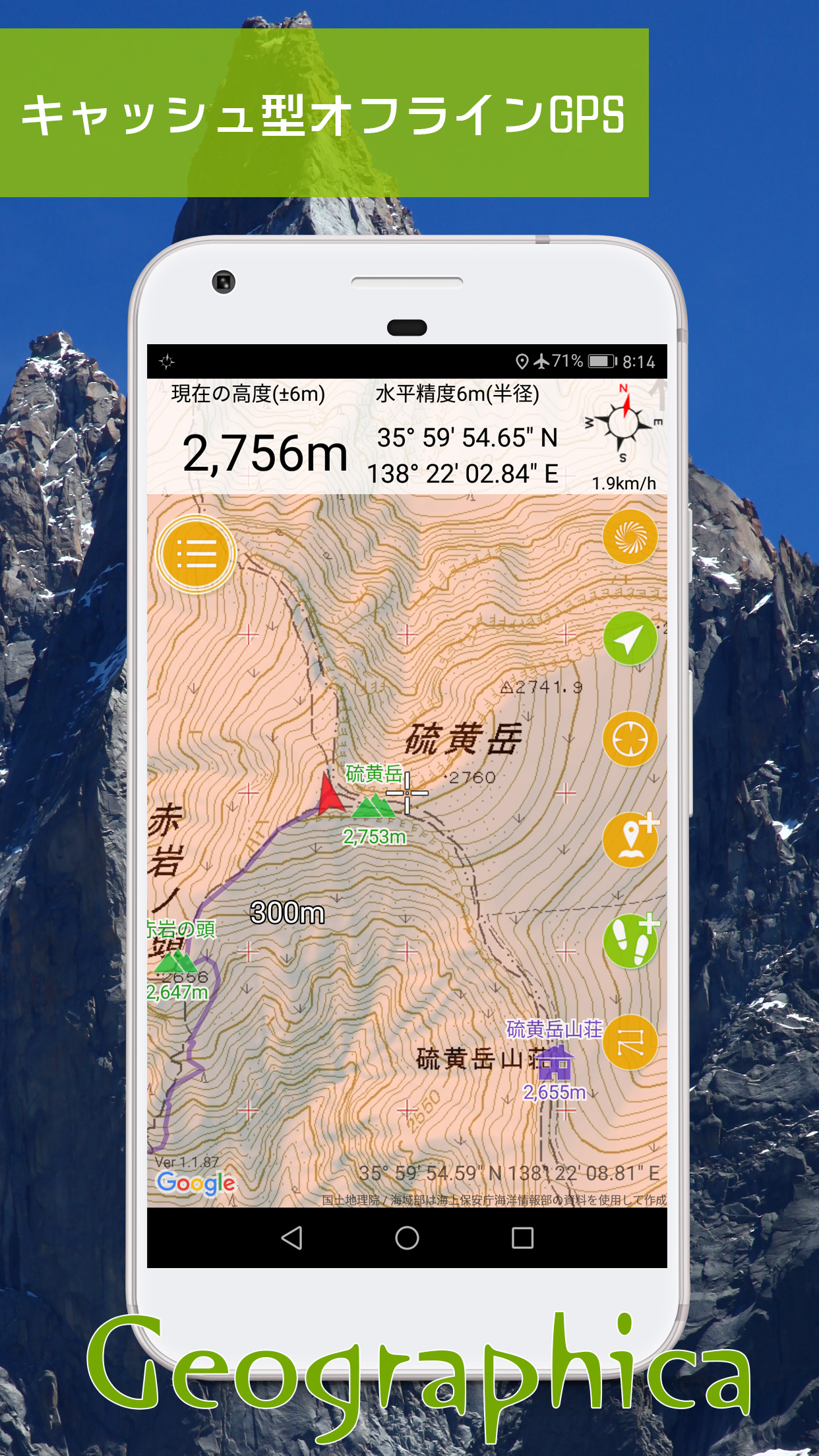
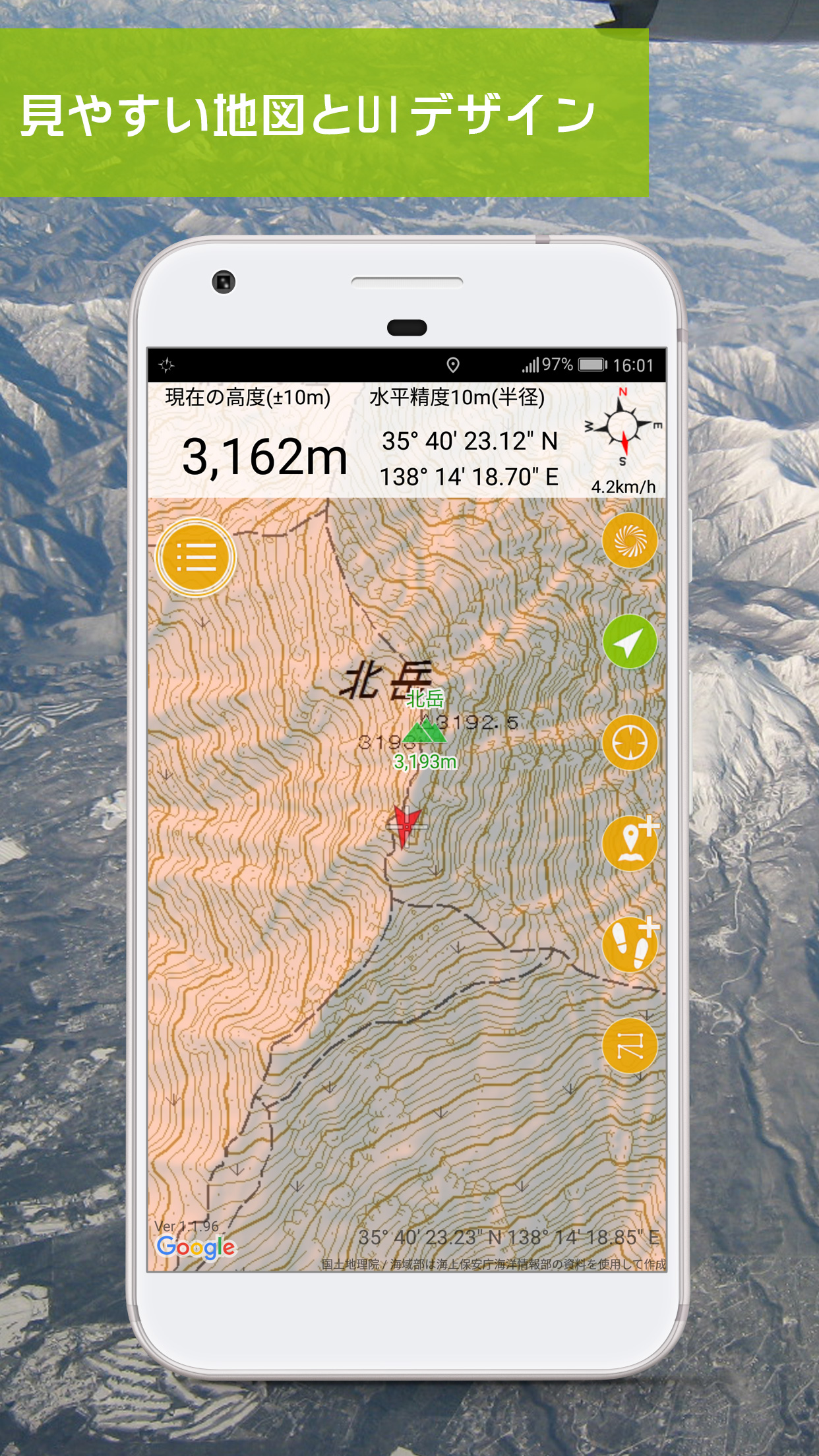
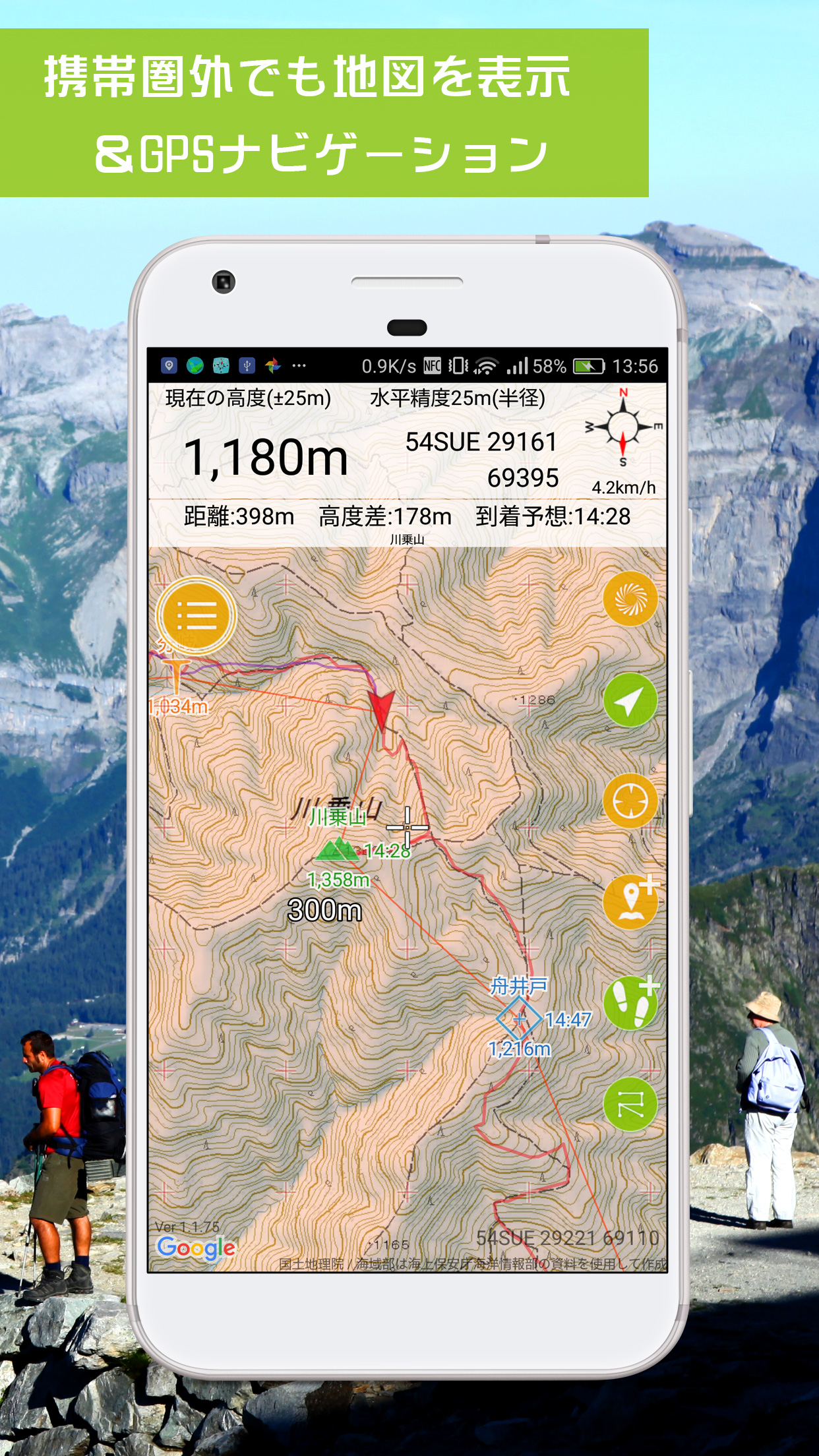
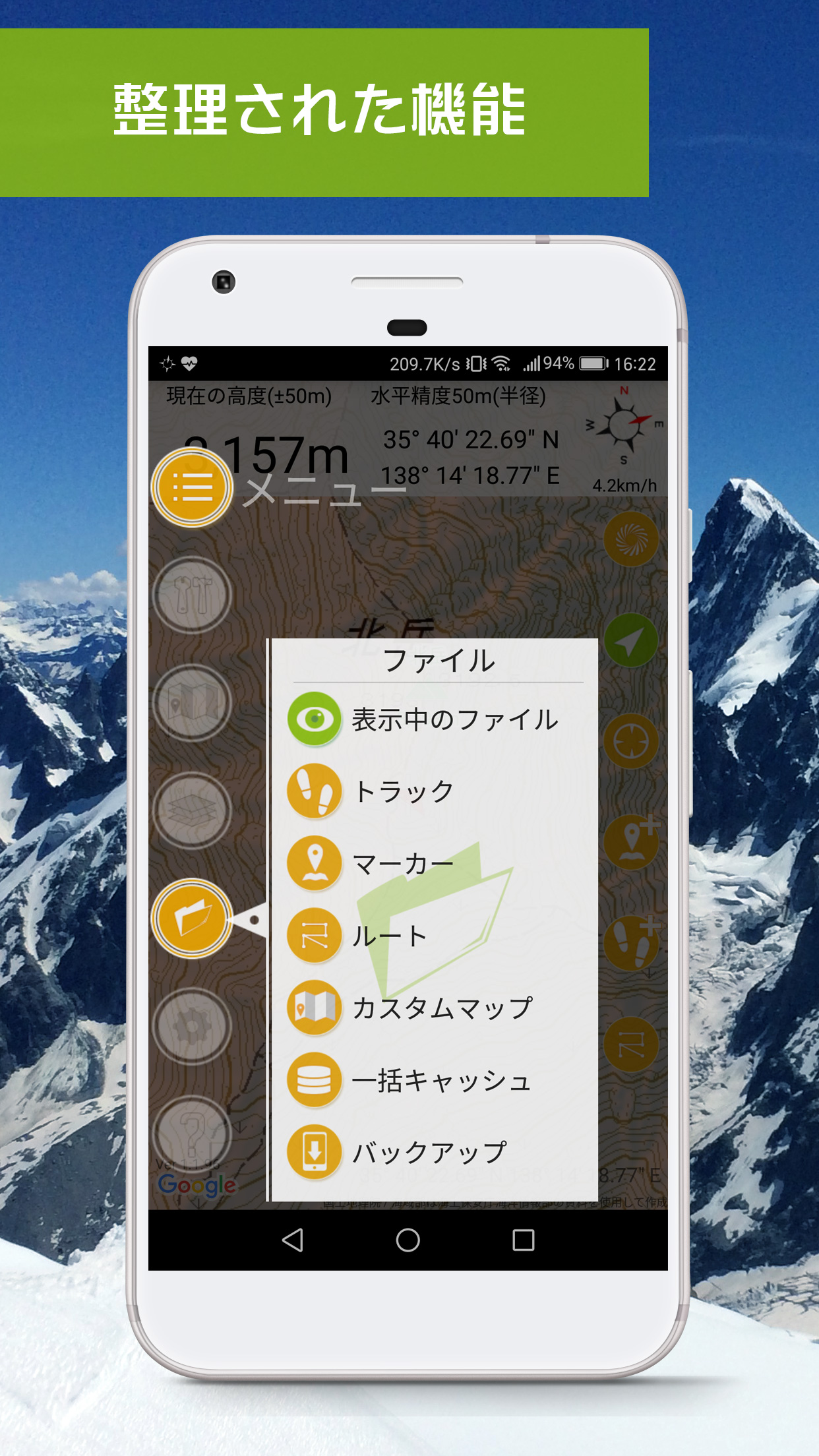
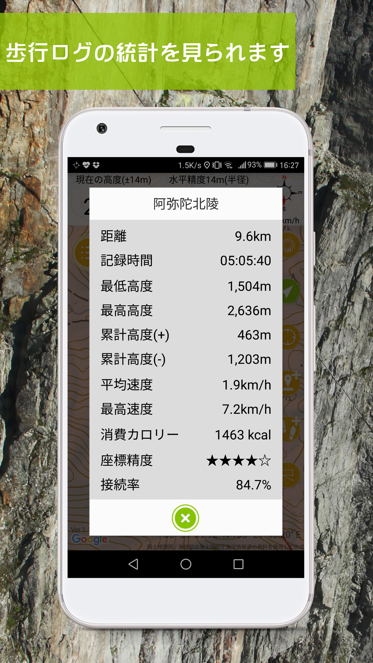
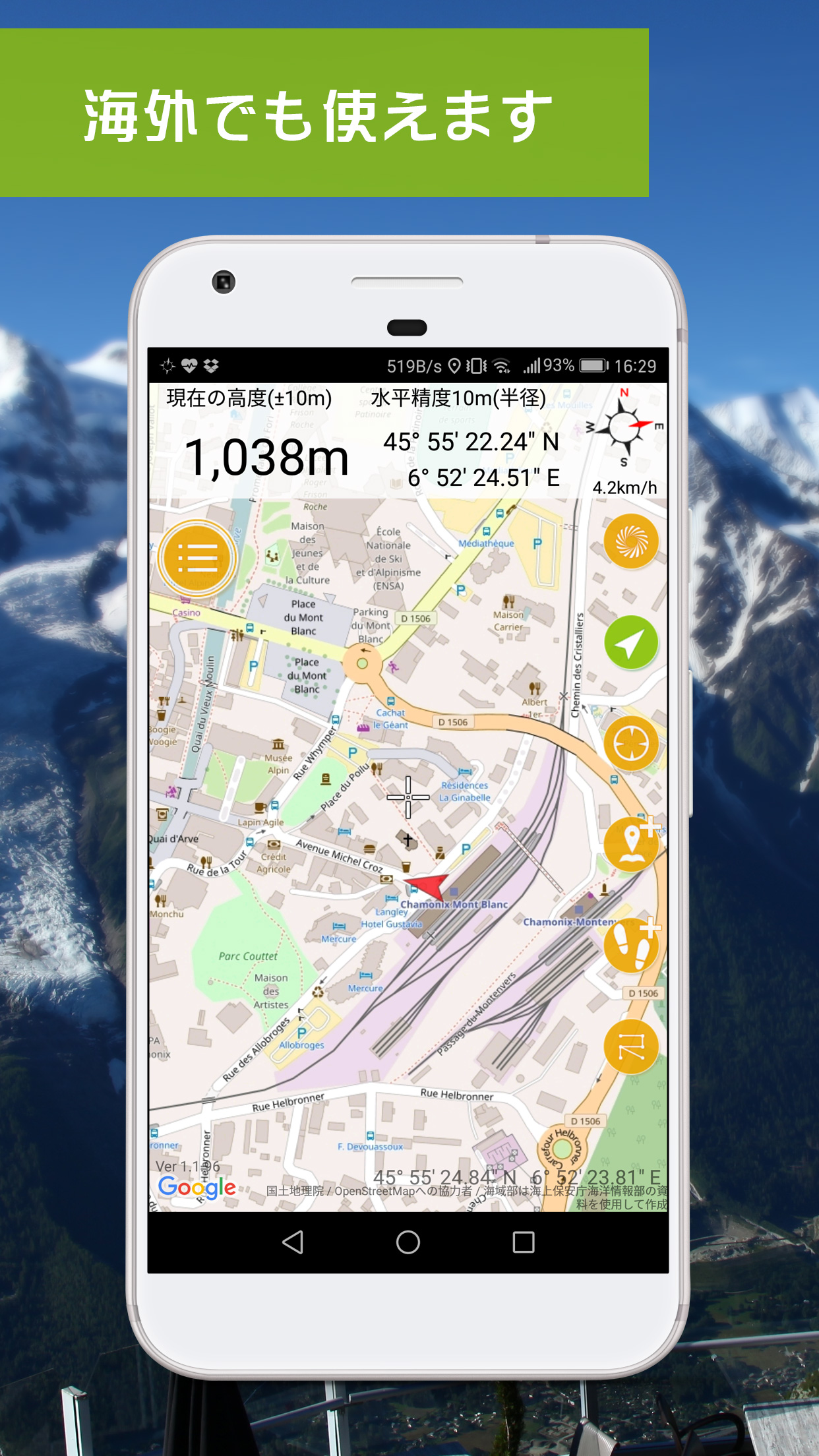
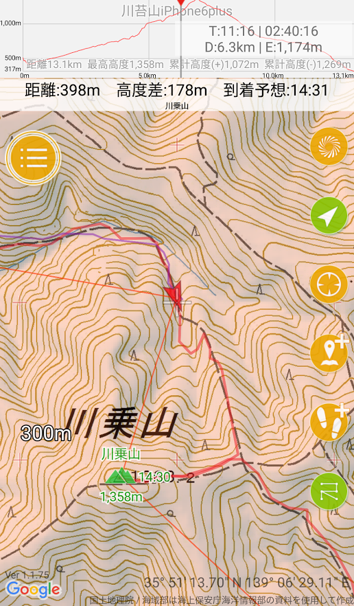
- Overhauled custom map import. Large KMZ files (30MB) now display reliably with minimal quality loss. KMZ files with internally split images are also supported. - Added custom map opacity to Display Settings. Custom maps can be shown semi-transparent. This is a global setting only — per-map opacity is not supported (and won't be added). - Bug fixes
- Added climbing speed (altitude gain/loss per hour) below the elevation in the coordinate banner. - Tapping a Google Maps marker now lets you create a Geographica marker at the same location. - Track logging now auto-stops at 5% battery when not charging. Logging continues if charging starts within 30 seconds. - Disabled auto-zoom when pressing the current location button at 20 km/h or faster.