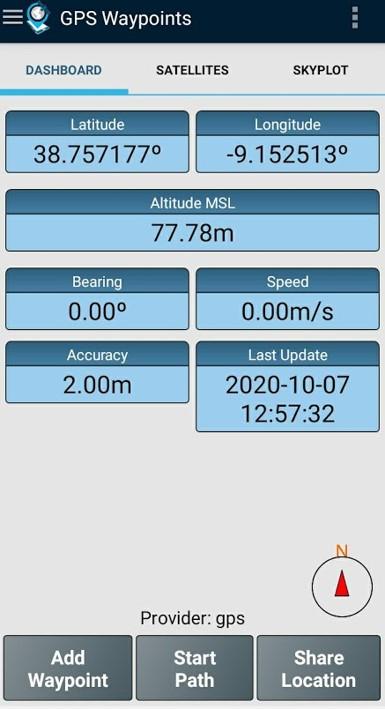
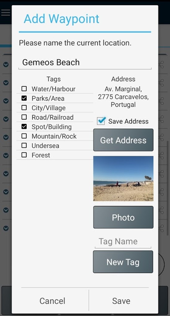
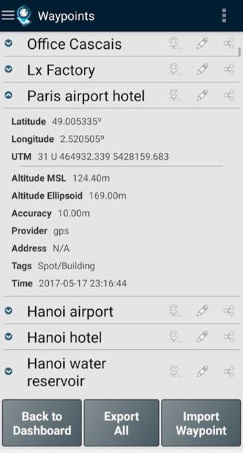
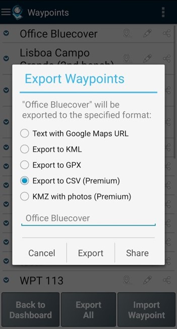
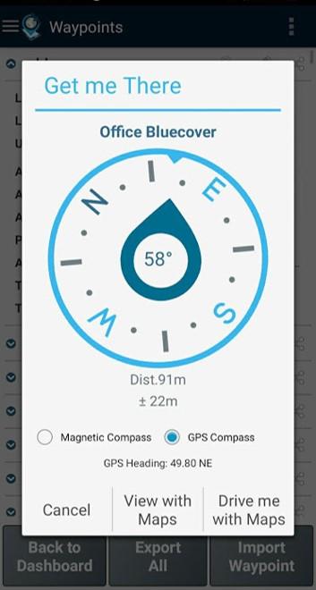
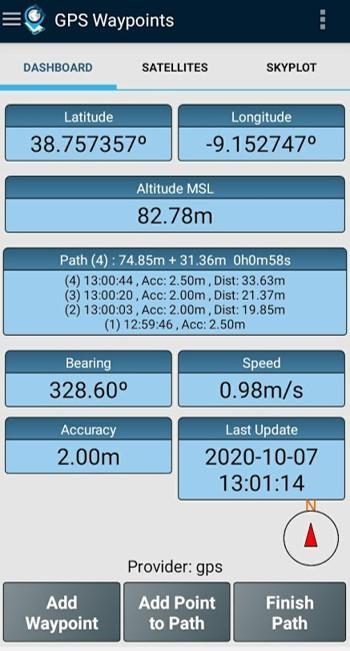
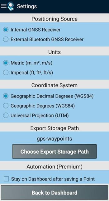
Herramienta multipropósito de cartografía y topografía para uso profesional y personal. Resulta útil en diversas actividades profesionales de topografía terrestre, como agricultura, gestión forestal, mantenimiento de infraestructuras (p. ej., carreteras y redes eléctricas), planificación urbana, bienes raíces y cartografía de emergencias. También se utiliza para actividades personales al aire libre, como senderismo, correr, caminar, viajar y geocaching. La aplicación recopila puntos (como puntos de interés) y rutas (secuencias de puntos) para realizar actividades de cartografía y topografía. Los puntos, adquiridos con información precisa, pueden ser clasificados por el usuario con etiquetas específicas o caracterizados con fotos. Las rutas se crean como una secuencia temporal de puntos recién adquiridos (p. ej., para registrar un recorrido) o, alternativamente, con puntos existentes (p. ej., para crear una ruta). Las rutas permiten medir distancias y, si se cierran, forman polígonos que permiten determinar áreas y perímetros. Tanto los puntos como las rutas pueden exportarse a archivos KML, GPX y CSV para su procesamiento externo con una herramienta geoespacial. La aplicación utiliza el receptor GPS interno del dispositivo móvil (normalmente con precisiones superiores a 3 m) o, alternativamente, permite a los usuarios profesionales obtener mayor precisión con un receptor GNSS externo Bluetooth compatible con el formato de transmisión NMEA (por ejemplo, receptores RTK con precisión centimétrica). A continuación, se muestran algunos ejemplos de receptores externos compatibles. La aplicación incluye las siguientes funciones: - Adquirir la posición actual con precisión e información de navegación; - Proporcionar detalles de los satélites activos y visibles (GPS, GLONASS, GALILEO, BEIDOU y otros); - Crear puntos con información de precisión, clasificarlos con etiquetas, adjuntar fotos y convertir las coordenadas en una dirección legible (geocodificación inversa); - Importar puntos a partir de coordenadas geográficas (latitud, longitud) o buscando una dirección/punto de interés (geocodificación); - Crear rutas mediante la adquisición manual o automática de secuencias de puntos; - Importar rutas desde puntos existentes; - Cree temas de encuesta con etiquetas personalizadas para clasificar puntos y rutas. - Obtenga direcciones y distancias desde la posición actual hasta los puntos y rutas usando una brújula magnética o GPS. - Exporte puntos y rutas a archivos KML y GPX. - Comparta datos con otras aplicaciones (p. ej., Dropbox/Google Drive). - Configure la fuente de posicionamiento para el receptor interno o con un receptor externo. La suscripción Premium incluye las siguientes funciones profesionales: - Copia de seguridad y restauración de los datos del usuario (también permite transferir datos de un dispositivo a otro). - Exporte puntos de referencia y rutas a archivos CSV. - Exporte puntos de referencia con fotos a archivos KMZ. - Importe múltiples puntos y rutas desde archivos CSV y GPX. - Ordene y filtre puntos y rutas por fecha de creación, nombre y proximidad. - Análisis de señales satelitales y detección de interferencias. La función Mapas es una función adicional de pago que permite seleccionar y visualizar puntos, rutas y polígonos en Open Street Maps. Además del receptor móvil interno, la versión actual es compatible con los siguientes receptores externos: Bad Elf GNSS Surveyor, Garmin Glo, Navilock BT-821G, Qstarz BT-Q818XT, Trimple R1 y ublox F9P. Si probó la aplicación correctamente con otro receptor externo, por favor, envíenos sus comentarios como usuario o fabricante para ampliar esta lista. Para más información, visite nuestra web (https://www.bluecover.pt/gps-waypoints) y conozca todos los detalles de nuestra oferta: - Funciones gratuitas, premium y mapas (https://www.bluecover.pt/gps-waypoints/features) - Receptores GISUY (https://www.bluecover.pt/gisuy-gnss-receiver/) - Enterprise (https://www.bluecover.pt/gps-waypoints/enterprise-version/)
Actualización de GPS Waypoints 4.00
Version 4.00 - Minor fixes - Filter count and Export optimization to handle large number of geoitems - Full landscape support - Export Paths to CAD file in DXF format (Premium) - Local themes with numeric tags example - Import points with numeric tags from CSV - User interface general upgrade Version 3.18 - Improvements on thematic tagging (numeric, load fix) - Web map Layers improvement with historic visualization (Maps) - Automatic updates of current location on map (Maps)
Version 3.18 - Minors updates on About view - Improvements on thematic tagging (numeric, load fix) - Web map Layers improvement with historic visualization (Maps) - Automatic updates of current location on map (Maps) Version 3.17 - Tags enhanced with numeric atribute values (e.g. height 32) - New features: Follow a Route and Follow Polygon - Ge Me There with current and target coordinates - EO images refactoring (Maps)
Version 3.17 - EO images improvements (Maps) Version 3.16 - Autopath improvements (inc trigger by distance) - Edit Points and Paths on map (Maps) - High resolution Satellite basemap added (Maps) - Ruler from map with imperial metrics (Maps) - EO images improvements (Maps)
Version 3.16 - Autopath improvements (inc trigger by distance) - Edit Points and Paths on map (Maps) - High resolution Satellite basemap added (Maps) - Ruler from map with imperial metrics (Maps) - EO images improvements (Maps) Version 3.15 - Add manual Points and draw Paths on map (Maps) - Ruler for measurements (Maps) - Line charts in time from multi-selected Paths
APKFab.com y el enlace de descarga de esta aplicación son 100% seguros. Todos los enlaces de descarga de aplicaciones que aparecen en APKFab.com son de Google Play Store o enviados por los usuarios. Para la aplicación desde Google Play Store, APKFab.com no lo modificará de ninguna manera. Para la aplicación enviada por los usuarios, APKFab.com verificará la seguridad de la firma de APK antes de publicarla en nuestro sitio web.