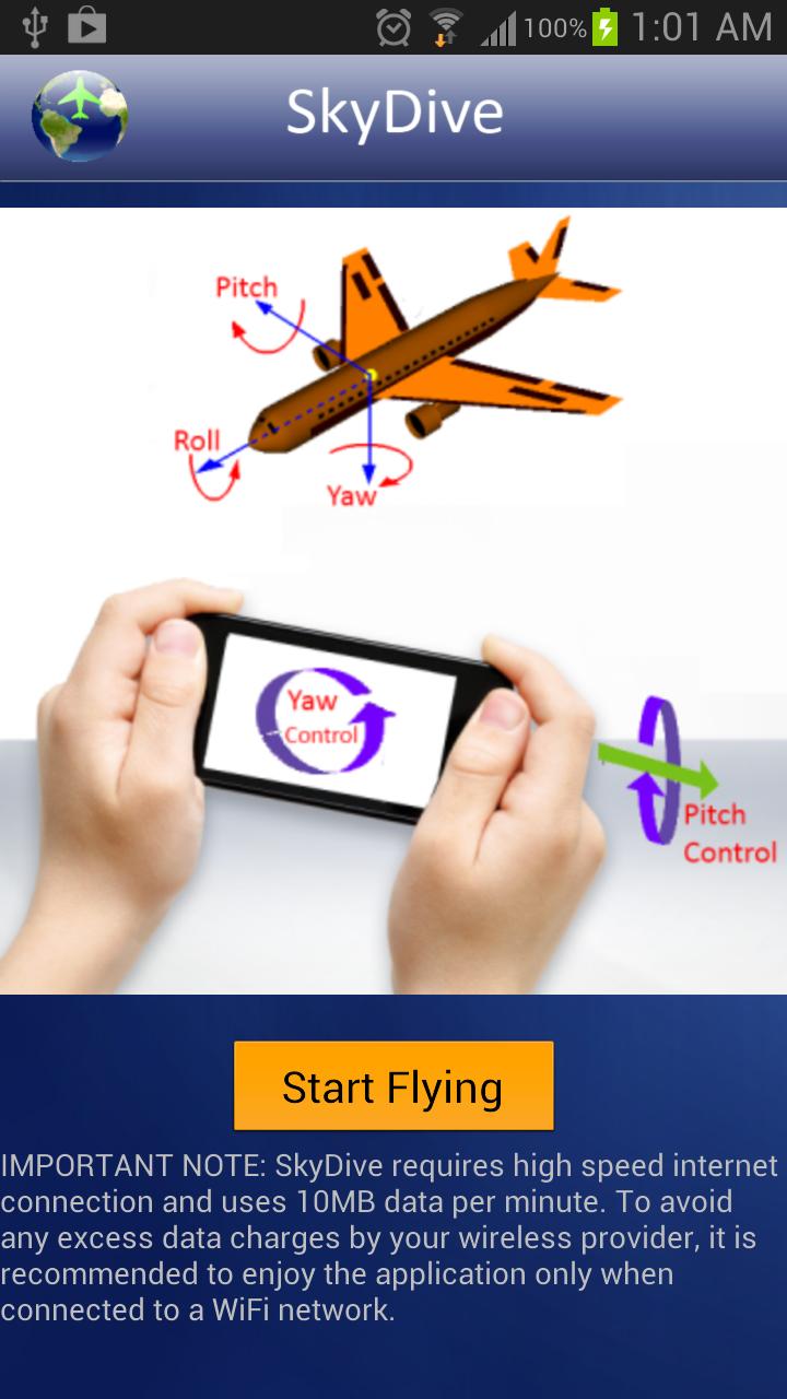
Use your smartphone to fly over Google maps satellite view with real-time traffic view. SkyDive uses smartphone built-in sensors to navigate on the Google maps satellite views. It has intuitive flight control features and provides a real experience of flying over satellite maps of your city with a perfect aerial views. Make sure your GPS is enabled before running the app. The app will use your GPS location and will fly over your current location. If GPS is disabled, it will fly over Toronto. Keywords: fly, sky, sky view, satellite view, maps, Smartphone, orientation sensor, tilt, yaw, pitch, roll
SkyDive 2.0 更新
fixed a bug. Now SkyDive uses the gps location data and flies over your area. Enjoy!
APKFab.com和該應用的下載連結是100%安全的。APKFab.com上列出的所有應用下載連結均來自Google Play Store或由用戶提交。對於來自Google Play商店的應用,APKFab.com不會對其進行任何形式的修改。對於用戶提交的應用,APKFab.com會在網站上發佈之前驗證其APK簽名的安全性。