Urban Biker (Package Name: com.sublimis.urbanbiker) is developed by Urban Biker and the latest version of U Biker: GPS Tracks 8.114 (2026-06-09) was updated on June 9, 2026. U Biker: GPS Tracks is in the category of Health & Fitness with the feature Travel & Local. You can check all apps from the developer of U Biker: GPS Tracks and find 200 alternative apps to U Biker: GPS Tracks on Android. Currently this app is for free. This app can be downloaded on Android 8.0+ on APKFab or Google Play. All APK/XAPK files on APKFab.com are original and 100% safe with fast download.
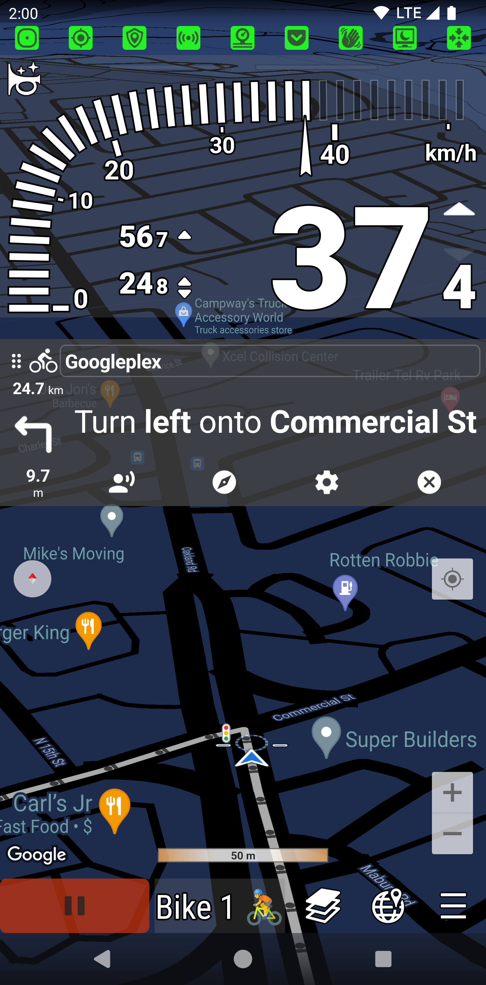
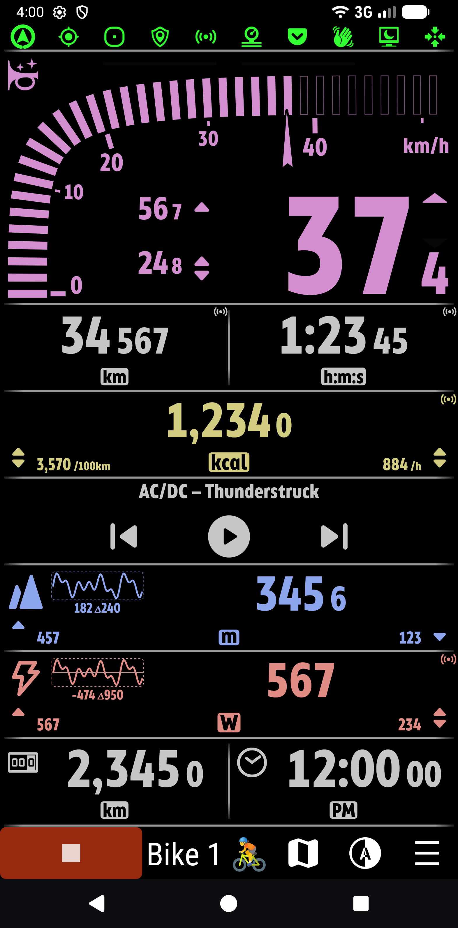
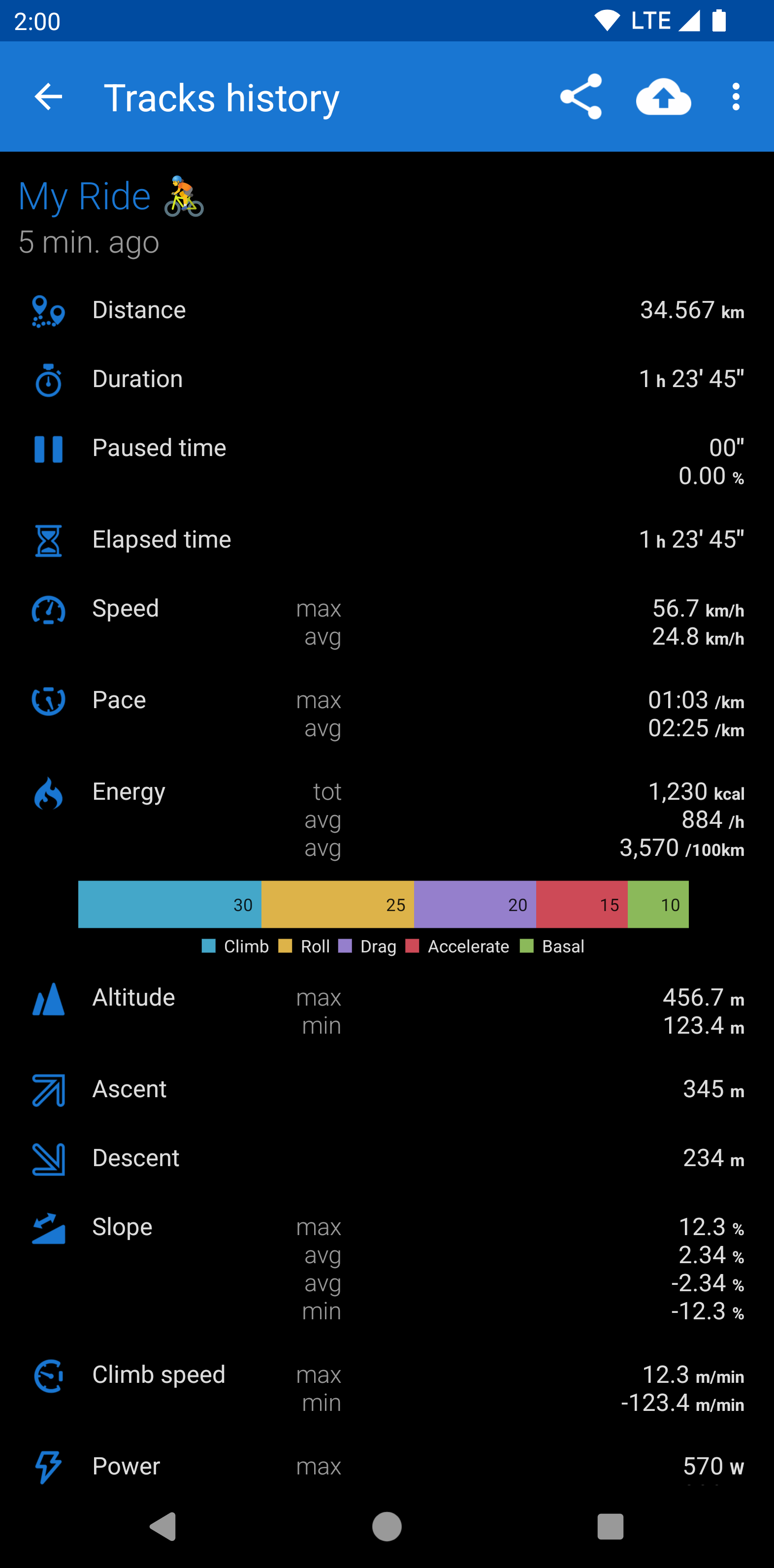
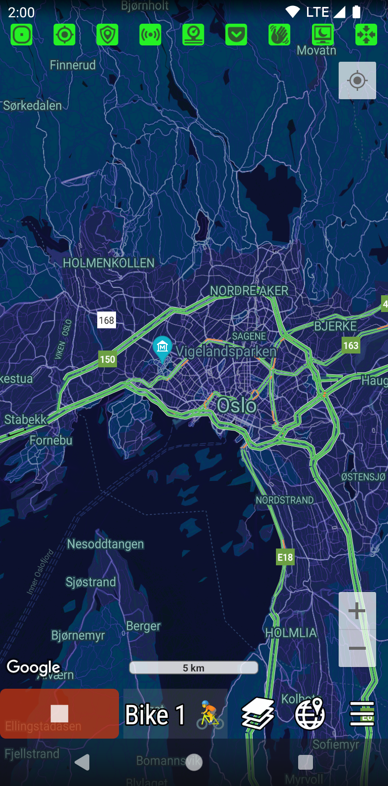
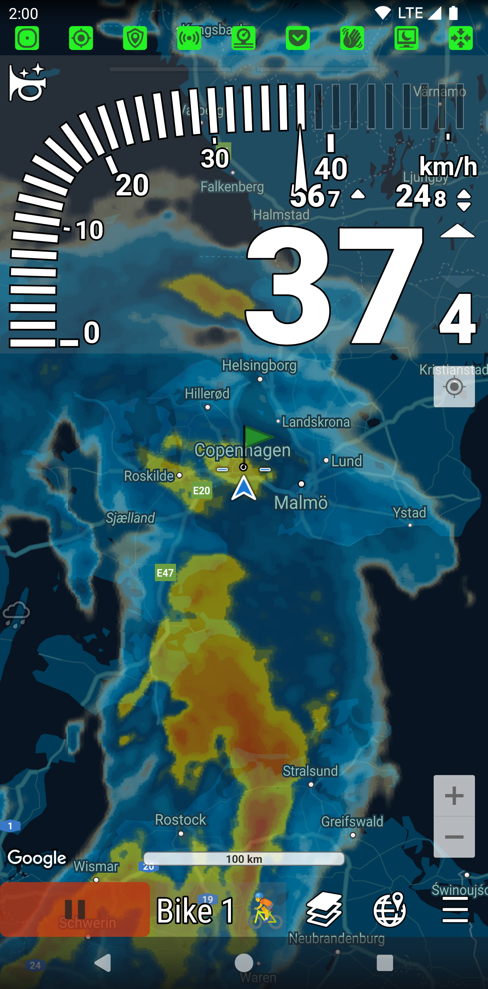
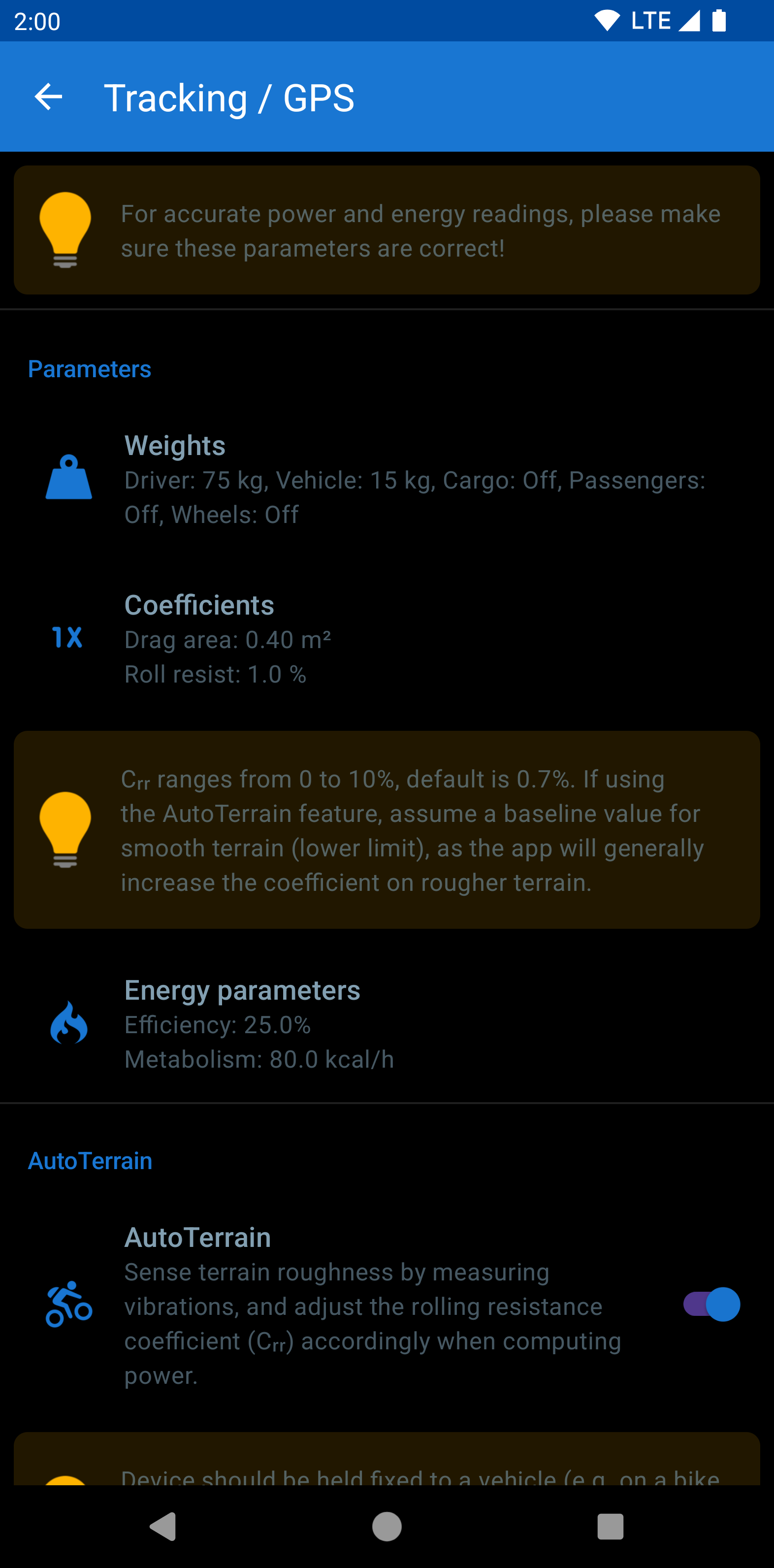
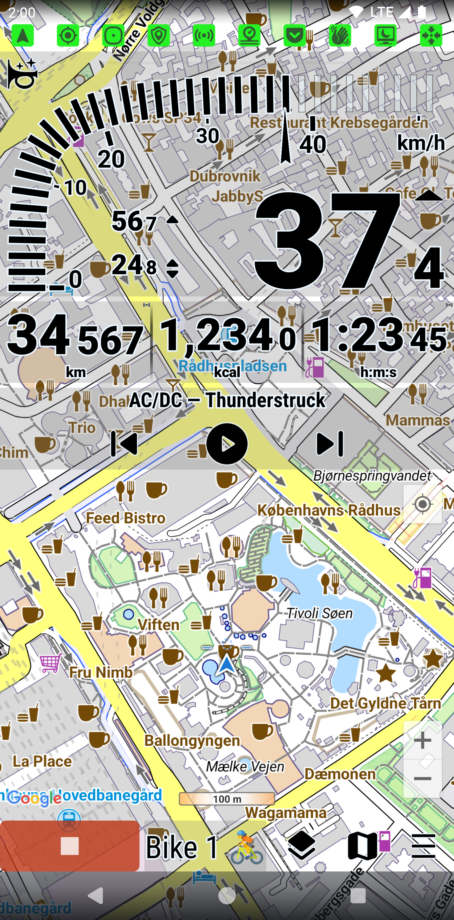
Track your rides, runs, walks and fitness privately. No account required. No ads. 👉 Precise. 👉 Reliable. 👉 Feature-rich. 📈 Science underneath INNOVATIVE ALGORITHMS – machine learning and robust statistics algorithms are utilized for data processing. NUMBER CRUNCHING – more than 75 statistics computed for every activity in sub-second resolution, raw data available in CSV format. PHYSICAL CONSISTENCY – maximum speed cannot possibly be smaller than average speed, and metrics shouldn't spike without a cause. MATHEMATICAL CONSISTENCY – problems of decimal rounding, finite precision, or round-off errors are all handled very carefully for top accuracy. ✅ Ideal for sports and adventures With this app you can track all of your day-to-day activities, like walking and running, cycling, car driving, and even flying. 🛰️ GPS & Tracking • No data collected, no account required • GPS automatic sleep saves battery by turning off GPS when you stop • Adaptive GPS interval saves battery by using GPS less often when you're going slow • Speech • Automatic pause • Physical activity recognition • Barometric altitude (use barometer sensor) • Offline altitude (use elevation data from offline maps) • Energy breakdown: Examine individual contributions (climb, drag, roll, etc.) • Power from a power sensor, or accurately computed • Functional threshold power (FTP) estimate • AutoTerrain senses terrain roughness and adjusts power and energy consumption accordingly • Advanced digital filters of our own design (IIR, FIR, non-linear) for superior accuracy and response • Works accurately on extremely steep terrain • Reduce location noise • FenceGuard hides the location of your home or other important places from the recorded tracks • Bluetooth and ANT+ wireless sensors • Automatic sensor selection • Compass • Inclinometer • Automatic wheel circumference • Gear ratio • Kinetic energy: Shows you the fall height equivalent to your current speed, so you can better perceive potential danger • Braking energy: How much energy you lost by braking • Brake pad wear • Multiple vehicle and activity profiles • Resume any past track • Share to Strava, Google Fit • Can be used without GPS, e.g. for indoor spinning 🗺️ Maps & Navigation • Turn-by-turn directions to your destination, both visual and spoken • More than 40 map types, including Google, Mapbox, HERE, MapTiler, Thunderforest, CycleOSM, and others • Offline maps with terrain • Weather radar map, animated • Strava global heatmap with thousands of tracks from other users • Guide routes • Map auto-zoom depending on speed • Quick zoom buttons 🎨 User interface • Custom layouts • Custom colors and fonts • Light/Dark themes • Screen stabilization by suppressing small movements • Speech • Media controls • Live 10-minute charts • Dim and app-lock the screen by waving your hand • Pocket mode: Keeps the screen off while in your pocket • Screensaver with adjustable timeout and dim strength • Track color by parameter (altitude, speed, etc.) • Screenshot: Share the current app screen • Automatic or manual bell sounds • Automatic or manual moving sounds (AVAS, Acoustic Vehicle Alerting System) • Flashlight with automatic blinking • Derived temperature sensor ℹ️ Effort The application is built from around 350'000 lines of original source code. That's about 10x more lines than the famous three-volume fantasy novel.
Urban Biker 8.114 (2026-06-09) Update
v8.114 2026-06-09 📊 Statistics screen: Study your total distance, duration, energy, chain wear, etc. by profile and time range! 🐞 Fixed: Zooming on the map is difficult while the auto-zoom feature is active ✅ Various improvements and fixes v8.113 2026-05-16 🐞 Fixed: Resuming a track would cause the app to freeze. Note: Tracks are not lost. They will reappear in History the next time you finish any activity in any profile. ✅ Misc. fixes and improvements
v8.114 2026-06-09 📊 Statistics screen: Study your total distance, duration, energy, chain wear, etc. by profile and time range! 🐞 Fixed: Zooming on the map is difficult while the auto-zoom feature is active ✅ Various improvements and fixes v8.113 2026-05-16 🐞 Fixed: Resuming a track would cause the app to freeze. Note: Tracks are not lost. They will reappear in History the next time you finish any activity in any profile. ✅ Misc. fixes and improvements
v8.114 2026-06-09 📊 Statistics screen: Study your total distance, duration, energy, chain wear, etc. by profile and time range! 🐞 Fixed: Zooming on the map is difficult while the auto-zoom feature is active ✅ Various improvements and fixes v8.113 2026-05-16 🐞 Fixed: Resuming a track would cause the app to freeze. Note: Tracks are not lost. They will reappear in History the next time you finish any activity in any profile. ✅ Misc. fixes and improvements
v8.113 2026-05-16 🐞 Fixed: Resuming a track would cause the app to freeze. Note: Tracks are not lost. They will reappear in History the next time you finish any activity in any profile. ✅ Misc. fixes and improvements v8.112 2026-05-11 ✅ Navigation is now more reliable and uses less battery 📌 GPS algorithm is improved to prevent location jumping when stationary ✅ History screen now loads faster
v8.112 2026-05-11 ✅ Navigation is now more reliable and uses less battery 📌 GPS algorithm is improved to prevent location jumping when stationary ✅ History screen now loads faster ✅ Misc. fixes and improvements v8.111 2026-04-22 📌 Improved GPS algorithm prevents location jumping when stationary 🌧️ Precipitation radar is now available up to a scale of about 50 km 🎨 Speed metric now has a different default color ✅ Misc. fixes and improvements
v8.111 2026-04-22 📌 Improved GPS algorithm prevents location jumping when stationary 🌧️ Precipitation radar is now available up to a scale of about 50 km 🎨 Speed metric now has a different default color ✅ Misc. fixes and improvements v8.110 2026-03-28 🐞 Fixed some weird low-level bug (present mostly on Android 11) v8.101-102 2026-03-25 🐞 Barometric altitude now consumes less battery and processing power ✅ Misc. fixes and improvements
APKFab.com and the download link of this app are 100% safe. All download links of apps listed on APKFab.com are from Google Play Store or submitted by users. For the app from Google Play Store, APKFab.com won't modify it in any way. For the app submitted by users, APKFab.com will verify its APK signature safety before release it on our website.