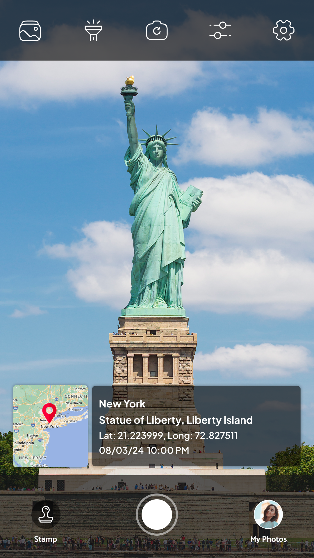
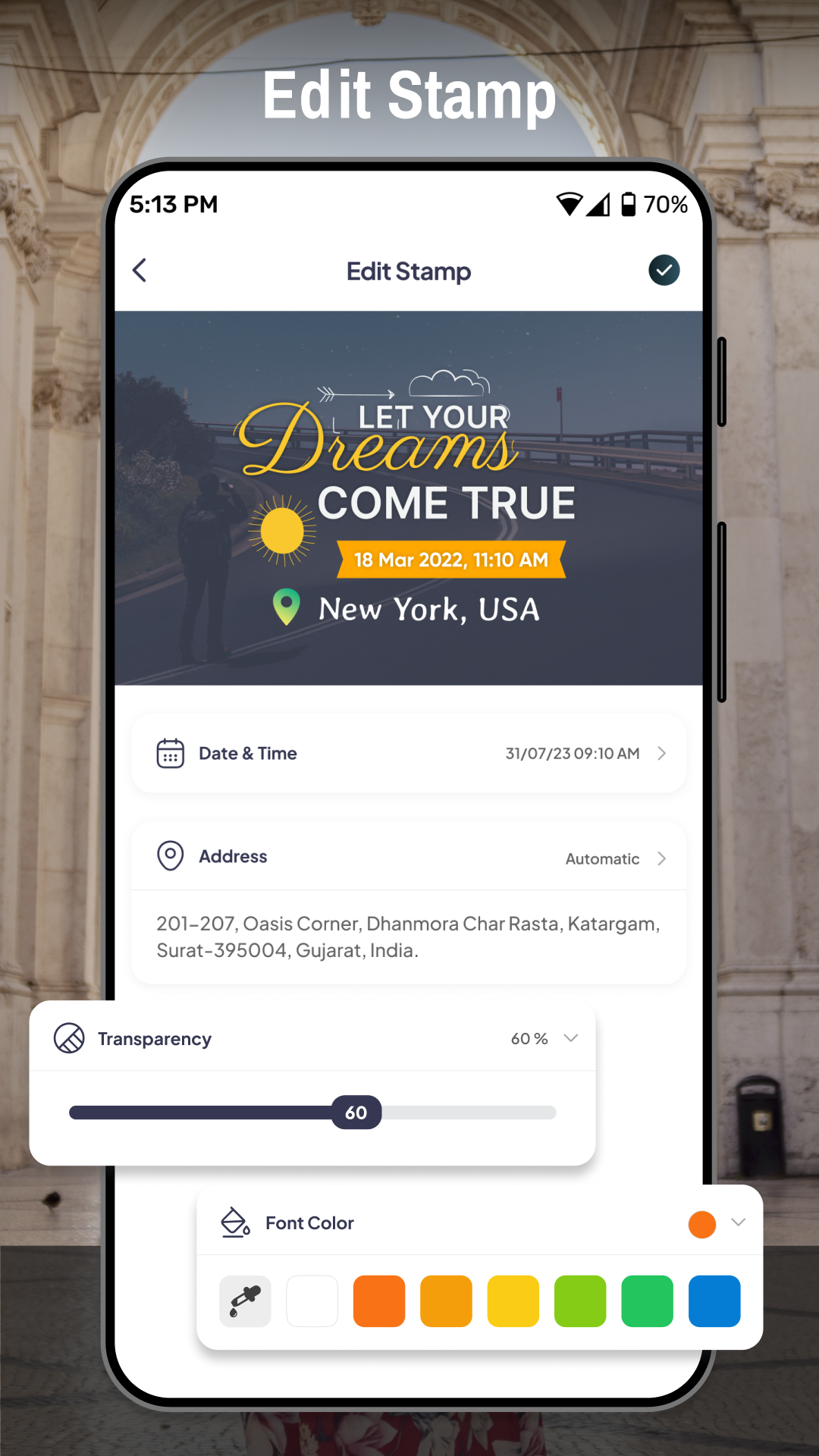
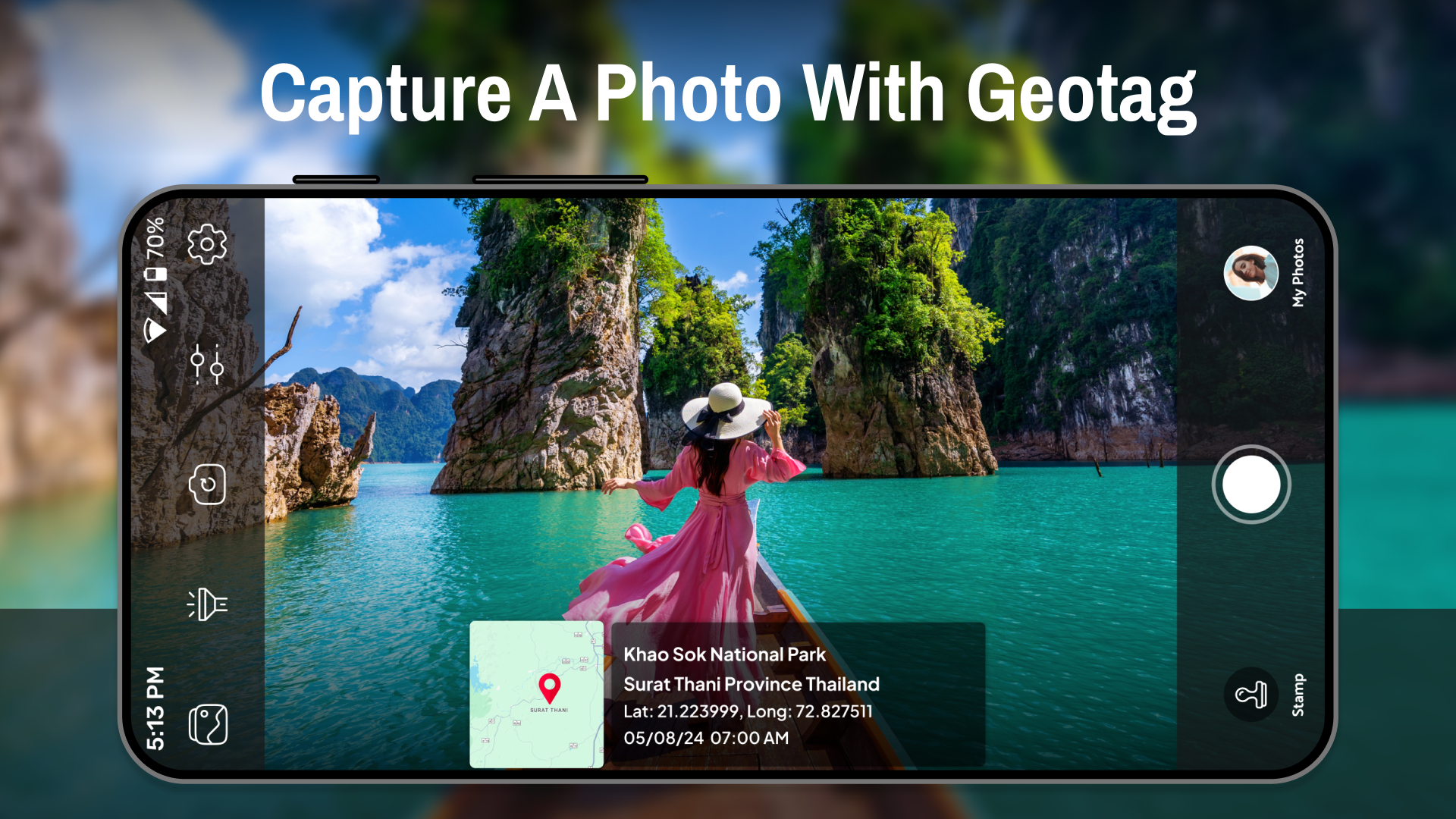
Tagofy - Geotag Map Camera
7.4 568
v5.0 by Vasundhara Infotech LLP


Requires Android: Android 7.0+
Architecture: arm64-v8a, armeabi-v7a
Screen DPI: nodpi
SHA1: e72adf9cbfd77edf1dc18e293288e78d110e33fb
Size: 39.39 MB
Requires Android: Android 7.0+
Architecture: arm64-v8a
Screen DPI: nodpi
SHA1: e9ef2e0ef28a41dbb2362023f8aafaf9bde98805
Size: 42.78 MB
What's New:
Requires Android: Android 7.0+
Architecture: armeabi-v7a
Screen DPI: nodpi
SHA1: 88ea54539170d94c591519a7f7dff4b194df440a
Size: 37.29 MB
What's New:
Package Name:
Category:
Update Date:
2025-03-24
Latest Version:
5.0
Need Update:
Available on:
Requirements:
Android 7.0+
Report:
Google Photos
The home for your memories. Relive, share, and organize your photos.
8.9 3M+
Video Editor & Maker - InShot
AI video editor with music! Edit video with effects, slideshow & slow motion
9.6 1M+
PhotoGrid: Video & Pic Collage Maker, Photo Editor
Camera app for Video & Photo Collage, Video maker with Music, Text& Sticker edit
9.4 752K+
GPS Area Measure - FieldCalc
GPS fields Area Measure - Distance measure - Yard measure - Acreage calculator
7.9 2K+
Assistive Touch: Home Button
Access Home, Back & Action buttons with Assistive Touch app from the Home screen
5.8 377
AI Gallery - Photo Vault
Simple & powerful gallery for easily edit, manage, hide picture & video
9.3 4K+
Love Locket Photo Editor
Love locket photo frames is high-quality locket frames for your photo
8.9 505
AI Photo Editor - AI Enhancer
Color pop effects, splash effects & black and white photo editor for you
8.4 407
Photo Crop - Video Crop
Crop your photo with picture crop photo editor & image crop photo editor
8.1 720