Navitel (Package Name: com.navitel) is developed by NAVITEL and the latest version of Navitel Navigator GPS & Maps v12.6.1544 was updated on July 6, 2026. Navitel Navigator GPS & Maps is in the category of Maps & Navigation with the feature Carpool Option. You can check all apps from the developer of Navitel Navigator GPS & Maps and find 200 alternative apps to Navitel Navigator GPS & Maps on Android. Navitel Navigator GPS & Maps is listed in Top 10 GPS & Navigation Apps. Currently this app is for free. This app can be downloaded on Android 6.0+ on APKFab or Google Play. All APK/XAPK files on APKFab.com are original and 100% safe with fast download.
ADVANTAGES
• Modern user-friendly interface.
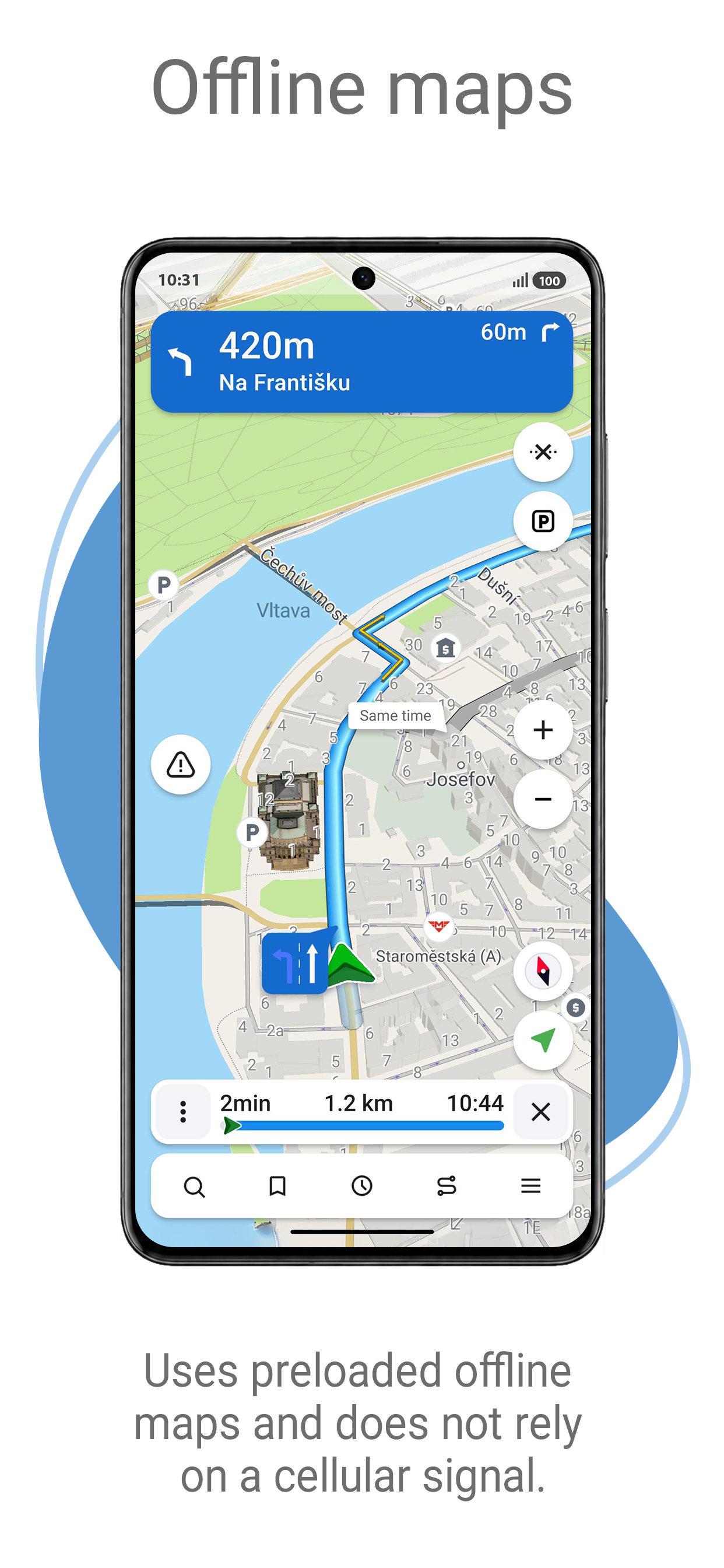
• Offline maps. To work with the program and maps, you do not need the Internet: savings in roaming and independence from the quality of communication in the regions.
• Navigation maps with a high level of detail.
• Easy and convenient POI search by category.
• Visual and voice guidance along the route.
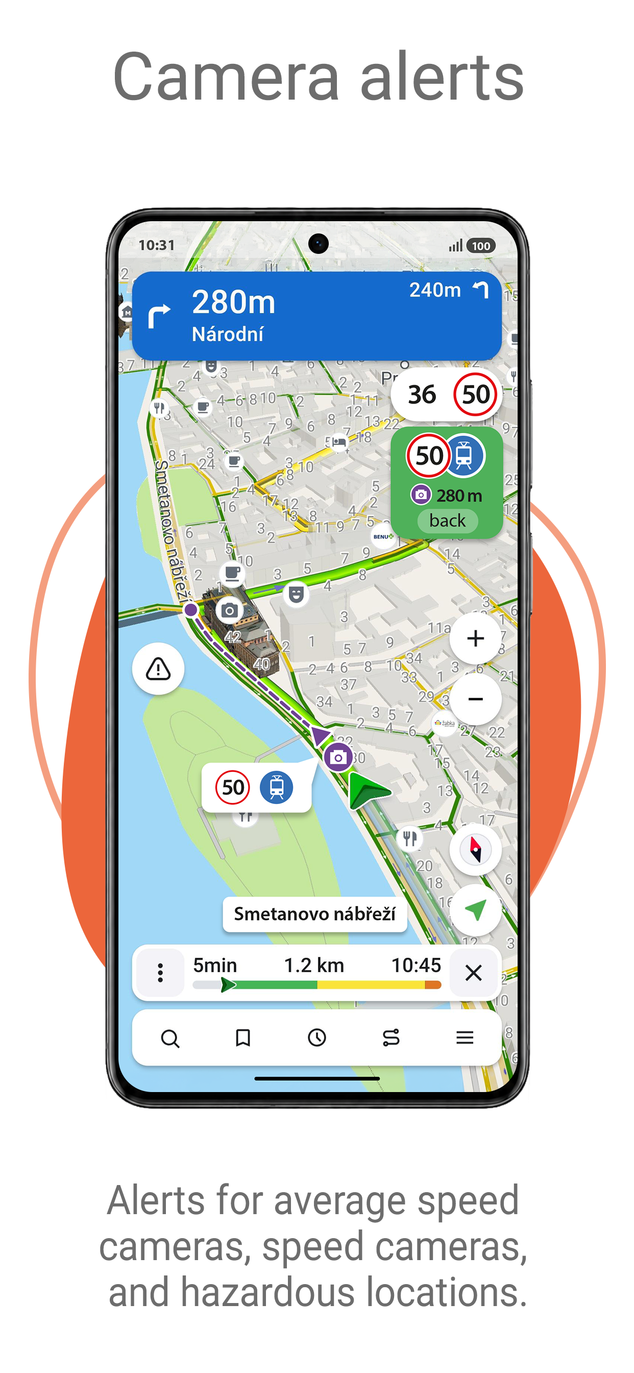
• Information about radars, speed cameras and road restrictions.
• The ability to display information on the windshield of the car — HUD (Head-Up Display)
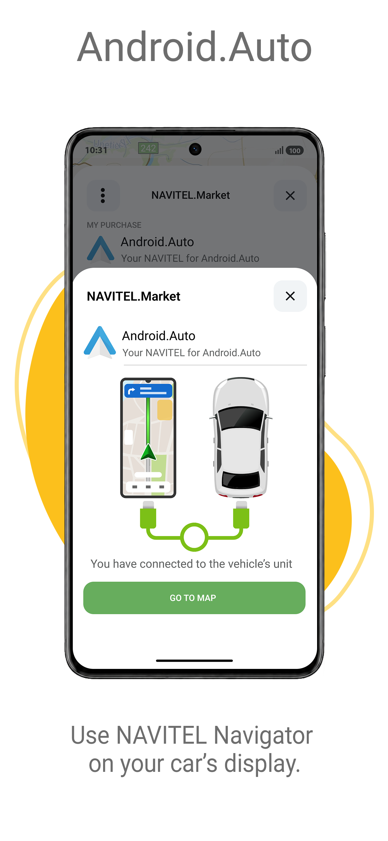
• Android Auto support.
• Navigation maps of 66 countries are available.
SPECIAL FEATURES
• Fast route calculation. Instant calculation and routing of any length and complexity.
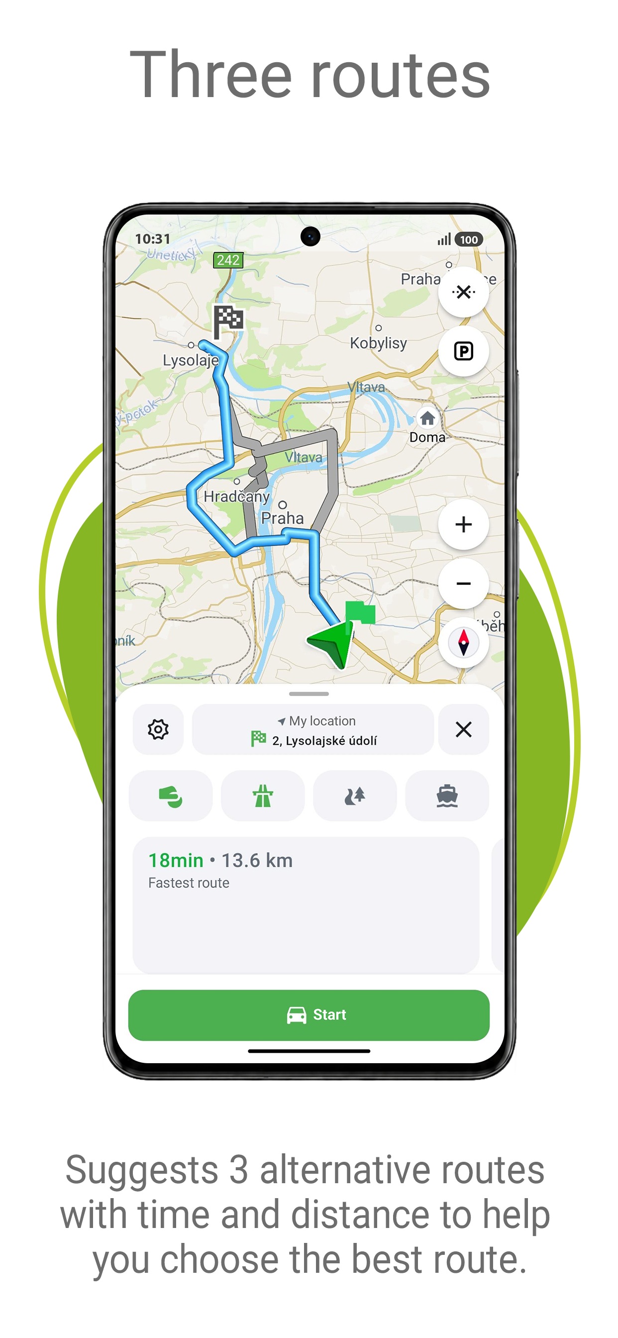
• Three alternative routes with distance and travel time information.
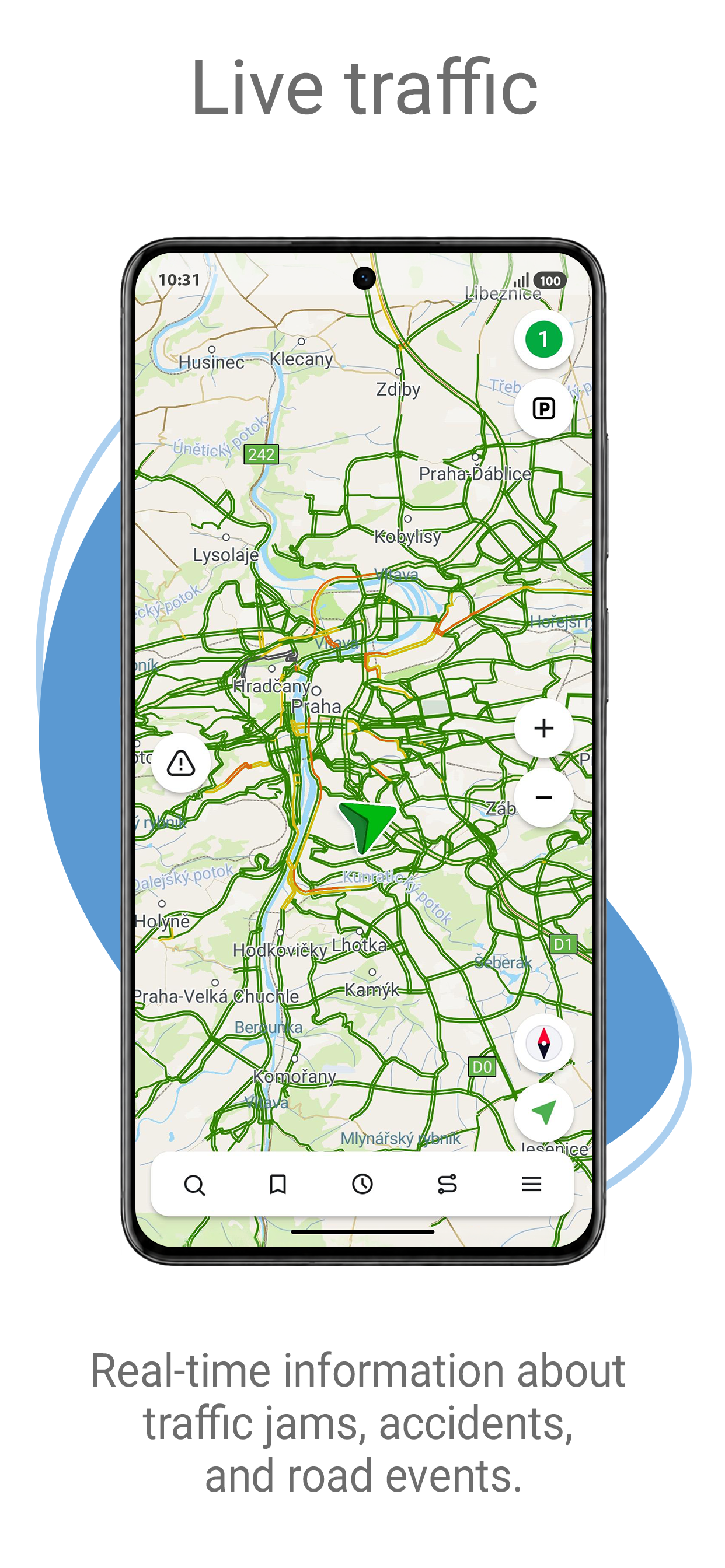
• Navitel.Traffic — information about traffic jams in real time throughout the maps.
• Navitel.Events — information about speed cameras, road accidents, road works and incidents marked on the map by users of the program.
• SpeedCam warnings —information about radars, speed cameras and road restrictions.
• 3D Maps — three-dimensional maps with support for textures and display of building heights.
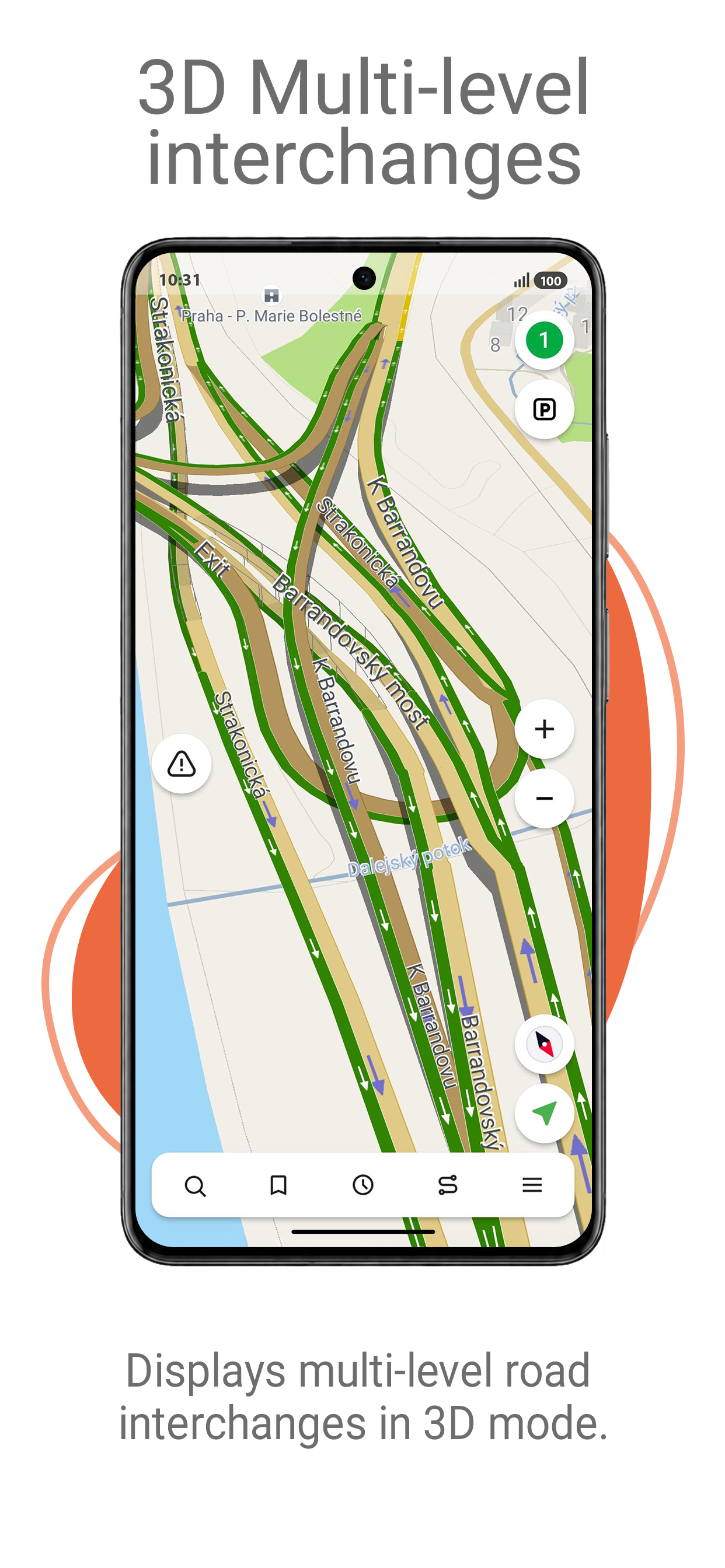
• 3D Road interchanges — display of multi-level road interchanges in 3D mode.
• Lane Assist — route calculations taking multilane traffic into account and visual prompts while following the route.
• Turn-by-turn voice guidance while moving along the route.
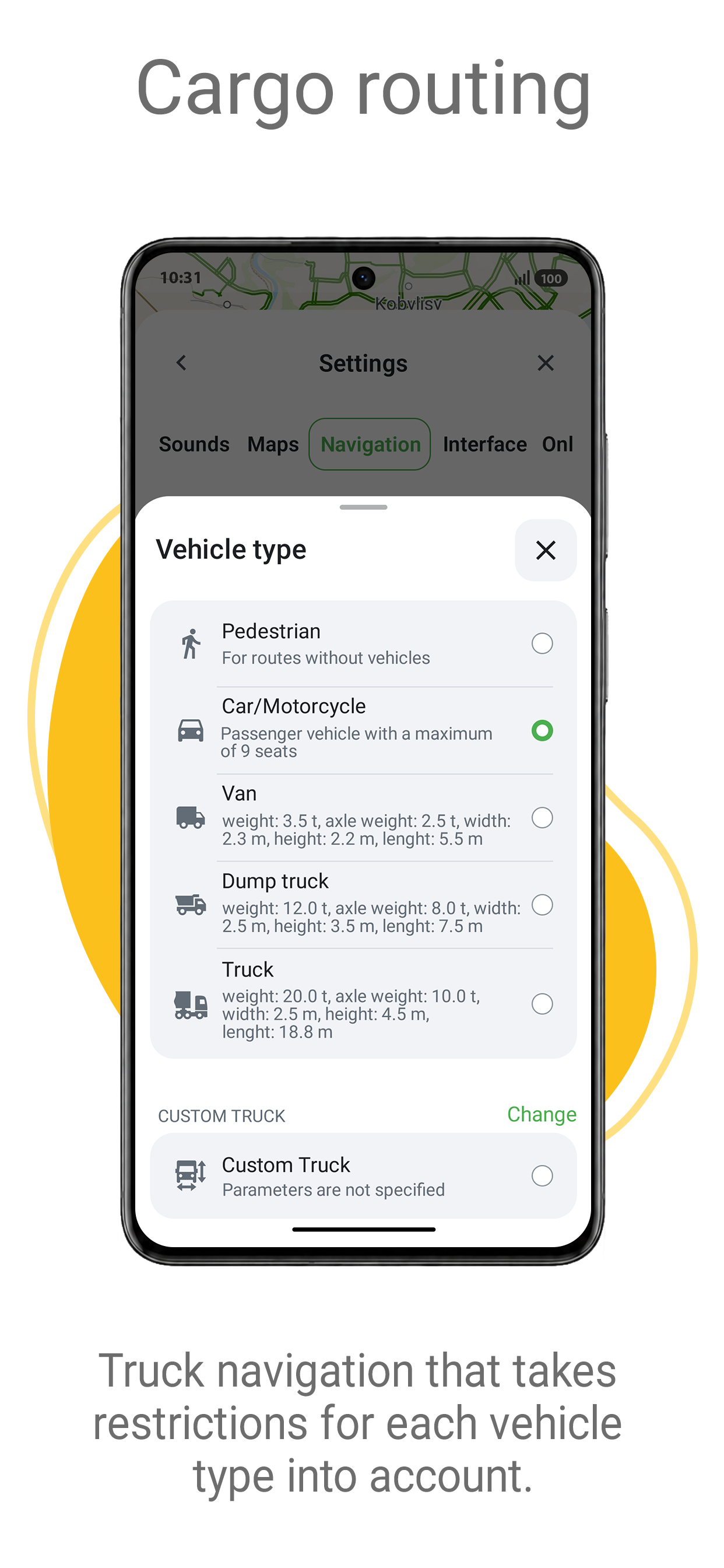
• Cargo graph — building routes considering road signs for cars from 3.5 to 40+ tons.
• Unlimited number of waypoints when building a route. Convenient route planning with an unlimited number of waypoints.
• Customizable user interface. Ability to adapt the program interface and map display mode for your own needs.
OFFLINE MAPS FOR DOWNLOAD
Austria, Azerbaijan, Albania, Andorra, Argentina, Armenia, Belarus, Belgium, Bulgaria, Bosnia and Herzegovina, Great Britain, Hungary, Germany, Gibraltar, Greece, Georgia, Denmark, Iran, Iceland, Spain, Kazakhstan, Cyprus, Kyrgyzstan, Latvia, Lithuania, Liechtenstein, Luxembourg, Maldives, Moldova, Monaco, Mongolia, the Netherlands, Norway, Isle of Man, Pakistan, Poland, Portugal, Romania, North Macedonia, Serbia, Slovakia, Slovenia, Tajikistan, Turkmenistan Turkey, Uzbekistan, Philippines, Finland, France, Croatia, Montenegro, Czech Republic, Switzerland, Sweden, Estonia.
If you have any questions contact us:
[email protected].
We will be happy to help you.