MyMaps (Package Name: perltek.myTransit.nycMaps) is developed by MyTransit™ and the latest version of NYC Subway Map & MTA Bus Maps 1.14.1 was updated on April 16, 2026. NYC Subway Map & MTA Bus Maps is in the category of Maps & Navigation. You can check all apps from the developer of NYC Subway Map & MTA Bus Maps and find 200 alternative apps to NYC Subway Map & MTA Bus Maps on Android. Currently this app is for free. This app can be downloaded on Android 6.0+ on APKFab or Google Play. All APK/XAPK files on APKFab.com are original and 100% safe with fast download.
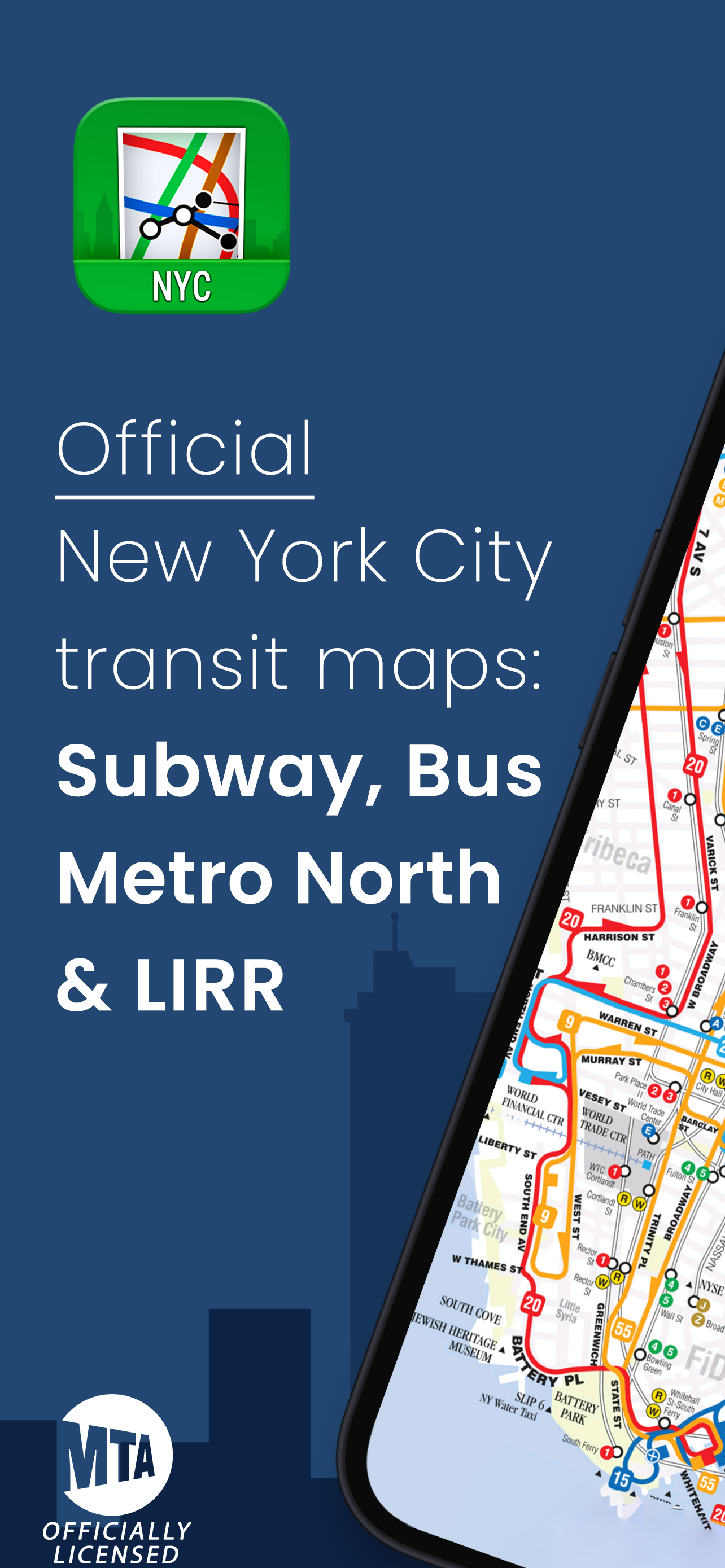
NEW YORK’s OFFICIAL TRANSIT MAPS: NYC SUBWAY, MTA BUSES, LIRR & METRO-NORTH
⭐️⭐️⭐️⭐️⭐️ 4.8 - Top rated NYC maps app!
MyMaps - from the creators of MyTransit App (New York’s Most Accurate Transit App 🗽 used by hundreds of thousands of New Yorkers daily), includes maps of NYC Subway, MTA Buses, LIRR and Metro-North (works offline, no internet connected required).
Free and offline accessible NYC maps app that comes with a comprehensive collection of New York’s transit maps officially licensed from the Metropolitan Transportation Authority (MTA). A popular choice for NYC commuters and tourists alike! 👍
Download now and get the
8 official NYC transit maps. Access maps
offline so you can navigate easily even when there is no internet connection between subway stations. Zoom into
high-resolution maps 🔎 to see every important detail of the MTA transit maps.
🚇
NYC SUBWAY MAPSHave a detailed MTA subway map that shows all train stations and includes both regular & night-time service. The app also shows subway service on weekends. Access official MTA subway maps without an internet connection and feel empowered knowing that you have all the necessary NYC MTA maps in your pocket right next to your OMNY card.
🚌
NYC BUS MAPSNavigate through different bus stations with NYC bus maps for all NYC MTA bus lines in Manhattan, Brooklyn, Bronx, Queens, and Staten Island. Never get lost ever again when you try to catch a bus or find the connection from bus to subway and vice versa. Maps include connections to JFK Airport and LaGuardia Airport.
🚆
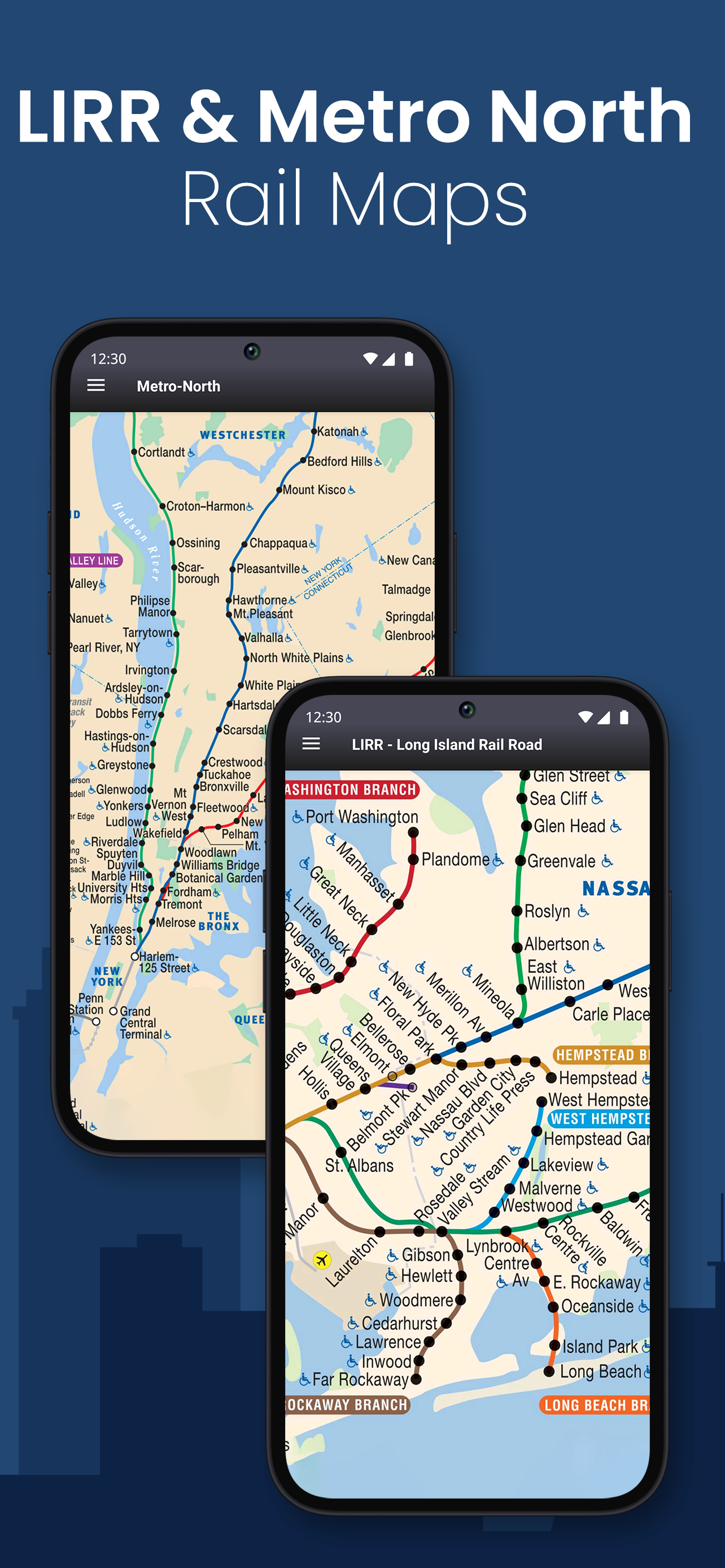
LIRR MAPIncludes station details of the entire Long Island Railroad and connections with subway and bus for smarter NYC transit. Travel with ease on LIRR and easily find transfers to bus and subway.
🚊
METRO-NORTH MAPView a detailed Metro-North map with all lines and stations to make commuting across New York, New Jersey, Connecticut and surrounding areas easier. Find station stops, and see connections to NYC subway, MTA buses, NJ Transit and other transit options.
COMPREHENSIVE COLLECTION OF NEW YORK CITY TRANSIT MAPS
🚇 2 SUBWAY MAPS:
● NYC Subway Map MTA - Regular Service
● Subway Night Map MTA - Night Service
🚌 5 BUS MAPS:
● Manhattan Bus Service
● Brooklyn Bus Service
● Queens Bus Service
● Bronx Bus Service
● Staten Island Bus Service
🚊 2 RAIL MAPS:
● LIRR - Long Island Rail Road
● Metro-North Railroad
🛥️ NYC FERRY MAP (coming soon...)
Each NYC transit map has a legend in the top right corner for a better understanding of the MTA map.
See why our NYC maps app is the popular choice for tourists, visitors, and MTA commuters for NYC subway navigation! New York is gigantic, and our NYC transit maps app eases makes navigating your way around the Big Apple easy!
✅
Download MyMaps: NYC Subway, MTA Bus & Rail app for FREE and have the perfect New York City travel guide in your pocket!
🌐 https://www.MyTrans.it
📧
[email protected]