GPS Map Live Cam (Package Name: com.gpsmapcamera.weather.location) is developed by crystalapps and the latest version of GPS Map camera: Geotag photos 3.4.0 was updated on March 30, 2023. GPS Map camera: Geotag photos is in the category of Travel & Local. You can check all apps from the developer of GPS Map camera: Geotag photos. Currently this app is for free. This app can be downloaded on Android 5.0+ on APKFab or Google Play. All APK/XAPK files on APKFab.com are original and 100% safe with fast download.
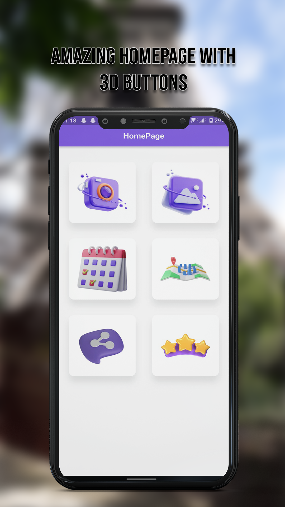
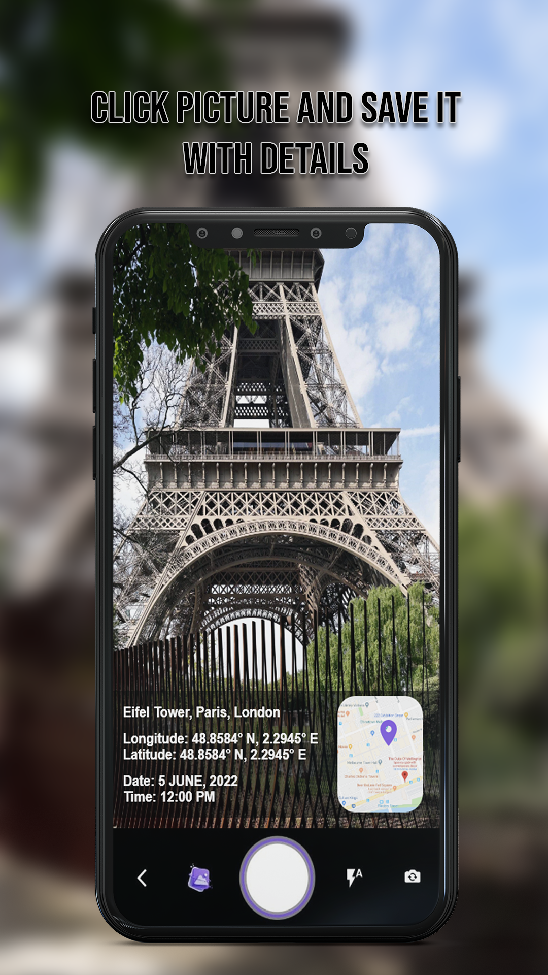
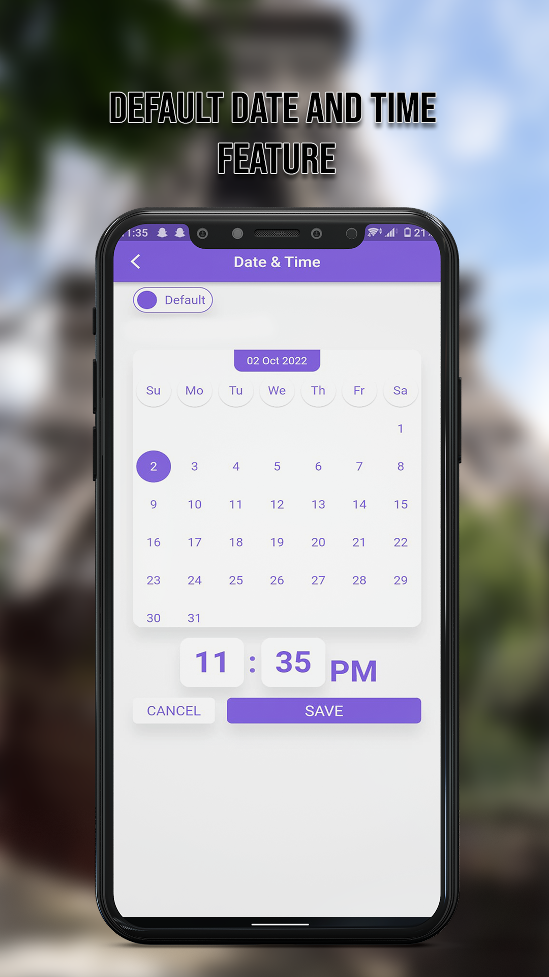
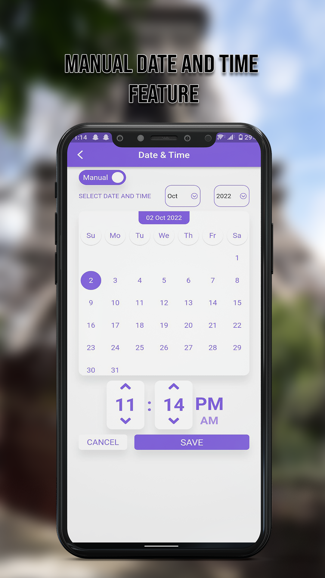
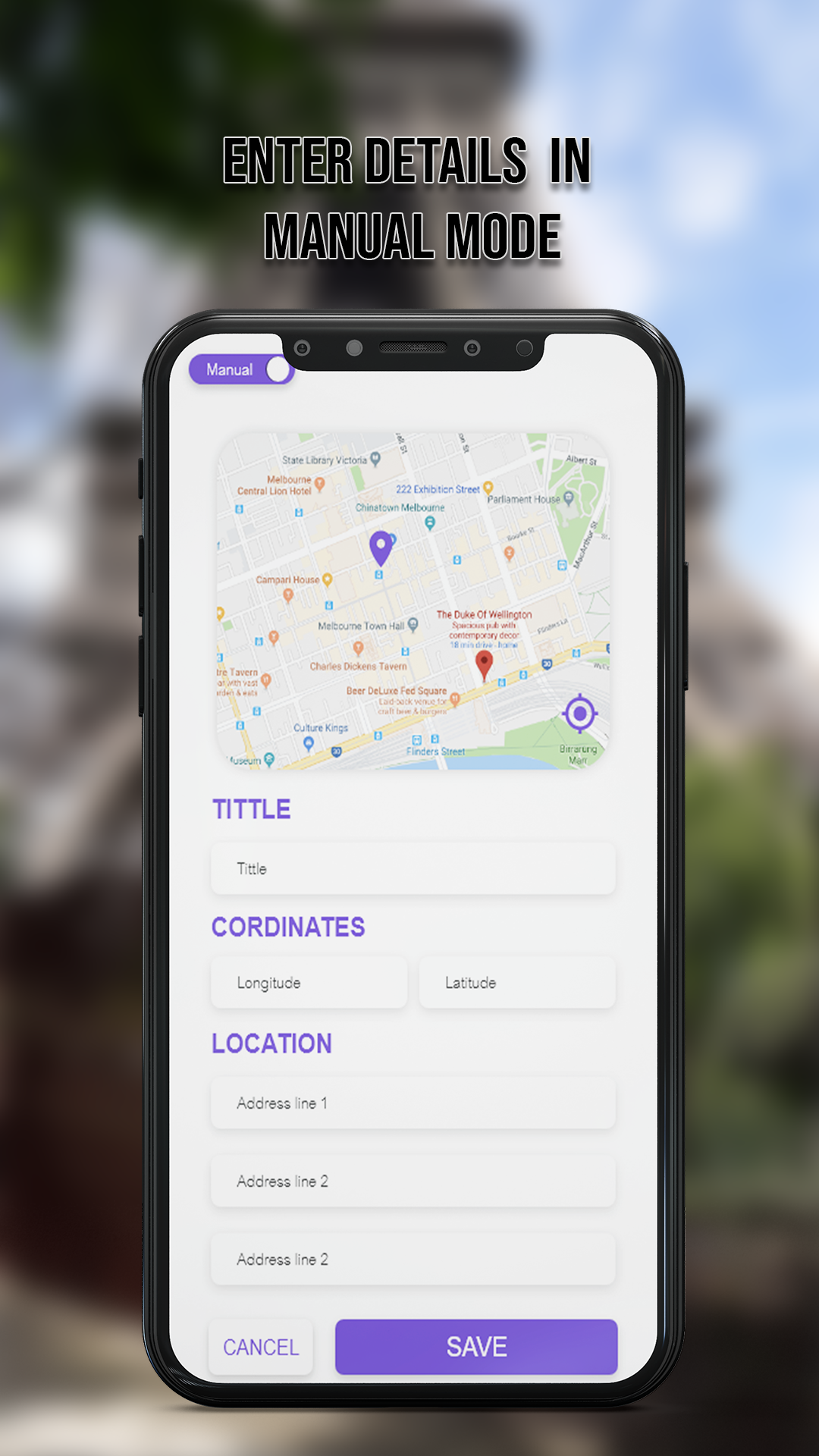
Do you want to capture your memories while driving? Make your memories with this GPS map camera geotag photos app, add date time, map, latitude and longitude, altitude, and accurate weather, to your gallery photos. To support you we launch a live Gps camera map photos application as a road route viewer easily with a 3d Gps camera. Add GPS coordinates, and date time stamps on Photos with a GPS Map camera for location. Convert your smartphone into the ultimate geotagging solution. GPS map lives Cam: Geotag Photos & add GPS location App trace your current location and weather forecast information of your route map images taken by GPS stamps camera. Share your geolocation of street/place, longitude, and latitude through photos with your family & friends. Different templates and settings to adjust your dialog size and speed limit. GPS camera map is handy to use with 3d GPS navigation photos to save and remember your trip driving skills without an internet connection. Offline 3D maps can be saved on your phone for GPS navigation without an internet connection. A real GPS camera geotag photo with many amazing hidden features. Add GPS directions on the location image to save in the gallery. While the GPS Map Camera starts: the route finder, map, address, and GPS coordinates will be displayed on the live camera preview. You can also check the location, and GPS map preview before capturing Geotag photos. If you wish to tune the GPS location, latitude and longitude manually, it is easy and fast. With the GPS video camera app, you can stamp geotag information such as latitude, longitude, date, time, chart, weather, compass, magnetic field, and much other information to your video while recording from your phone. GPS live Camera Map adds GPS stamps to camera pictures easily, to let your friends know where you are which is a handy feature in an emergency. When you want to add a location map stamp on Photos, you must have a GPS Map Camera app on your phone. Use live geo camera - route map for: - Get satellite map stamp on photos while capturing - Get offline map & navigation on photo - Put GPS location stamp, location stamp & date stamp on photos - Put longitude, latitude, date-time, geolocation, and accurate weather to photo stamps Features of GPS Map Live Camera photos - car maps: Map setting: Change map format such as satellite and hybrid directions. Address: Add your address and automatically or manually select your current location on photos. Date & Time: Set date time on GPS stamp for different geotag times formats. Latitude navigation maps: Set GPS coordinates such as latitude and longitude for the GPS map camera. Weather: Measure accurate weather & temperature units on geo-navigation photos. Compass tracker for smart cam, dashcam offline maps GPS navigation image. How to add GPS map location on photos? Get this Geotag Photos, GPS Map Camera app from the play store. Select your required Date Time Format, GPS coordinates, and directions. Add GPS location stamps automatically or manually to your beautiful images. Share your feedback with us while using this GPS Map Live Cam: Route Finder.
APKFab.com and the download link of this app are 100% safe. All download links of apps listed on APKFab.com are from Google Play Store or submitted by users. For the app from Google Play Store, APKFab.com won't modify it in any way. For the app submitted by users, APKFab.com will verify its APK signature safety before release it on our website.