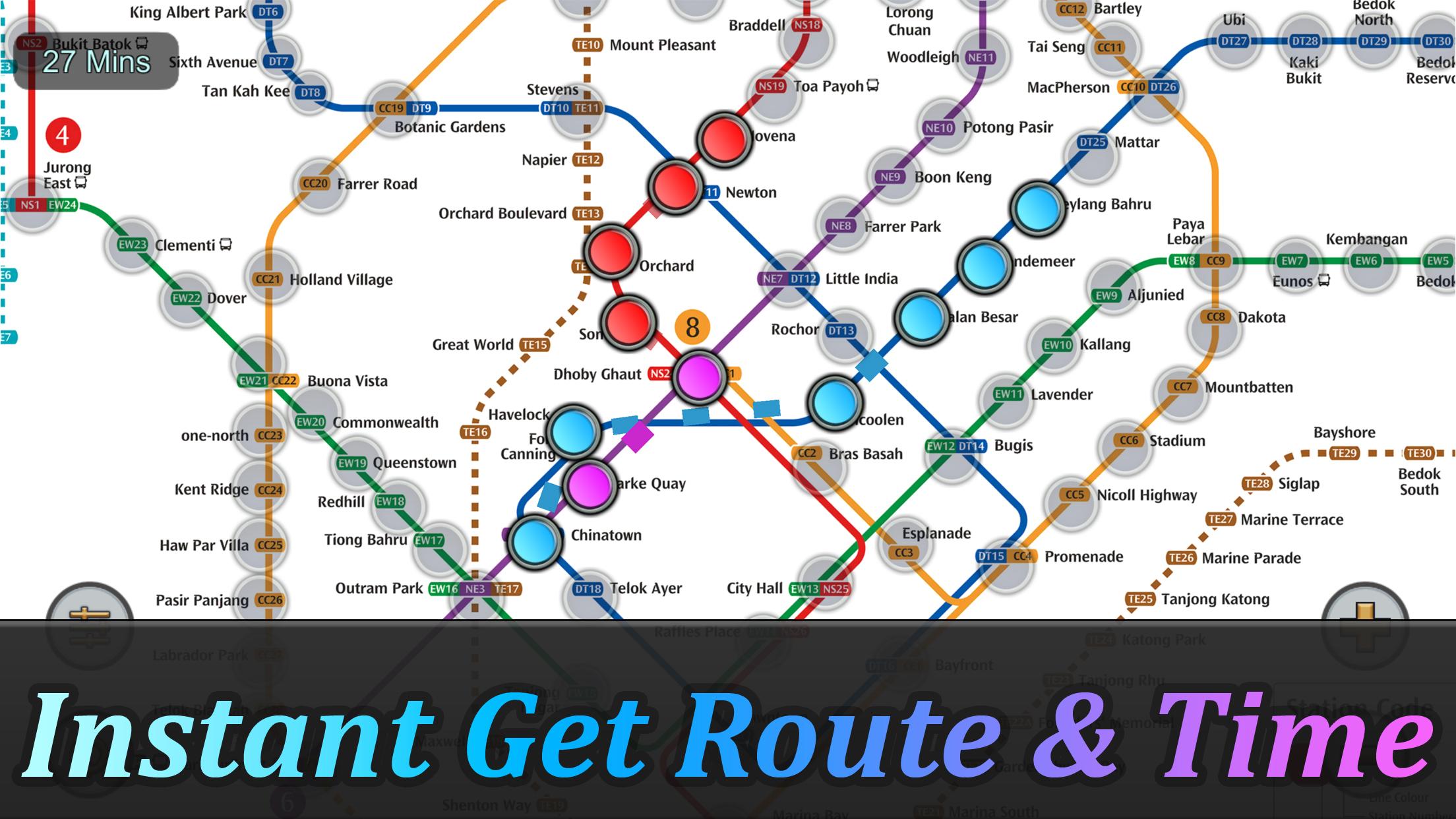
Singapore MRT Mapa Ruta
8.8 331
v2.9.0 por momoStorm Entertainment
8.8 331
v2.9.0 por momoStorm Entertainment


Requires Android: Android 6.0+
Architecture: arm64-v8a
Screen DPI: 120-640dpi
SHA1: 06cd1e0f5745819bece208a7b543367ef5cce38a
Size: 45.92 MB
Requires Android: Android 6.0+
Architecture: arm64-v8a
Screen DPI: 120-640dpi
SHA1: d0488d53c4e0524dc96d7ea59b617bf5c2a3475b
Size: 44.39 MB
Requires Android: Android 6.0+
Architecture: arm64-v8a
Screen DPI: 120-640dpi
SHA1: 65d48396b76a6179c51f4dfad2c8359c633e8a4f
Size: 72.16 MB
Requires Android: Android 6.0+
Architecture: arm64-v8a
Screen DPI: 120-640dpi
SHA1: bcc8159503d84a4643c773d341950facdb744ef4
Size: 72.15 MB
Nombre de paquete:
Categoría:
Fecha de actualización:
2025-08-13
Última versión:
2.9.0
Pedir actualización:
Disponible en:
Requisitos:
Android 6.0+
Denunciar:
Uber - Request a ride
Rideshare, taxi cabs, and more for your airport travels and everyday trips.
8.8 1M+
Yandex Go: Taxi Food Delivery
Paseos en coche y scooter, entrega de artículos y comida.
9.7 1M+
inDrive. Viajes alternativos
La app de movilidad en la que el pasajero elige su tarifa y a sus conductores
9.6 997K+
Waze Navegación y Tráfico
Datos actualizados del tráfico, accidentes, precios de gasolina, controles, etc.
8.3 679K+
Bolt: Solicita viajes 24/7
Viajes rápidos y accesibles!
9.6 610K+
Rapido: Book Bike-Taxi & Auto
Viaja con facilidad y precios asequibles con un Rapido Bike-Taxi o Auto, en cualquier momento.
9.6 251K+
Epic Cards Battle(TCG)
Experimenta las batallas legendarias con amigos y jugadores de todo el mundo!
8.9 8K+
Epic Cards Battle 2
Juego en línea Fantasy Strategy TCG Online, Battle With Global Players Realtime!
8.2 255
Battle Royale: Survivors
BRS es un juego de supervivencia de pvp de disparos de arriba hacia abajo.
9.9 32