Drone Assist (Package Name: uk.co.nats.droneassist) is developed by Altitude Angel and the latest version of Drone Assist - Flight Planning 2.0.183634 was updated on July 16, 2025. Drone Assist - Flight Planning is in the category of Maps & Navigation with the feature Productivity. You can check all apps from the developer of Drone Assist - Flight Planning. Currently this app is for free. This app can be downloaded on Android 5.0+ on APKFab or Google Play. All APK/XAPK files on APKFab.com are original and 100% safe with fast download.
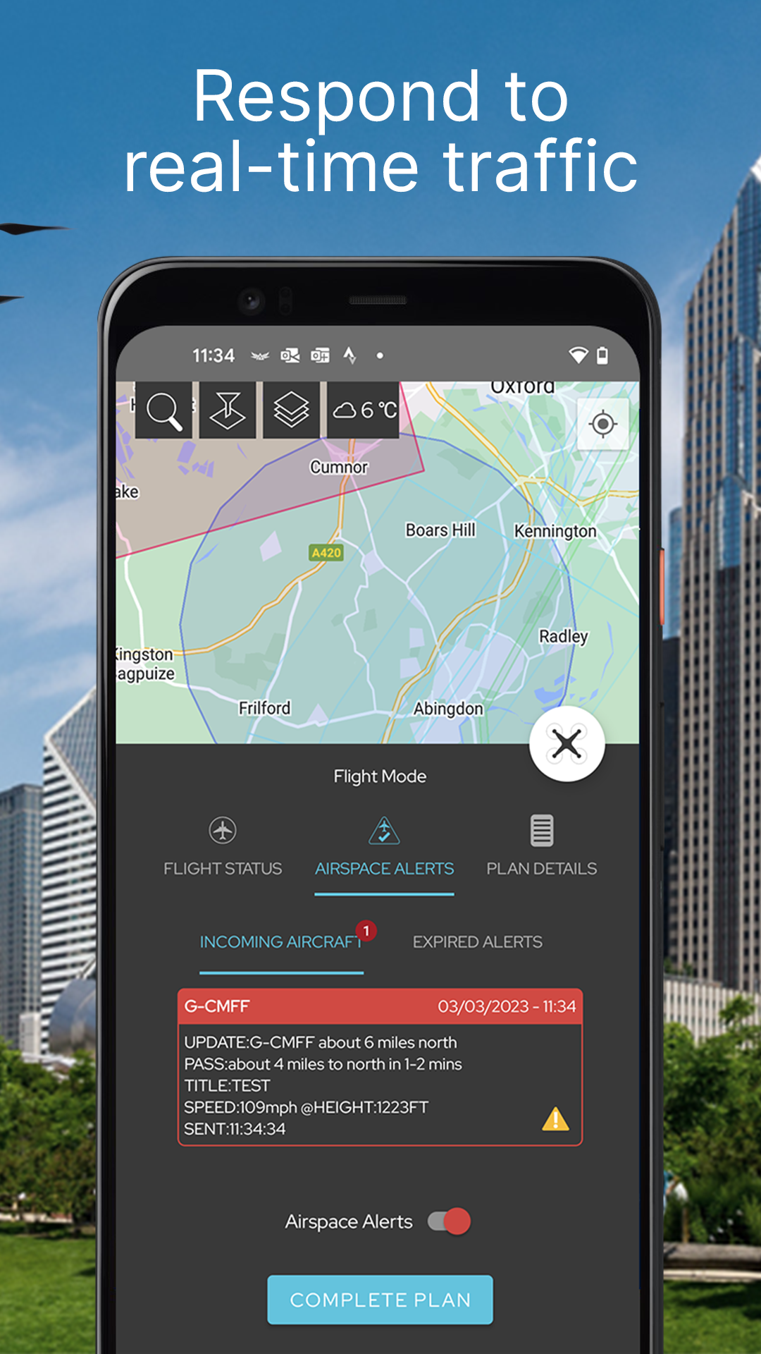
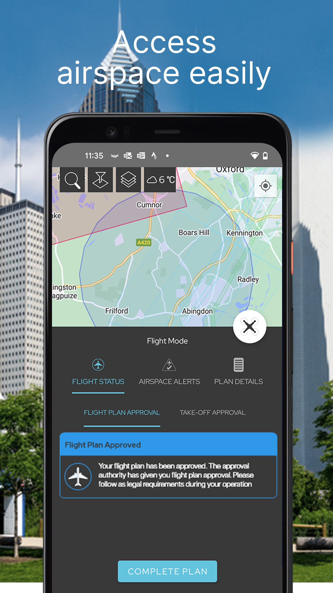
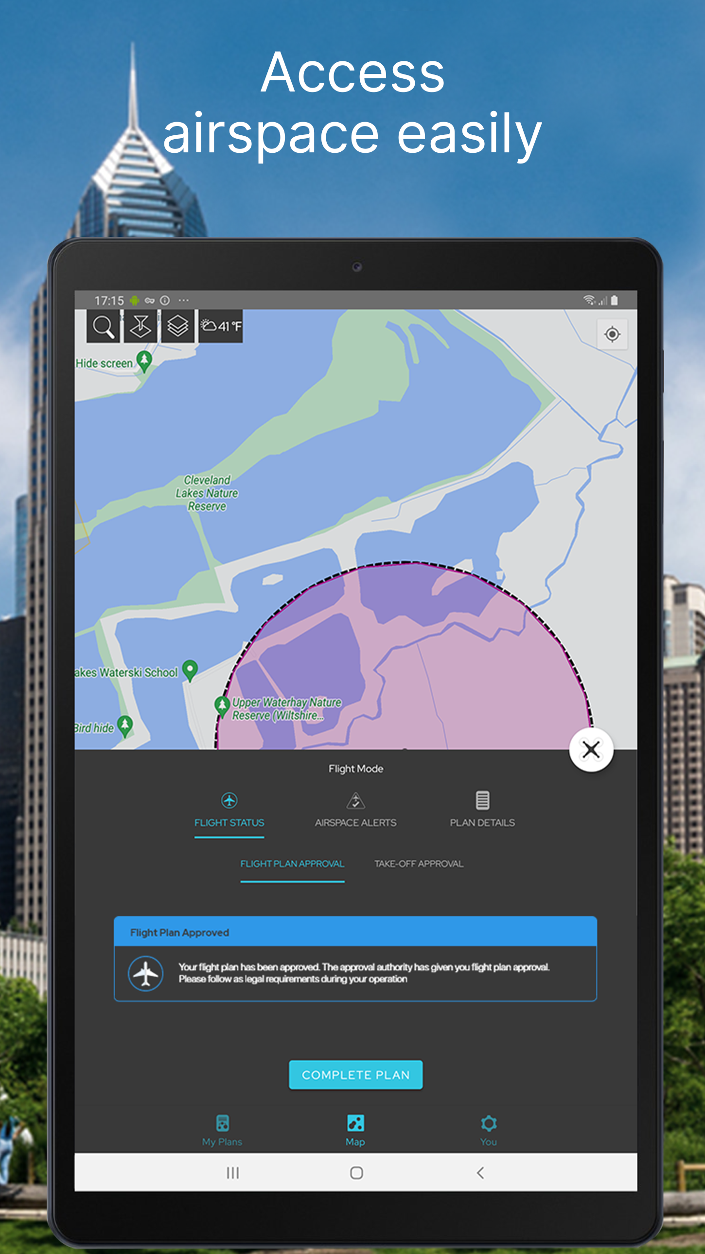
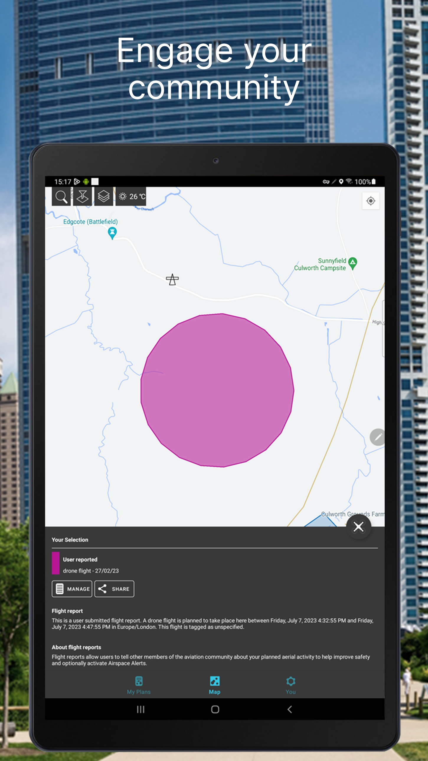
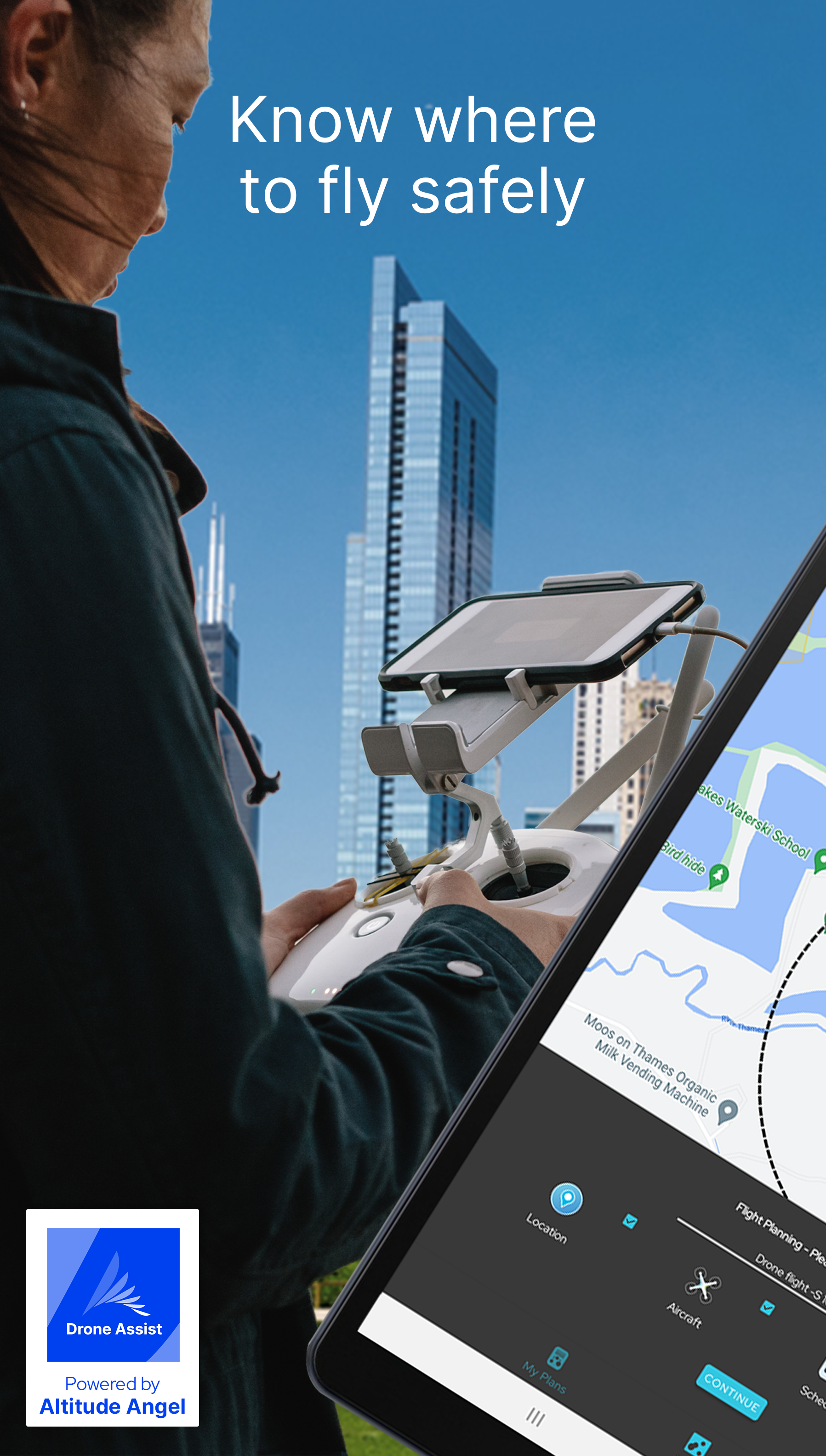
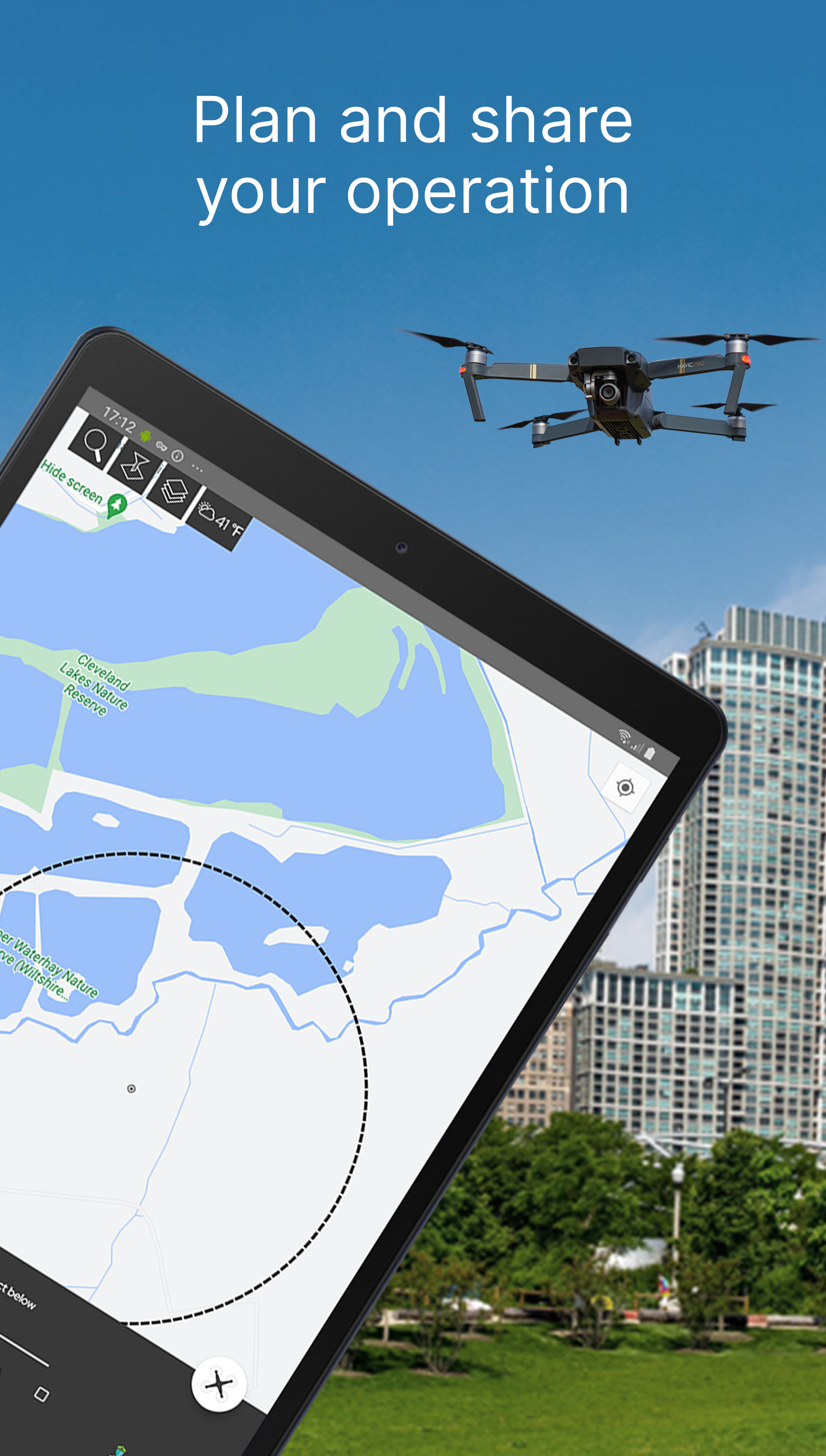
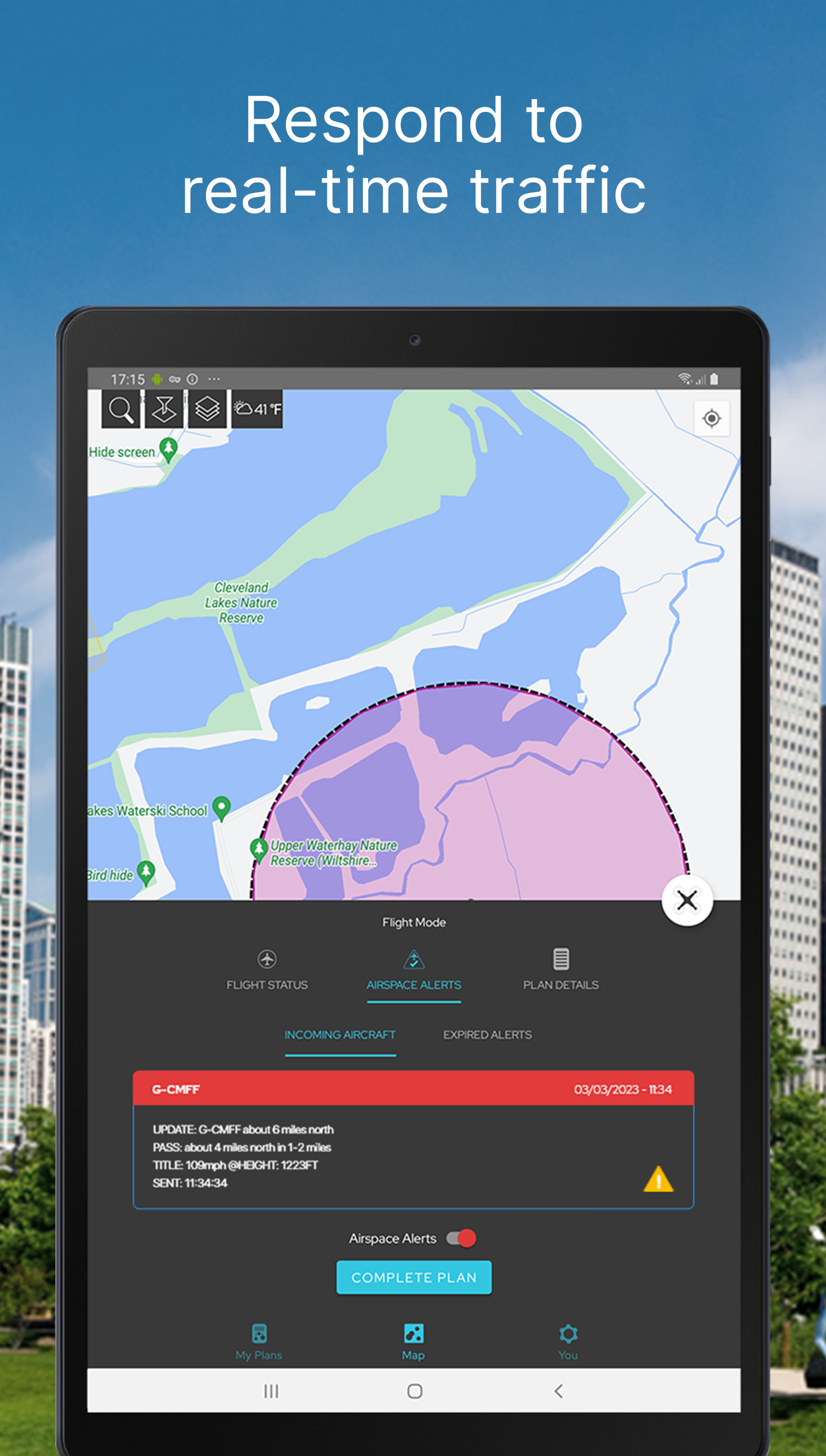
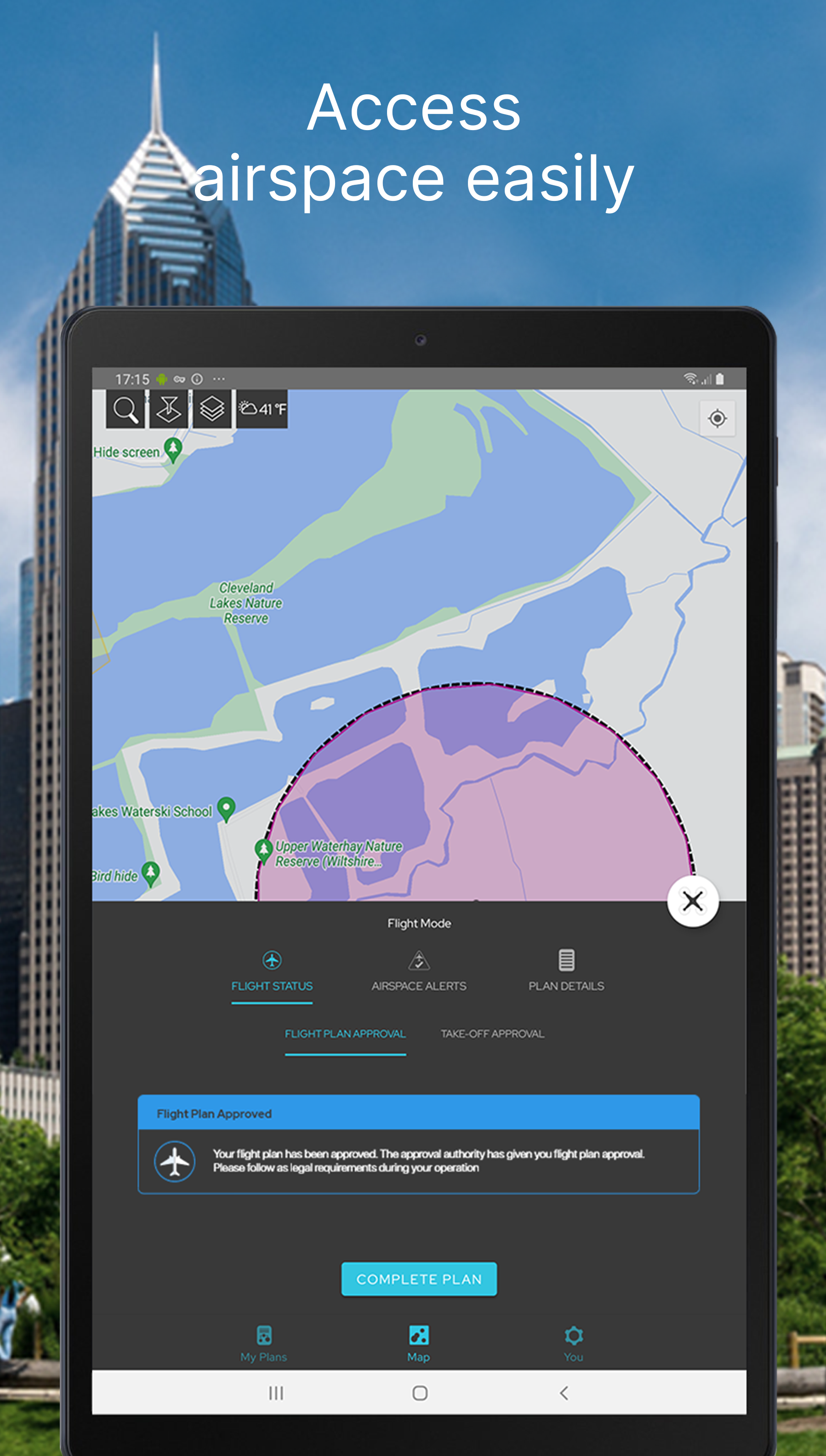
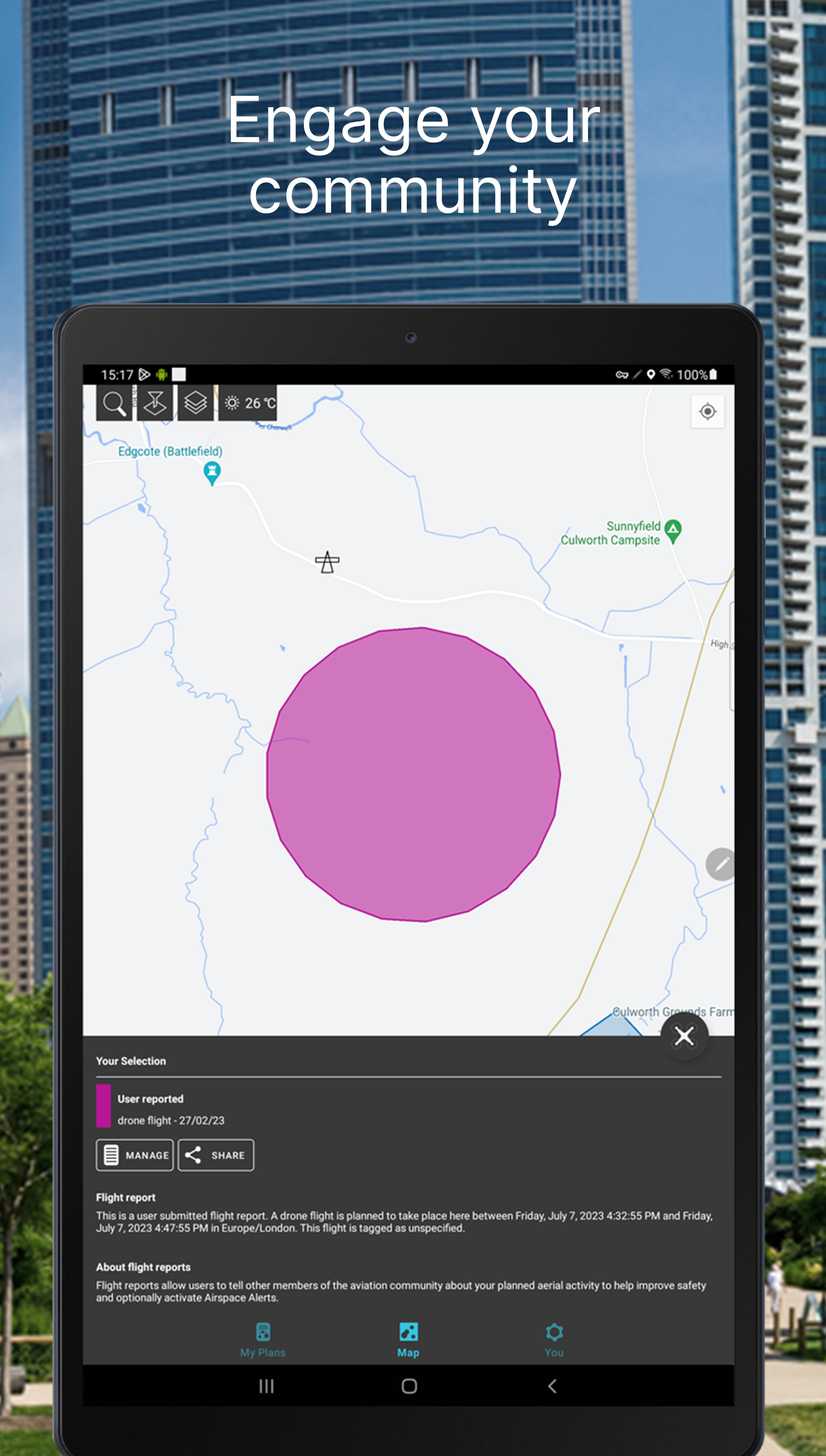
Plan and submit your commercial and recreational drone flights, check the weather, fly safely, and be in control with Drone Assist, the industry’s most trusted drone flight situational awareness source. Do your pre-flight checks via the mobile app, and submit your flight plans to share your flights with other airspace users. Using Drone Assist allows you to check for any hazards preflight, and submit your flight plans, helping you stay safe and compliant when flying your drones. Key Features Flight Planning Flight Reporting Approval access to controlled airspace Manage Company Operations or Single Pilots Share your flight plans on Social Channels Access real-time aerial and ground data to plan and submit your flights, or choose our Fly Now feature to instantly alert other airspace users of your flight area using location-based services. Our apps are the trusted free source for Drone flights, which also allow you to access approval services for restricted airspaces for your flight operations. It doesn’t matter if you fly a DJI Mavic, Mini or Autel for fun, or a Parrot, Ruko, or Yuneec. Recreational use or Commercial, in a park, or doing surveys. Drone Assist is your one-stop shop to fly safely, pre-plan your flights and submit your flight plans to alert other pilots to your drone activity. Download the Drone Assist app by Altitude Angel today to ensure you have access to the latest map data, including ground hazards, NOTAMS, and no-fly zones (NFZ). Whether you fly for fun, or professionally, Altitude Angel’s high-fidelity, accurate and authoritative data aims to help you plan your drone operations so that they can be conducted with greater respect for safety and privacy for all airspace users. Using your location, Drone Assist supplements your normal due-diligence activities by displaying no-fly zones and ground hazards for a growing number of countries around the world, completely free of charge. Simple and easy to use, the Drone Assist App has been designed and built with the Pilot in mind, providing you with the trusted insights you would expect from a company paving the way for Drone integration into regulated and unregulated airspace. Our range of flight planning tools, offered both independently and as part of our wider work with ANSPs and National Aviation Authorities, make operating a drone safely as easy as possible. We encourage drone users to download the Drone Assist app to understand airspace regulations and register flights. Happy (safe) flying! Drone Assist is the #1 drone safety app from Altitude Angel in the UK. It provides an interactive map of the sky and is used by general aviation, balloon pilots, other airspace users, and of course, drone pilots! Our map data is currently most effective in the UK, but will work in other GEOs and we are continually adding new country-specific map data. It allows you to see areas to avoid or in which extreme caution should be exercised, as well as ground hazards that may pose safety, security, or privacy risks when flying your drone. The Drone Assist app has been built natively for optimised performance on Android. By downloading the app you agree to the Altitude Angel Terms of Use, Privacy Policy, and Cookie Notice. Terms of Use: https://www.altitudeangel.com/terms-conditions Privacy & Cookie Policy: https://www.altitudeangel.com/privacy-policy Social Channels https://www.facebook.com/InternetOfFlyingThings https://twitter.com/altitudeangel https://www.linkedin.com/company/altitude-angel https://www.linkedin.com/company/altitude-angel
Drone Assist 2.0.183634 Update
- Improved UX to support multiple approvals - Approval statuses are automatically updated - Improved flight mode - Various fixes to improve usage, performance and stability
- Improved UX to support multiple approvals - Approval statuses are automatically updated - Improved flight mode - Various fixes to improve usage, performance and stability
APKFab.com and the download link of this app are 100% safe. All download links of apps listed on APKFab.com are from Google Play Store or submitted by users. For the app from Google Play Store, APKFab.com won't modify it in any way. For the app submitted by users, APKFab.com will verify its APK signature safety before release it on our website.