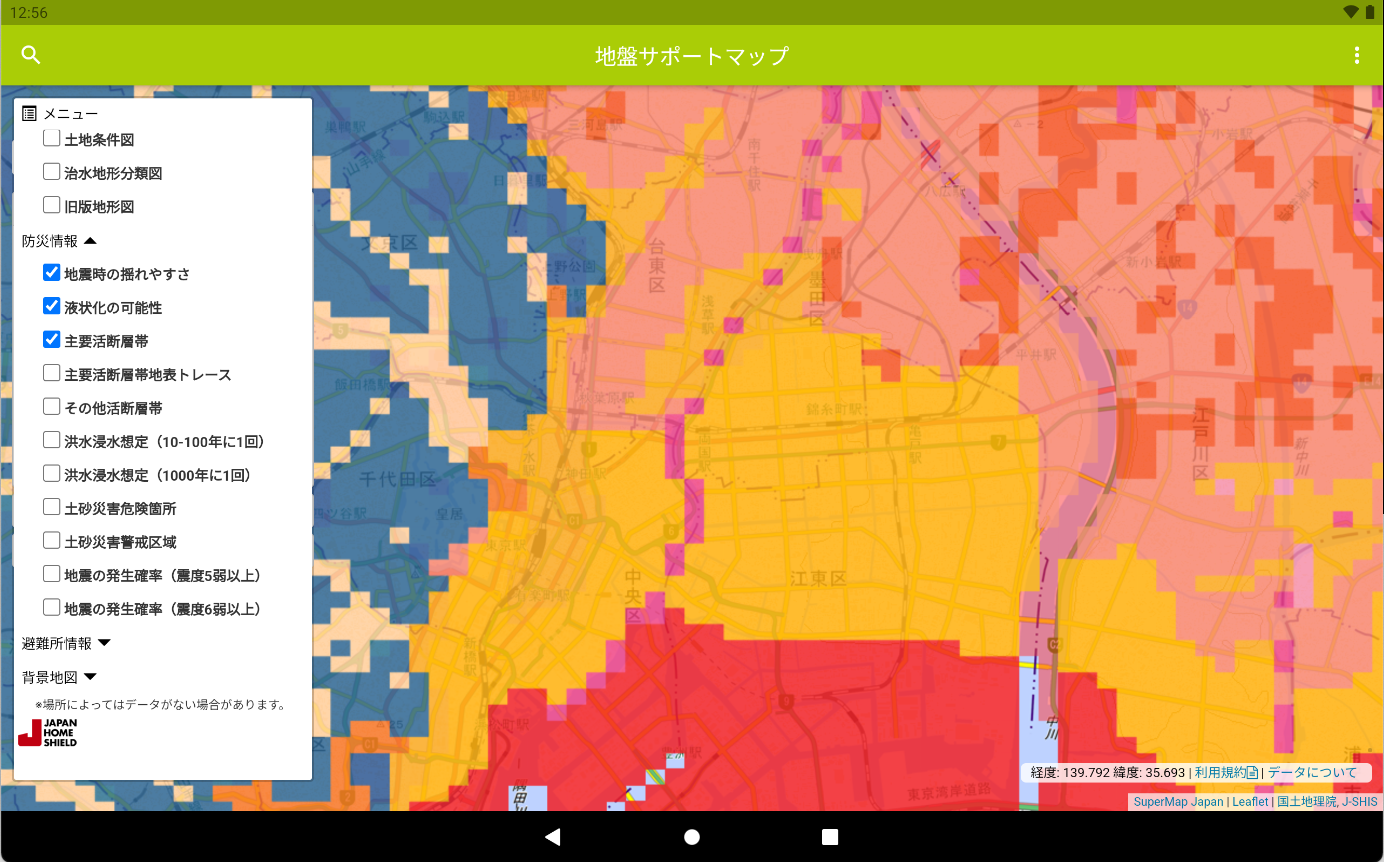
地盤サポートマップ

1.0 5

v1.1.0 by JAPAN HOME SHIELD CORPORATION

地盤サポートマップ XAPK download 地盤サポートマップ XAPK download

About 地盤マップ

地盤マップ (Package Name: jp.co.jshield.supportmap) is developed by JAPAN HOME SHIELD CORPORATION and the latest version of 地盤サポートマップ 1.1.0 was updated on August 3, 2021. 地盤サポートマップ is in the category of Maps & Navigation. You can check all apps from the developer of 地盤サポートマップ and find 4 alternative apps to 地盤サポートマップ on Android. Currently this app is for free. This app can be downloaded on Android 4.4+ on APKFab or Google Play. All APK/XAPK files on APKFab.com are original and 100% safe with fast download.
It is an application that you can check the ground, disaster prevention, and living information of the land you care about on the map. Japan Home Shield Co., Ltd., which has 1.2 million ground surveys and analysis results, has captured the ground data of the surveyed properties conducted in the past on a map and visualized it at a glance. In addition, information on areas useful for daily life, such as the location of elementary and junior high school districts and nearby evacuation shelters, can be viewed on the map. From daily life to emergency preparedness, we provide total support for your life.
[Information that can be seen]
■ Ground information
・ Ground bearing capacity
・ Geological map (AIST seamless geological map)
・ Micro-topography classification map
・ Land condition map
・ Hydraulic topography classification map
・ Old version topographic map
■ Disaster prevention information
・ Ease of shaking during an earthquake
・ Possibility of liquefaction
・ Other active fault zones
・ Major active fault zone
・ Inundation area
・ Sediment-related disaster risk areas
・ Earthquake occurrence probability (seismic intensity 5 lower or higher)
・ Earthquake occurrence probability (seismic intensity 6 lower or higher)
・ Evacuation facility
■ Living information
・ Average number of passengers getting on and off the station per day
・ Elementary school district
・ Junior high school district
・ City park
・ Medical facilities
・ Bus stop
・ Use district
■ Aerial photography
・ 1945-1950
・ 1961 to 1964
・ 1974-1978
・ 1979-1983
・ 1984-1986
・ 1988-1990
·latest
■ Background map
・ Geospatial Information Authority of Japan standard map
・ Geospatial Information Authority of Japan light color map
・ Geospatial Information Authority of Japan color-coded elevation map
・ Open Street Map
・ Google Map
・ Google Terrain
・ Google aerial photography
・ Google Hybrid

地盤マップ 1.1.0 Update

このAppは、コンテンツ充実やシステム改修に伴って更新されました。
Read More
地盤マップ Features
Previous Versions More
地盤サポートマップ
地盤サポートマップ 1.1.0 XAPK APKs
August 20, 2021 17.49 MB

Requires Android: Android 4.4+

Architecture: arm64-v8a

Screen DPI: 160-640dpi

SHA1: c82cd5966b632760b13a0bb09153fda97f17104a

Size: 17.49 MB

What's New:

このAppは、コンテンツ充実やシステム改修に伴って更新されました。
地盤サポートマップ
地盤サポートマップ 1.0 APK
March 9, 2017 26.1 MB

Requires Android: Android 4.0.3+

Screen DPI: nodpi

SHA1: 880a979b7bf08a366bf2c4e383b765708dbed871

Size: 26.1 MB

What's New:

地盤サポートマップ初回リリース
More Information

Package Name:

jp.co.jshield.supportmap

Update Date:

Latest Version:

1.1.0

Need Update:

Submit latest version

Available on:

Google Play

Requirements:

Android 4.4+