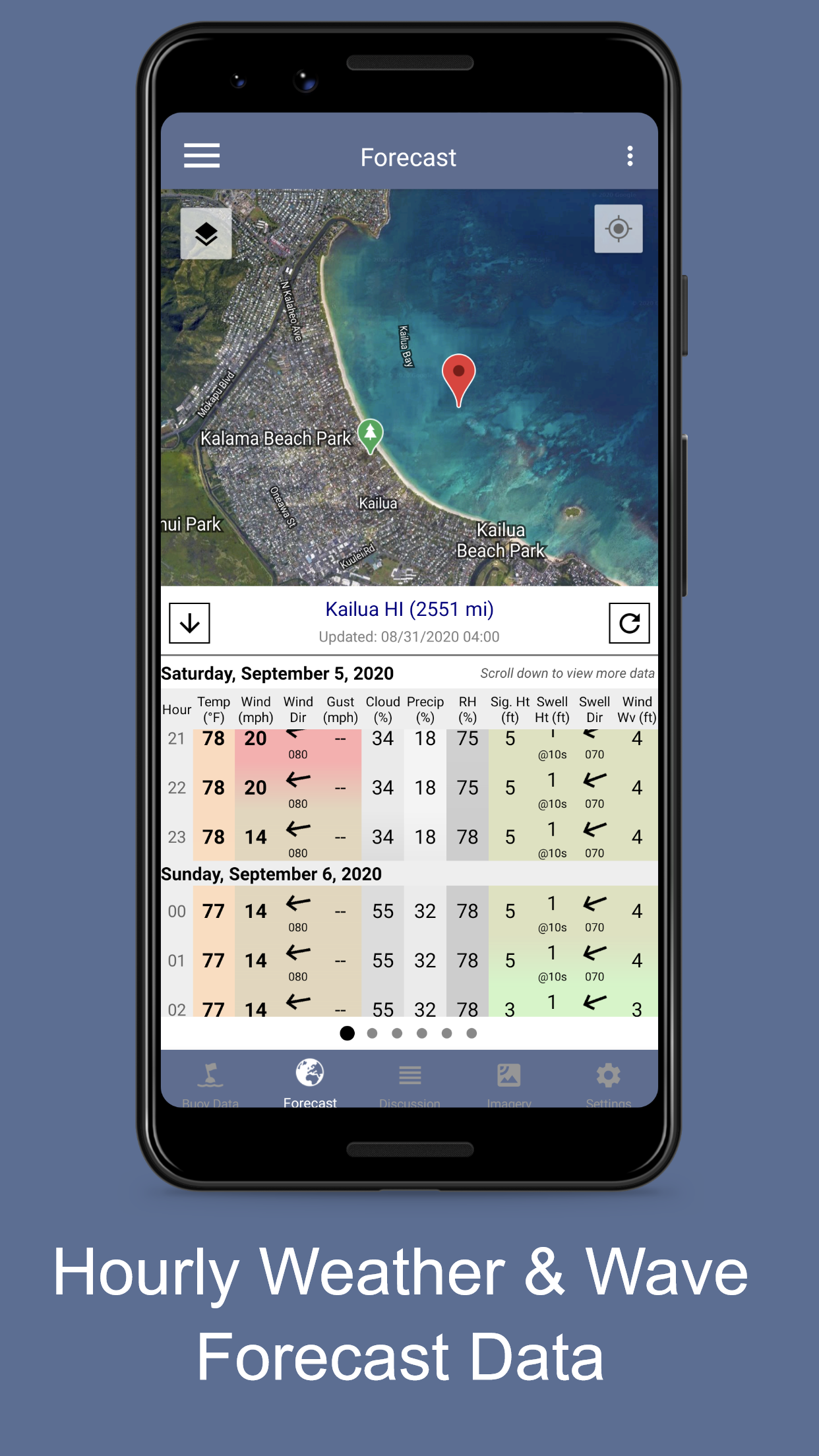
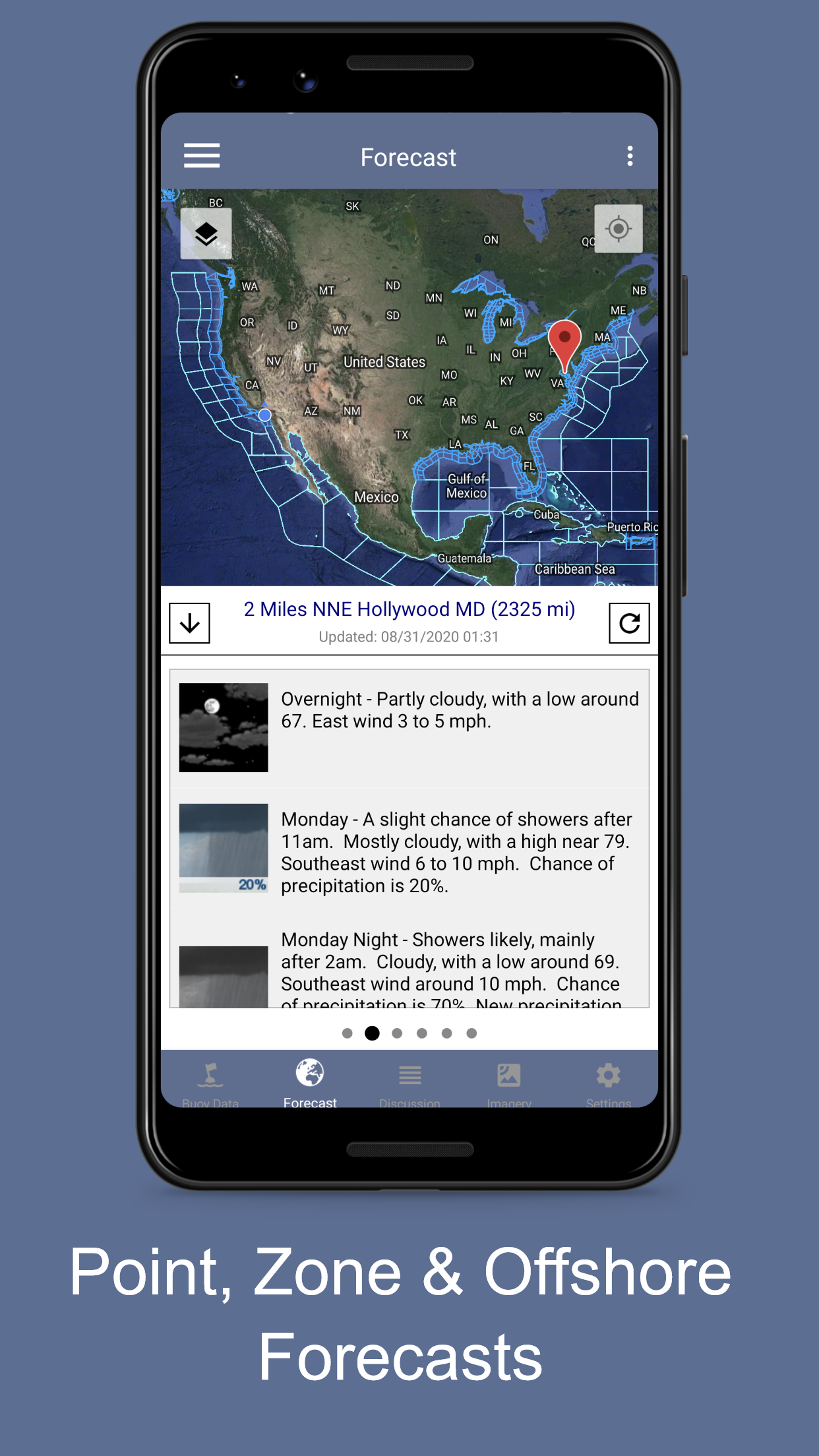
NOAA Marine Weather Forecast
8.3 11
v3.1.0 by QuantumTek Engineering
8.3 11
v3.1.0 by QuantumTek Engineering


Requires Android: Android 4.4+
Screen DPI: 120-640dpi
SHA1: 06e137f5981883adb82e6e762ea1fba2171bcd92
Size: 27.79 MB
What's New:
Package Name:
Update Date:
2021-05-06
Latest Version:
3.1.0
Need Update:
Available on:
Requirements:
Android 4.4+
Report:
Surfline: Wave & Surf Reports
Forecasts, Cams, Wind, & Tide
8.2 609
Fishidy: Fishing Hot Spot Maps
Identify the best fishing spots and cast with confidence using the Fishidy app!
4.3 102
Savvy Navvy Boating Navigation
Sailing & Fishing Nautical charts. Marine Weather & Tides. Boat GPS & Depth Map
8.4 213
SailFlow: Marine Forecasts
Wind, tides, waves for sailing and boating with maps, alerts, and forecasts
9.7 150
Avare
Aviation U.S. FAA materials + non-current TPC & ONC charts for Canada & more.
9.5 548
iWindsurf: Weather and Waves
iWindsurf is your most trusted Windsurfing weather source with Waves & Tides.
9.4 70