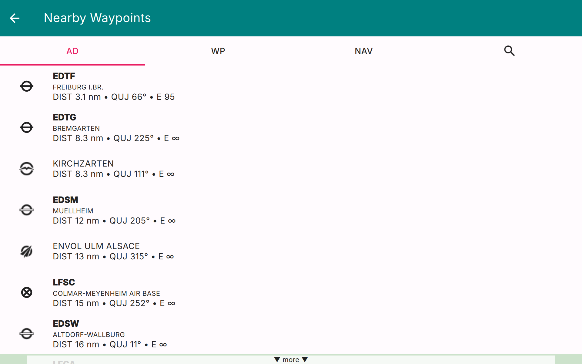
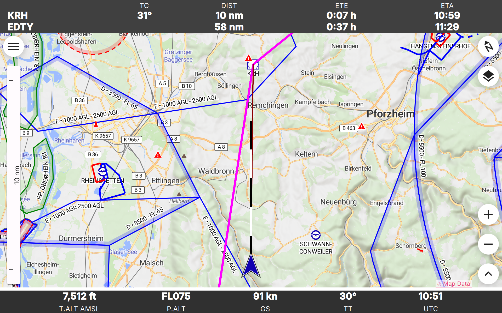
Enroute es una aplicación de navegación aérea no comercial escrita por aficionados a la aviación para pilotos VFR. Diseñada para ser sencilla, funcional y elegante, le quita el estrés a su próximo vuelo. Enroute ofrece un mapa móvil de estilo similar al de las cartas oficiales de la OACI. Se marcan su posición actual y su trayectoria de vuelo para los próximos cinco minutos, así como la ruta de vuelo prevista. Con un simple toque obtiene toda la información sobre espacios aéreos, aeródromos y radioayudas: frecuencias, códigos, elevaciones e información de pistas. Nuestras cartas aeronáuticas son gratuitas, se actualizan semanalmente y cubren gran parte del mundo. Algunas cartas muestran además los circuitos de tráfico y los procedimientos de vuelo para las zonas de control. Enroute permite la planificación básica de vuelos. Le permite calcular de forma rápida y sencilla distancias, rutas y rumbos. Le ofrece una estimación del tiempo de vuelo y del consumo de combustible. Si el tiempo empeora, la aplicación le mostrará los aeródromos más cercanos para aterrizar, con distancias, direcciones, información de pistas y frecuencias. No hay publicidad ni versión comercial «pro» de la aplicación. No le espiamos. No necesita registrarse para obtener una «membresía». Y no le molestamos con correos electrónicos. ¡Ni siquiera tenemos su dirección, ni la queremos! Aviso legal: Publicamos esta aplicación gratuita con la esperanza de que resulte útil como ayuda para una navegación prudente. No ofrece garantía alguna. Puede que no funcione como se espera. Los datos no proceden de fuentes oficiales y pueden estar incompletos, desactualizados o ser incorrectos. Esta aplicación no sustituye una preparación adecuada del vuelo ni una buena pericia como piloto. Confiar en ella como medio principal de navegación es muy probablemente ilegal, sin duda estúpido y potencialmente suicida.
Actualización de Enroute Flight Navigation 3.5.10
### Fixed - Fixed a possible crash on malformed GDL90 messages received over UDP. - Fixed potential data loss with traffic receivers connected via UDP. - Fixed potential data loss when replacing an approach chart (VAC). - Fixed import of GeoTIFF charts with 32-bit image dimensions. - On Android 11 and later, routes and waypoints can now be opened in other apps. - On Android, sharing system information now offers all apps that accept text.
### Fixed - Fixed the moving map slowly drifting vertically while it is panned sideways, so that the point under the finger or mouse pointer now stays in place. (#397)
### Changed - Searching for waypoints on the Nearby page and when adding waypoints to a route is much faster. - Opening and importing routes, opening the Nearby page and updating weather data are now much faster. ### Fixed - Fixed a freeze of several seconds when clearing a route or opening a route from the library, which occurred with large route libraries. - Fixed weather stations missing from the weather page after app start until the next weather update.
### Fixed - Fixed an issue on Android where the moving map stayed blank when the device had no network connection, for instance on phones without a SIM card that are used only for navigation, or when the system settings deny the app the use of mobile data. (#440)
APKFab.com y el enlace de descarga de esta aplicación son 100% seguros. Todos los enlaces de descarga de aplicaciones que aparecen en APKFab.com son de Google Play Store o enviados por los usuarios. Para la aplicación desde Google Play Store, APKFab.com no lo modificará de ninguna manera. Para la aplicación enviada por los usuarios, APKFab.com verificará la seguridad de la firma de APK antes de publicarla en nuestro sitio web.