Peakbagger (Paketname: com.mountainside.peakbagger) wird von Mountainside entwickelt und die neueste Version von Peakbagger 1.65.4 wurde am 11. Juli 2026 aktualisiert. Peakbagger liegt in der Kategorie von Reisen & Lokales. Sie können alle Apps von dem Entwickler der Peakbagger durchsuchen und 200 alternative Apps zu Peakbagger auf Android finden. Derzeit ist diese APP kostenlos. Diese App kann auf Android 6.0+ auf APKFab oder Google Play heruntergeladen werden. Alle APK/XAPK Dateien auf APKFab.com sind original und 100% sicher, schnell herunterzuladen.
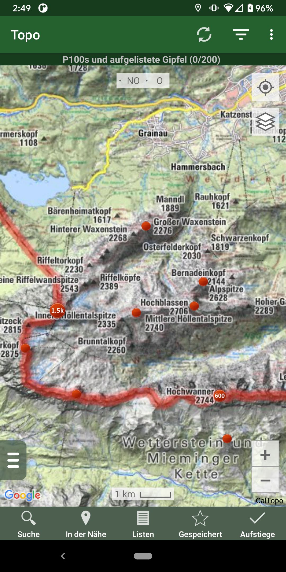
* Durchsuchen Sie die riesige Datenbank an Bergen und Tourenberichten von Peakbagger.com und ListsOfJohn.com * Behalten Sie den Überblick über Ihre Bergbesteigungen, auch wenn Sie offline sind * Messen Sie Ihren Fortschritt anhand von Hunderten von Gipfellisten * Holen Sie sich Routeninformationen und Wegbeschreibungen von SummitPost und ListsofJohn.com * Suchen Sie nach Gipfeln in der Nähe Ihres aktuellen Standorts oder in der Nähe von anderen Gipfeln * Filtern Sie Gipfel nach Prominenz, bestiegenen oder unbestiegenen Gipfeln oder nach Aufnahme in eine Gipfelliste * Schauen Sie, welche anderen Gipfel oft zusammen mit Ihrem Zielgipfel bestiegen werden * Wettervorhersagen für alle US-Gipfel vom National Weather Service und für mehr als 11.000 Hauptgipfel weltweit von mountain-forecast.com * Topografische Karten für jeden Ort der Welt (+/- 60 Grad geografische Breite) * Karten von geschützten Gebieten in Nordamerika, Europa, Japan, Australien und Neuseeland * Speichern einen Gipfel auf Ihrem Gerät zur Offline-Nutzung, einschließlich topografischer Karten * Herunterladen topografischen Karten entlang einer Route für die Offline-Nutzung * Sofortiger Import und Anzeige von GPS-Tracks und Wegpunkten * Kompass auf dem Bildschirm zur Orientierung entlang Ihrer Route * Klicken Sie lange auf die Karte, um Street View, Höhenangaben und Wegbeschreibungen zu erhalten. * Zeichen Sie Ihre Anfangshöhe, die Entfernung und Informationen über die verwendete Ausrüstung und Route auf * Leaderboards zeigen die Top-Kletterer für jede Gipfelliste * Sehen Sie die Gipfel, die Ihre Peakbagger-Freunde kürzlich bestiegen haben * Laden Sie Ihre Besteigungen automatisch zu ListsOfJohn hoch (US-Gipfel) * Zeigt tägliche Satellitenbilder für jeden Ort an jedem Tag seit 2011 * Anzeige des Höhenprofils für einen GPS-Track und Anzeige Ihres aktuellen Standorts entlang des Profils * Anzeige der Sonnenaufgangs- und Sonnenuntergangszeiten an einem Gipfel, auch wenn Sie offline sind * Zeichnen Sie GPS-Tracks, einschließlich Zeitstempel, auf und fügen Sie sie zu Ihren Aufstiegen hinzu * Erstellen und bearbeiten Sie Tracks direkt in der App * Automatisches Finden von Vermessungspunkten in der Nähe von Gipfeln (USA) * Jagen Sie Vermessungspunkte und lassen Sie Ihre Funde in den offiziellen Benchmark-Datenblättern aufzeichnen GPS-TRACKS IMPORTIEREN - 4 OPTIONEN 1) Klicken Sie auf den Link „GPS-Track laden" auf der Seite mit den Aufstiegsdetails für einen Aufstieg, der einen GPS-Track hat. 2) Klicken Sie auf eine GPX-, KML-, KMZ- oder FIT-Datei auf Ihrem Mobiltelefon, zum Beispiel in einem E-Mail-Anhang oder auf Google Drive 3) Öffnen Sie eine GPX-Datei in Ihrem Webbrowser, klicken Sie im Menü des Browsers auf „Teilen" und wählen Sie dann „Peakbagger". 4) Laden Sie eine GPX-, KML- oder KMZ-Datei manuell auf Ihr Telefon herunter oder kopieren Sie sie dorthin und öffnen Sie sie dann mit einer Datei-Browsing-App (z. B. Discoverer)
Peakbagger 1.65.4 Update
- OpenTopo map layer - Save some links in trip reports as PDFs for offline use - Summitpost pages saved as PDFs for offline use - Directional arrows on tracks - See which peaks you and a friend have both climbed or not climbed (when looking at a list, select "Combine buddy's ascents" from the menu) - On Statistics page, pinch-to-zoom calendar and click on individual days - Topographic maps for some regions of Italy - Import TCX track files - Setting for colorblind-safe colors
- OpenTopo map layer - Save some links in trip reports as PDFs for offline use - Summitpost pages saved as PDFs for offline use - Directional arrows on tracks - See which peaks you and a friend have both climbed or not climbed (when looking at a list, select "Combine buddy's ascents" from the menu) - On Statistics page, pinch-to-zoom calendar and click on individual days - Topographic maps for some regions of Italy - Import TCX track files - Setting for colorblind-safe colors
- OpenTopo map layer - Save some links in trip reports as PDFs for offline use - Summitpost pages saved as PDFs for offline use - Directional arrows on tracks - See which peaks you and a friend have both climbed or not climbed (when looking at a list, select "Combine buddy's ascents" from the menu) - On Statistics page, pinch-to-zoom calendar and click on individual days - Topographic maps for some regions of Italy - Import TCX track files - Setting for colorblind-safe colors
- OpenTopo map layer - Save some links in trip reports as PDFs for offline use - Summitpost pages saved as PDFs for offline use - Directional arrows on tracks - See which peaks you and a friend have both climbed or not climbed (when looking at a list, select "Combine buddy's ascents" from the menu) - On Statistics page, pinch-to-zoom calendar and click on individual days - Topographic maps for some regions of Italy - Import TCX track files - Setting for colorblind-safe colors
- OpenTopo map layer - Save some links in trip reports as PDFs for offline use - Summitpost pages saved as PDFs for offline use - Directional arrows on tracks - See which peaks you and a friend have both climbed or not climbed (when looking at a list, select "Combine buddy's ascents" from the menu) - On Statistics page, pinch-to-zoom calendar and click on individual days - Topographic maps for some regions of Italy - Import TCX track files - Setting for colorblind-safe colors
- Topo maps for Greece, Jamaica, Denmark, parts of Italy - Show source of peak elevation on More page - Sort peak lists by number of your ascents - Fix radar layer and Czech topo maps - Update offline databases
- Topo maps for Greece, Jamaica, Denmark, parts of Italy - Show source of peak elevation on More page - Sort peak lists by number of your ascents - Fix radar layer and Czech topo maps - Update offline databases
- Topo maps for Greece, Jamaica, Denmark, parts of Italy - Show source of peak elevation on More page - Sort peak lists by number of your ascents - Fix radar layer and Czech topo maps - Update offline databases
- Topo maps for Greece, Jamaica, Denmark, parts of Italy - Show source of peak elevation on More page - Sort peak lists by number of your ascents - Fix radar layer and Czech topo maps - Update offline databases
- Topo maps for Bulgaria, Ukraine, Georgia, Svalbard, Azores, Madeira - Can add shortcut to recent ascents of list to the home screen - Small bug fixes - Update offline peak databases - Update 2025 fire layer
- Topo maps for Bulgaria, Ukraine, Georgia, Svalbard, Azores, Madeira - Can add shortcut to recent ascents of list to the home screen - Small bug fixes - Update offline peak databases - Update 2025 fire layer
- Topo maps for Bulgaria, Ukraine, Georgia, Svalbard, Azores, Madeira - Can add shortcut to recent ascents of list to the home screen - Small bug fixes - Update offline peak databases - Update 2025 fire layer
- Topo maps for Bulgaria, Ukraine, Georgia, Svalbard, Azores, Madeira - Can add shortcut to recent ascents of list to the home screen - Small bug fixes - Update offline peak databases - Update 2025 fire layer
APKFab.com und der Download-Link dieser App sind 100% sicher. Alle auf APKFab.com aufgelisteten Download-Links für Apps stammen aus Google Play Store oder werden von Benutzern eingereicht. Bei der App aus Google Play Store wird sie von APKFab.com in keiner Weise geändert. Bei der von Benutzern eingereichten App überprüft APKFab.com die Sicherheit der APK-Signatur, bevor sie auf unserer Webseite veröffentlicht wird.